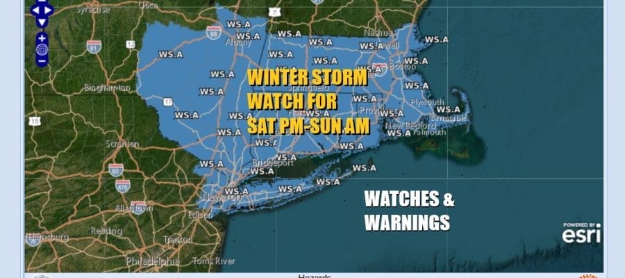
Winter Storm Watch Late Saturday into Early Sunday
Another Storm Follows Middle of Next Week

Winter Storm Watch Late Saturday into Early Sunday
Another Storm Follows Middle of Next Week
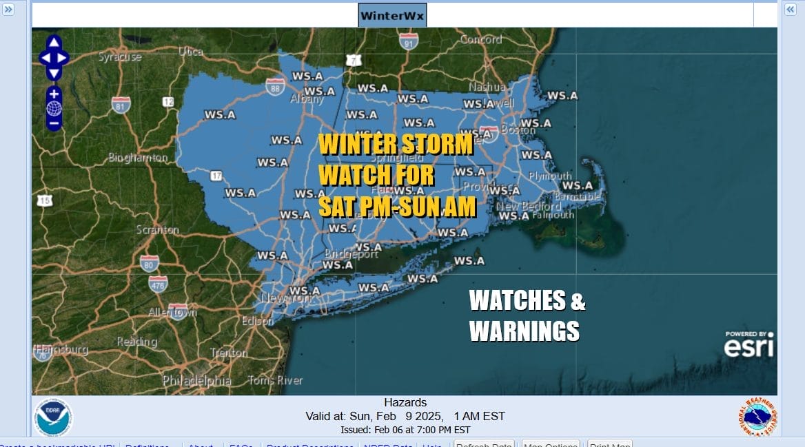
The next in a long series of storm systems will be heading into the Middle Atlantic and Northeast Saturday afternoon into Sunday morning and Winter Storm Watches are posted for much of Central and Southern New England to Long Island, NYC, Northeastern New Jersey, the Hudson Valley and the Catskills. Additional watches will probably go up for Northwest New Jersey and Northeastern Pennsylvania later today.
SATELLITE WITH LIGHTNING STRIKES

WEATHER RADAR

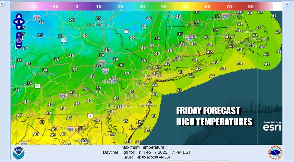
Ahead of this we have a windy day across the Northeast and Northern Mid Atlantic states. A weather front and upper trough are passing through this morning and there is colder air behind it. We are seeing some snow showers ahead of that colder air so we will throw in the chance for some scattered snow shower activity. Otherwise it will be a cloudy to partly sunny day. Temperatures today will likely hold mostly in the middle to upper 30s all day long north of NYC and upper 30s to lower 40s elsewhere.
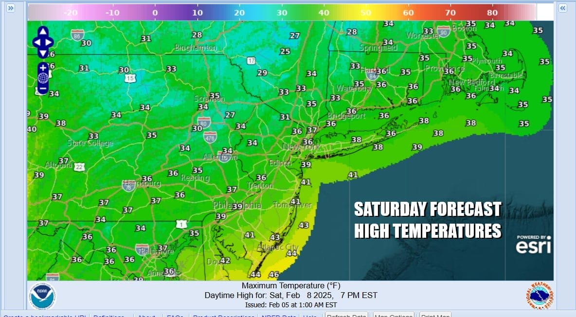
Skies tonight will be mostly clear with winds slowly diminishing. Lows will be in the upper teens inland and low to mid 20s coast and warmer urban areas. Saturday we will start off with some early sun only to see clouds rapidly increase ahead of low pressure that is going to be moving eastward across the Ohio Valley. Saturday highs will be just in the low to middle 30s.
Low pressure heads east into West Virginia Saturday night and redevelops off the Delaware coast. From there it heads east northeast and passes south of Long Island Saturday night into Sunday morning. This system will play out much the same way as the system we had Thursday however this time around we have more in the way of cold air surface and aloft. Also we have a more robust surface and upper air system at work here with better dynamics for snow.

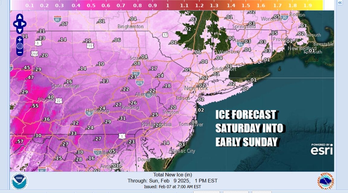
Snow develops across Southern Pennsylvania and Southern New Jersey Saturday by midday and then reaches NYC by mid to late afternoon and into Southern New England late afternoon and evening. Southern areas across Pennsylvania into Central and South Jersey will change to sleet and freezing rain (rain at the coast) while a thumping of snow should occur Saturday evening in the Hudson Valley to Long Island and Southeast New England. The change to sleet could reach areas in New Jersey around Interstate 78 as well as NYC and Long Island but that remains uncertain at this point.
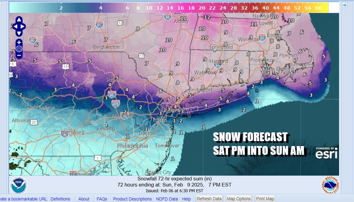
My own views on snow amounts are in line for the most part with the National Weather Service for areas inland of the coast and to the north. Along the coast however I’m being very cautious so my numbers for New York City and Long Island at least for now are lower. As for areas in Pennsylvania and New Jersey, this could be a serious icing situation as ice accretion will reach a quarter of an inch and in some places over a half an inch.
Temperatures Saturday night will be hovering in a range from 27 to 34 while it is precipitation. This all pulls away early Sunday morning followed by improving weather conditions later Sunday and highs in the 30s. This rather stormy weather pattern continues next week with another chance for snow later Tuesday into early Wednesday and again at the end of next week.
BE SURE TO DOWNLOAD THE FREE METEOROLOGIST JOE CIOFFI WEATHER APP &
ANGRY BEN’S FREE WEATHER APP “THE ANGRY WEATHERMAN!
MANY THANKS TO TROPICAL TIDBITS FOR THE USE OF MAPS
Please note that with regards to any severe weather, tropical storms, or hurricanes, should a storm be threatening, please consult your local National Weather Service office or your local government officials about what action you should be taking to protect life and property.


