
Winter Storm Warning Most of Coastal Connecticut Eastern Half of Long Island Coastal And Southern New Jersey, South Central Pa, Snow Ending This Morning

Weather in 5/Joe & Joe Weather Show Latest Podcast
Winter Storm Warning Most of Coastal Connecticut Eastern Half of Long Island Coastal And Southern New Jersey, South Central Pa, Snow Ending This Morning
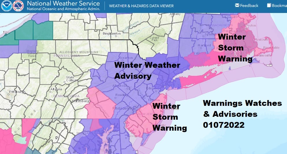
Our fast moving storm came in an hour or 2 sooner this morning and that means that we should hit snowfall targets set yesterday. Winter Storm Warnings are up for Coastal New and the southern half of New Jersey with Winter Weather Advisories to the northwest in Northern New Jersey, Eastern Pennsylvania, and the Hudson Valley. Winter Storm Warnings are up also for Suffolk County on Long Island, most of Coastal and Eastern Connecticut and Southeastern Massachusetts. Advisories are up for the rest of Connecticut and Massachusetts.

Snow fall estimates are in the 4 to 6 inch range for the most part with the higher amounts to the east in New England as it winds up snowing longer there while in the advisory area 3 to as much as 4 inches will be the final totals. All in all this storm is behaving according to plan and we should see snow begin to end from west to east starting at 6 or 7am in Eastern PA/ Western New Jersey, 9 to 11am on Long Island and across Connecticut, and 12 to 3 pm Eastern Connecticut to Eastern Massachusetts.
SATELLITE

WEATHER RADAR
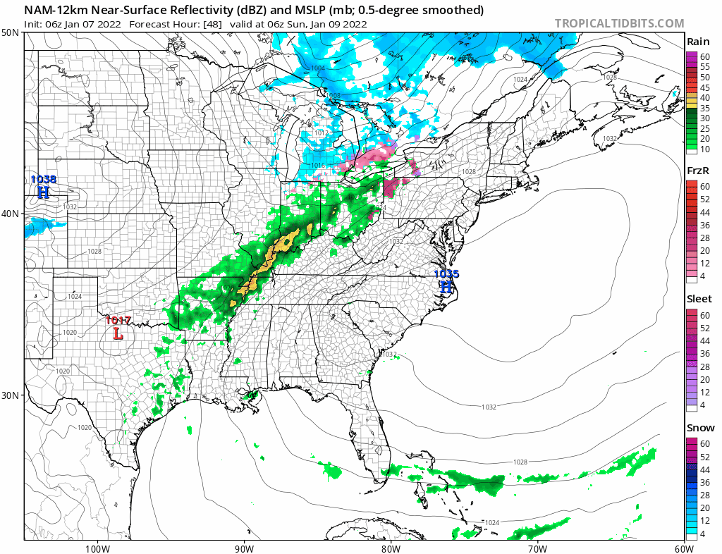
Radar is showing moderate to heavy snow from Southeastern Massachusetts to Delaware with the back edge now in Eastern Pennsylvania. the snow is advancing to the northeast and the back edge is advancing slowly eastward.

Weather conditions will improve this afternoon as we see leftover clouds and temperatures that will be in the low to mid 30s at best. Skies will clear tonight and it will be very cold with lows by morning in the teens to near 20 everywhere. Saturday will be mostly sunny but very cold with highs just back into the 30s.
The next weather issue comes Sunday with an arctic front. Warmer is will be moving east but it will be aloft and colder air will remain trapped at the surface. With the front moving quickly there won’t be much of a chance for temperatures to rise and the ground to warm so look for freezing rain and sleet to develop Sunday morning into the afternoon. Along the coast it may warm up in time to prevent icing but inland could be a different story. Temperatures Sunday will be into the 30s.
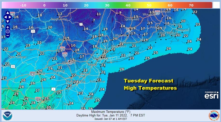
Very cold air looms behind the front for Monday and Tuesday and it will be the coldest air of the season so far. Monday temperatures will settle into the 20s and we will drop into the teens and single digits Tuesday morning. Tuesday highs will be barely out of the teens and low 20s. Cold lasts through Wednesday before we moderate for a day or so. Then we look for indications regarding more snow chances next weekend.
BE SURE TO DOWNLOAD THE FREE METEOROLOGIST JOE CIOFFI WEATHER APP &
ANGRY BEN’S FREE WEATHER APP “THE ANGRY WEATHERMAN!

MANY THANKS TO TROPICAL TIDBITS & F5 WEATHER FOR THE USE OF MAPS
Please note that with regards to any severe weather, tropical storms, or hurricanes, should a storm be threatening, please consult your local National Weather Service office or your local government officials about what action you should be taking to protect life and property.


