
Windy Colder Snow Threat Looms
![]()
The cold front that moved through this morning produced some rain and now we are on the back side which means strong gusty winds, clouds and some sunshine. The highs for the day have already been achieved and we will see temperatures settle back into the 40s this afternoon and down into the 20s to near 30 tonight as skies clear. Winds will diminish slowly overnight as well but they will remain busy from the northwest with gusts to 30 to 40 mph or more at times for the remainder of the day.
Windy Colder Snow Threat Looms Satellite Loop

Windy Colder Snow Threat Looms Regional Radar Loop

Windy Colder Snow Threat Looms Local Radar Loops


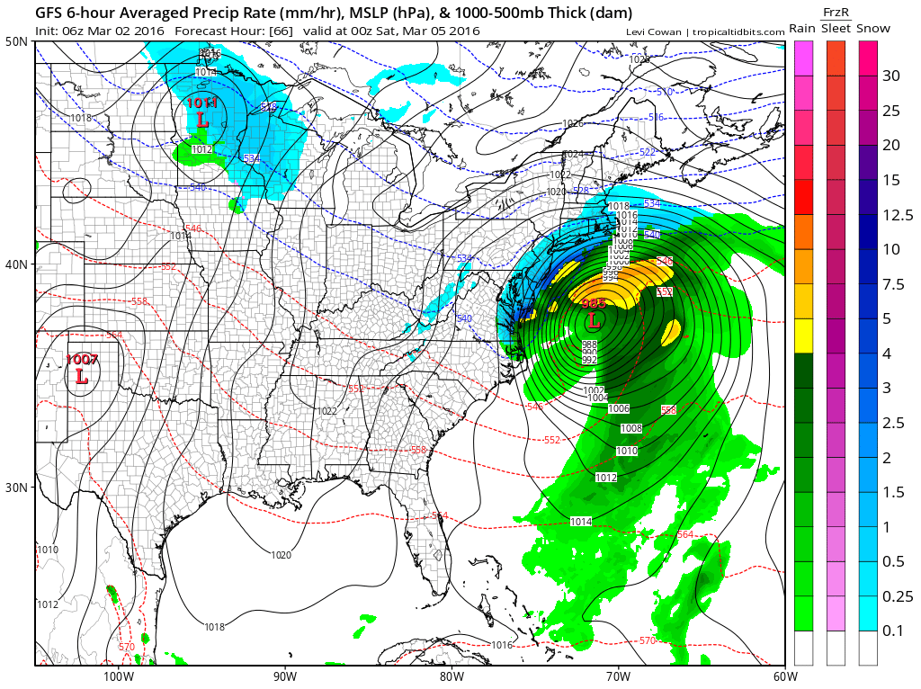
Radars are all pretty much done with the rainfall and now we move on to the next weather system that is dropping southward into the Middle Mississippi Valley. This low is forecast to become a major ocean storm off our coastline so it is really a matter now of figuring out how close does it get. Middle runs overnight showed a shift northwestward by the GFS by enough to double snowfall amounts for the coast line.
Windy Colder Snow Threat Looms GFS MIDDLE RUN SNOWFALL FORECAST
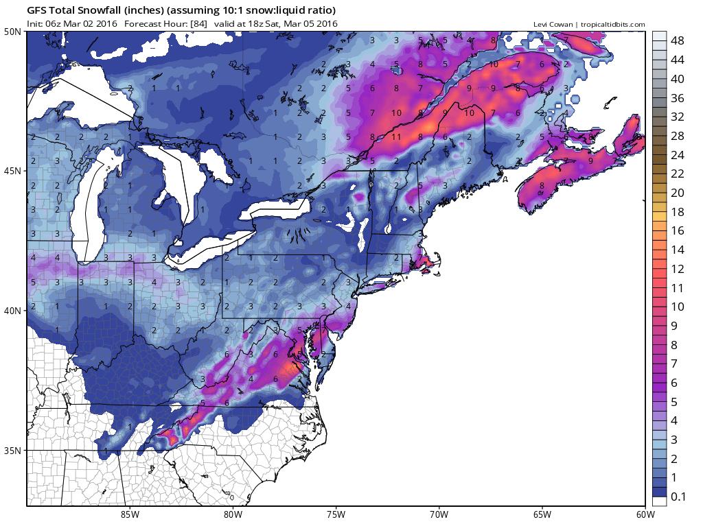
What the GFS Model did on the middle run this morning was slow the system down which allows it to become a little more vigorous and lift a little further north. The NAM model middle run did not show this, nor did the European. Both those models would argue for a coating to an inch or two at most.
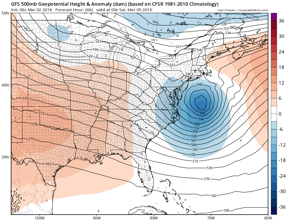
Windy Colder Snow Threat Looms GFS MIDDLE RUN UPPER AIR AND SURFACE MAP FRIDAY EVENING
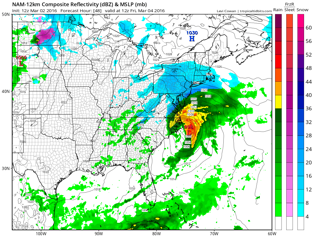
At this point here comes the new NAM model which might give us additional clues. This is the map for Friday morning at 7am showing snow falling for much of the area from Northeast Virginia through Southern New England. The NAM overnight was taking the low straight east just like the Euro model did. The NAM this morning to me shows no real discernible northwest shift and continues to move the low more to the east.
Windy Colder Snow Threat Looms NEW NAM MODEL RUN FRIDAY MORNING
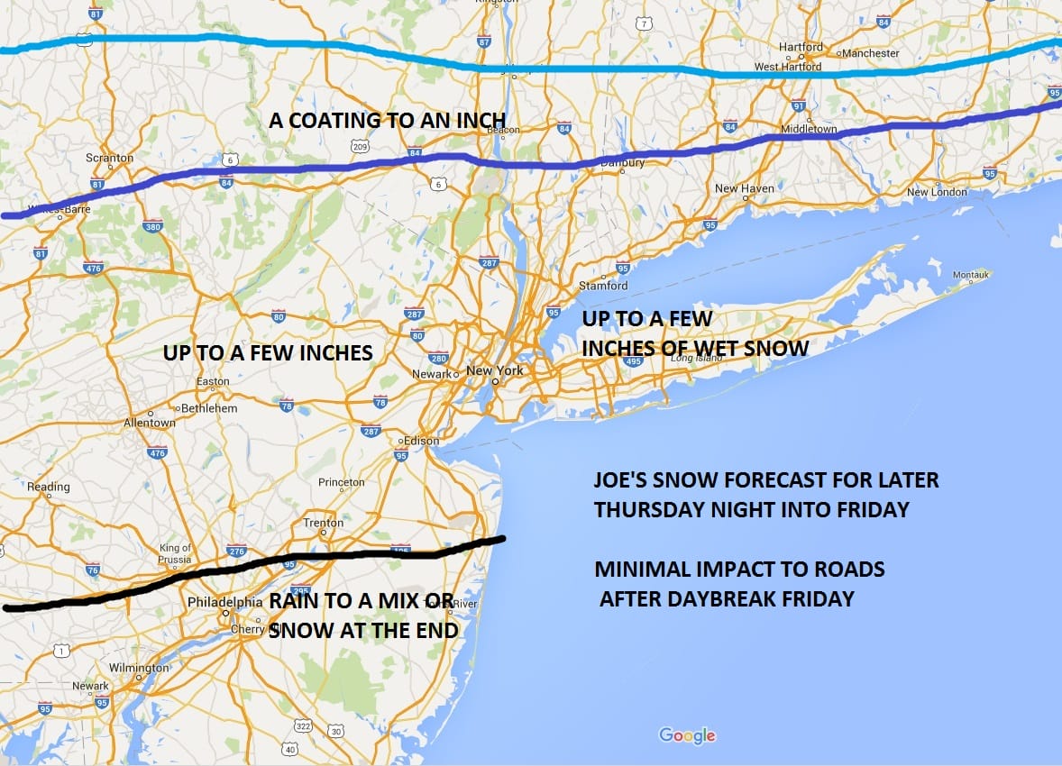
For now I am making no changes to my snowfall forecast from earlier which was for up to a few inches.
Windy Colder Snow Threat Looms JOE’S SNOWFALL FORECAST
Windy Colder Snow Threat Looms VIDEO ANALYSIS
NATIONAL WEATHER SERVICE SNOW FORECASTS
LATEST JOESTRADAMUS ON THE LONG RANGE
FiOS1 News Weather Forecast For Long Island
FiOS1 News Weather Forecast For New Jersey
FiOS1 News Weather Forecast For Hudson Valley
Weather App

Don’t be without Meteorologist Joe Cioffi’s weather app. It is really a meteorologist app because you get my forecasts and my analysis and not some automated computer generated forecast based on the GFS model. This is why your app forecast changes every 6 hours. It is model driven with no human input at all. It gives you an icon, a temperature and no insight whatsoever.
It is a complete weather app to suit your forecast needs. All the weather information you need is right on your phone. Android or I-phone, use it to keep track of all the latest weather information and forecasts. This weather app is also free of advertising so you don’t have to worry about security issues with your device. An accurate forecast and no worries that your device is being compromised.
Use it in conjunction with my website and my facebook and twitter and you have complete weather coverage of all the latest weather and the long range outlook. The website has been redone and upgraded. Its easy to use and everything is archived so you can see how well Joe does or doesn’t do when it comes to forecasts and outlooks.
Just click on the google play button or the apple store button on the sidebar for my app which is on My Weather Concierge. Download the app for free. Subscribe to my forecasts on an ad free environment for just 99 cents a month.
Get my forecasts in the palm of your hand for less than the cost of a cup of Joe!
![]()
![]()
<