Wind Advisories High Wind Warnings Continue
As Cold Air Holds Firm All Week Long

Wind Advisories High Wind Warnings Continue
As Cold Air Holds Firm All Week Long
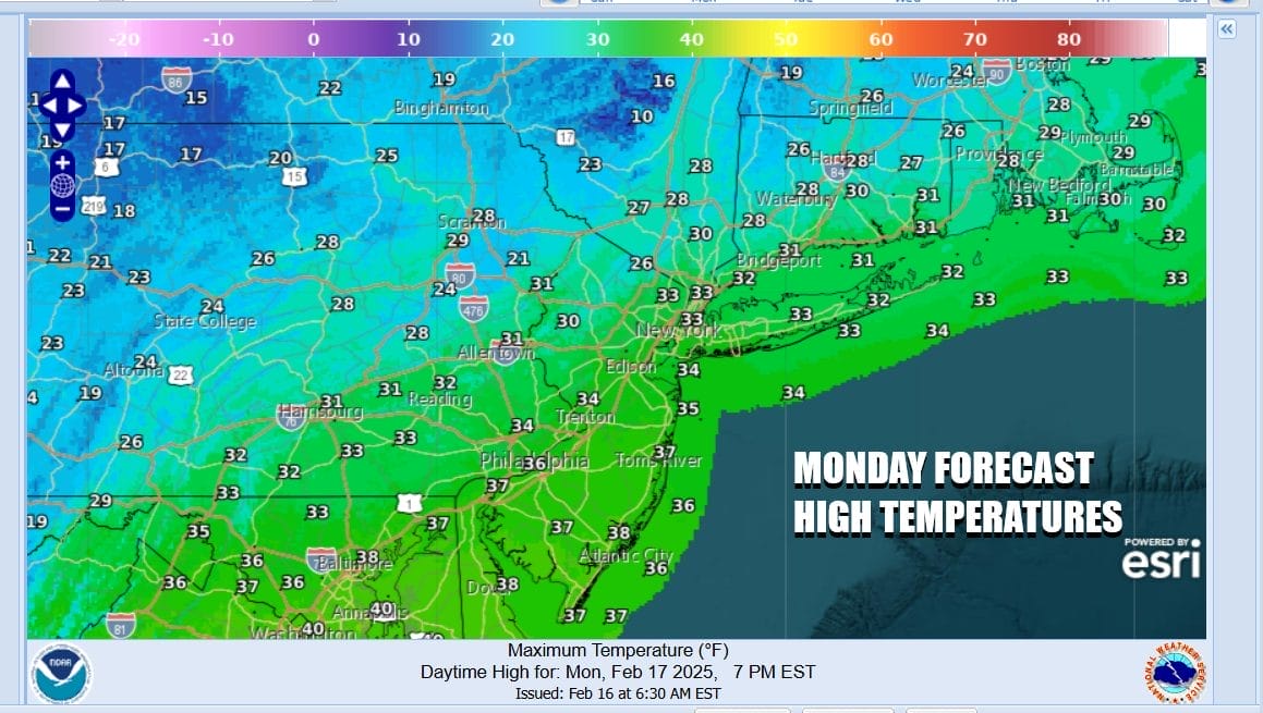
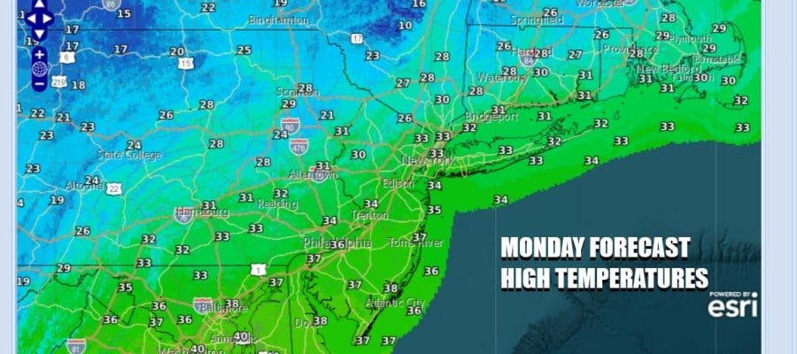
We continue to see strong winds across all of the Northeast and Mid Atlantic states. Wind Advisories and High Wind Warnings continue through the day for westerly winds gusting to 50 mph or more at times. We will see some sunshine today but temperatures won’t be going anywhere as most highs will be in the low to mid 30s. Low pressure finally moves away to the east, at least far enough to allow winds to ease somewhat tonight. It will be very cold tonight under clear skies. Lows will be mostly in the teens everywhere and wind chills will still be an issue all night long.
SATELLITE WITH LIGHTNING STRIKES

WEATHER RADAR

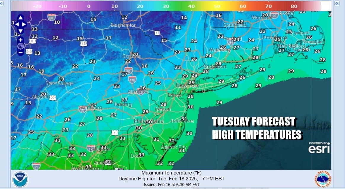
High pressure will build in Tuesday which will be a sunny but very cold day. Highs will only be in the upper 20s and lower 30s. This cold air mass stretches back all the way to Northern Plains and as reaches into the Deep South. This cold air mass will be with us in one form or another all week long.
A boundary lies across the Deep South separating the very cold arctic to the north and warm air across the Gulf Coast and points south. Low pressure develops along this boundary and we will see an area of snow breakout across the Southern Plains and the Middle Mississippi Valley. Low pressure develops along this boundary and moves along the Gulf Coast Tuesday into Wednesday.

To put it simply, there is no room for this storm system to turn up the East Coast. Rather it will spread snow across the Lower Ohio & Tennessee Valley Tuesday and Tuesday night. Wednesday snow reaches Virginia and North Carolina. The developing low will head for the Southeast US coast and move east northeastward out to see. The upper air set up along the East Coast is unfavorable for this storm to climb northward.
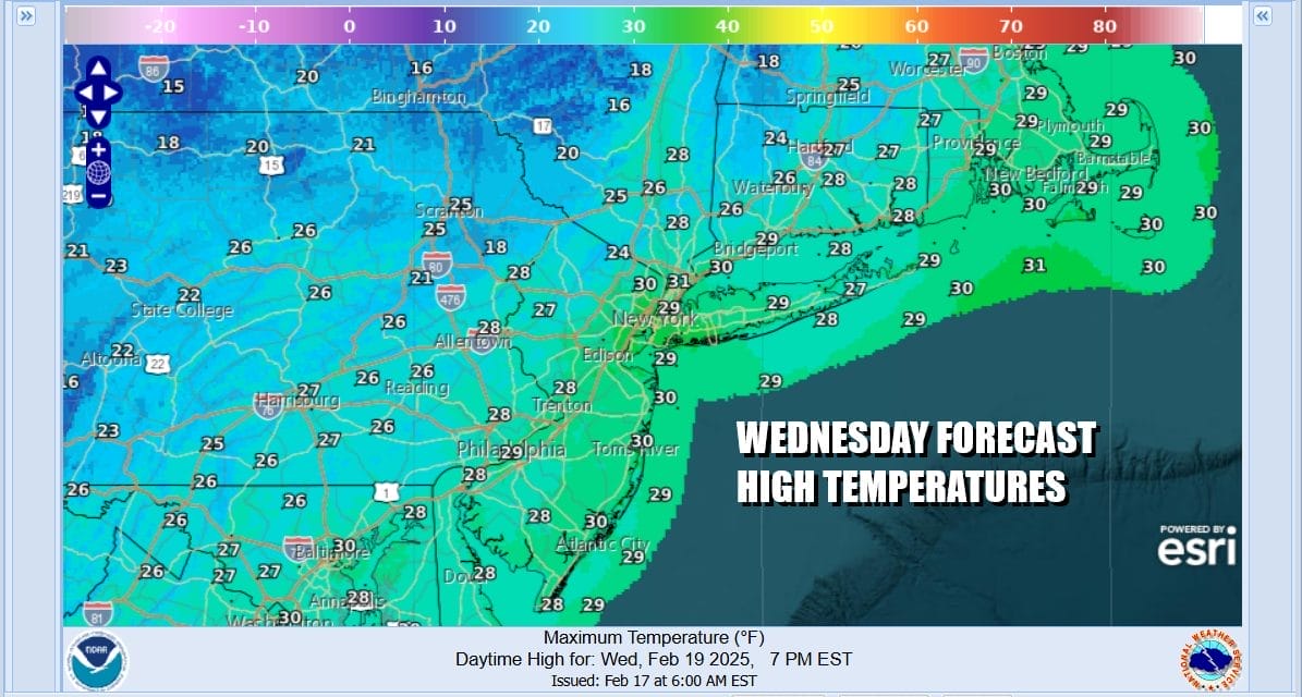
This set up will keep temperatures very cold for the rest of the week and both Wednesday and Thursday will be very cold indeed. High clouds and sunshine will be the forecast for Wednesday but temperatures will not get out of the 20s in most places. Wednesday night under mainly clear skies, lows will be mostly in the teens. Thursday we will see clouds and some sunshine as an upper low passes through. Perhaps there could be a few passing snow showers. Highs Thursday again won’t get out of the 20s. We will be dry Friday and into the weekend and temperatures will start to moderate. No storms or rain or snow risks are in the forecast through Sunday.
BE SURE TO DOWNLOAD THE FREE METEOROLOGIST JOE CIOFFI WEATHER APP &
ANGRY BEN’S FREE WEATHER APP “THE ANGRY WEATHERMAN!
MANY THANKS TO TROPICAL TIDBITS FOR THE USE OF MAPS
Please note that with regards to any severe weather, tropical storms, or hurricanes, should a storm be threatening, please consult your local National Weather Service office or your local government officials about what action you should be taking to protect life and property.


