
It looks like this is going to the be the hottest stretch of weather and the longest one of the summer as temperatures today will begin their run to 90 or better and that will continue into at least Tuesday. Monday and Tuesday look to be the 2 hottest days with highs approaching middle 90s in many areas. Humidity will be climbing throught the period. 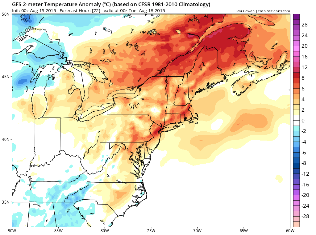
As far as any thunderstorm activity they will be very few and very far between over the weekend. The best chances for any afternoon downpours would be in Northeastern Pennsylvania and even there the chances through Sunday are low. Monday might afford a better chance for storms in this area but not enough to get into anyone’s way and the dominate weather feature of the day will be sun and hot temps.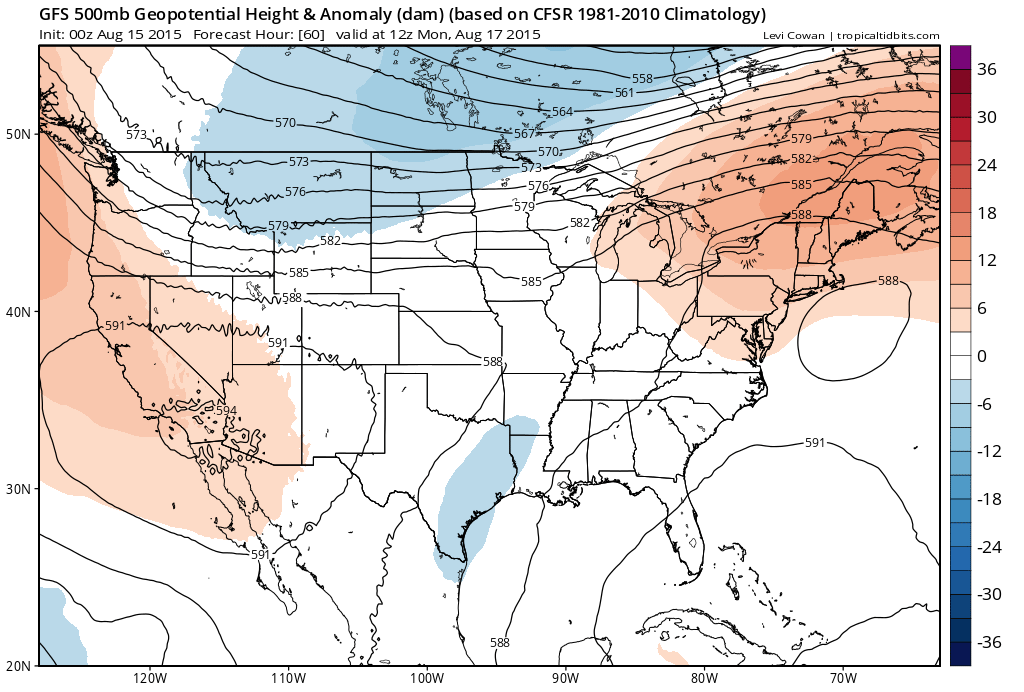
The forecast pattern is pretty simple. The jet stream is in Canada and that means cold fronts will not be able to come through. They can only get so far south before they fall apart. The next chance for anything meaningful on that end won’t be until sometime later next week.


