Weekend Weather Outlook Quiet
Weekend Weather Outlook Quiet
The weekend weather outlook looks quiet and close to average for early December. There really isn’t too much to worry about. The flow is from the northwest bringing down cooler but not especially cold air into the northeast. We have some patchy clouds on the satellite loop this morning as weak disturbances rotate around low pressure in Eastern Canada. This makes for no worse than a partly sunny day with temperatures that will be in the upper 40s to lower 50s.


Radars are quiet and calm and should remain so through Sunday evening. Saturday we should be partly to mostly sunny with highs in the mid to upper 40s and Sunday we will see sunshine giving way to arriving clouds with highs in the low to mid 40s.
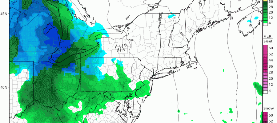
WEEKEND WEATHER OUTLOOK NAM MODEL SUNDAY NIGHT INTO MONDAY MORNING
 Attention then turns to the southwest as low pressure develops in the Gulf States. A small piece of this rushes out ahead and there is the chance of some light precipitation Sunday night, either a little wet snow or a light mix. I don’t think this amounts to much if anything at all. Not all the models have this precipitation even surviving the trip northeastward. For now we will mention the possibility and not be too concerned about it. There is a chance we could see a coating of snow inland if this materializes.
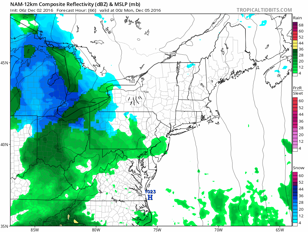
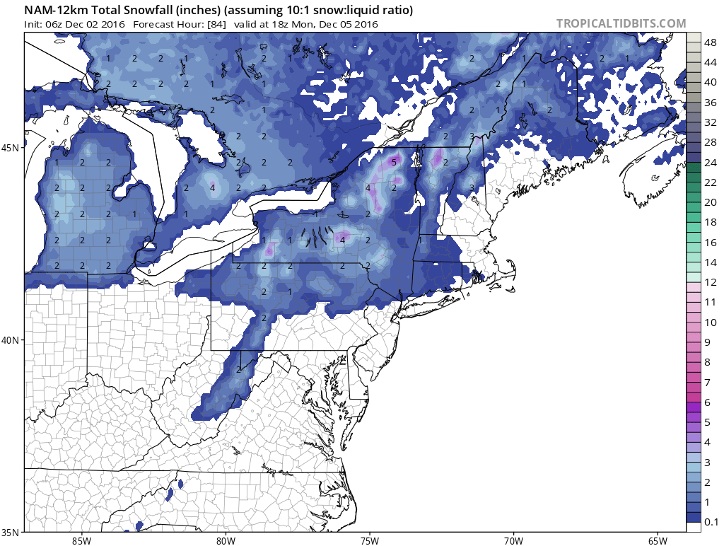 Then the weather system that follows for later Tuesday into Wednesday sees low pressure heading into the Ohio Valley with a secondary low forming along the coast. Cold air is marginal but there could be some wet snow at the start with this later Tuesday. We will have more on this later today.
SNOW REMOVAL COMPANIES FOR YOUR WINTER NEEDS
LONG ISLAND ROCKLAND COUNTY Connecticut

![]()

FiOS1 News Weather Forecast For Long Island
FiOS1 News Weather Forecast For New Jersey
FiOS1 News Weather Forecast For Hudson Valley
NATIONAL WEATHER SERVICE SNOW FORECASTS
LATEST JOESTRADAMUS ON THE LONG RANGE
Weather App

Don’t be without Meteorologist Joe Cioffi’s weather app. It is really a meteorologist app because you get my forecasts and my analysis and not some automated computer generated forecast based on the GFS model. This is why your app forecast changes every 6 hours. It is model driven with no human input at all. It gives you an icon, a temperature and no insight whatsoever.
It is a complete weather app to suit your forecast needs. All the weather information you need is right on your phone. Android or I-phone, use it to keep track of all the latest weather information and forecasts. This weather app is also free of advertising so you don’t have to worry about security issues with your device. An accurate forecast and no worries that your device is being compromised.
Use it in conjunction with my website and my facebook and twitter and you have complete weather coverage of all the latest weather and the long range outlook. The website has been redone and upgraded. Its easy to use and everything is archived so you can see how well Joe does or doesn’t do when it comes to forecasts and outlooks.
Just click on the google play button or the apple store button on the sidebar for my app which is on My Weather Concierge. Download the app for free. Subscribe to my forecasts on an ad free environment for just 99 cents a month.
Get my forecasts in the palm of your hand for less than the cost of a cup of Joe!


