DOWNLOAD MY NEW FREE JOESTRADAMUS WEATHER APP FOR ALL DEVICES
THE APP IS ABSOLUTELY FREE TO ALL BUT CONSIDERING SUBSCRIBING TO PATREON FOR A WEATHER EXPERIENCE FREE OF ADS, EXCLUSIVE VIDEOS FOR MEMBERS ONLY AND MUCH MORE…STARTS AT $2 A MONTH..MESSAGE ME AT ANY TIME
Weekend Split 70s Saturday Coastal Low Next Week
We continue to be on course for warmer temperatures and today is the day we struggle with clouds and passing showers in some areas and less so in others. The frontal boundary this morning is set up across Northeast Pennsylvania to just north of NYC to Connecticut. Areas south of Allentown PA to Route 78 in New Jersey southward will likely see just clouds with some breaks of sunshine later today.
SATELLITE

REGIONAL RADAR

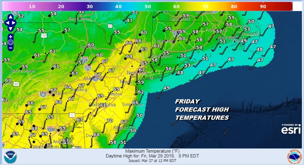
This makes our Friday temperature forecast tricky. Not only do you have clouds and rain as you go north you also have an ocean wind to contend with along the coast. This means wide temperature ranges today with highs from the upper 60s to near 70 in South Jersey to upper 50s and lower 60s North Jersey to the Hudson Valley and 50S to near 60 Long Island and Southern New England.
This weather front to the north moves further north tonight and Saturday should put us in clouds and sunshine for Saturday with highs from the low 60s along the coast to lower 70s inland. A bit more sun and you could see some upside temperature wise. Saturday afternoon. No rain is forecast Saturday or much of Saturday night.
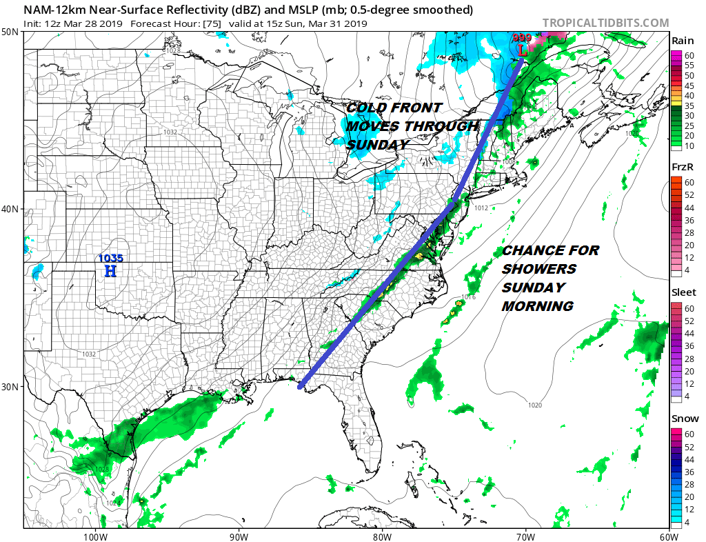
Here comes a cold front for Sunday with some showers Sunday morning and they could last into early afternoon before ending from west to east with highs in the 50s to near 60 early but then easing toward the low end of the 50s later in the day. Monday brings high pressure and sunshine with highs in the chilly 40s.
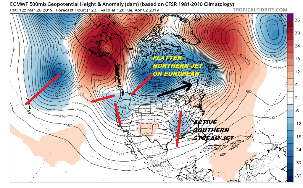
We are watching the prospects of low pressure moving up the East Coast for the middle of next week which would bring some wind and rain for coastal areas later Tuesday night and Wednesday. We still see model uncertainty here regarding whether the system lifts up the coast before it gets kicked out to the northeast. That to me seems the most favored idea given the overall weather pattern.
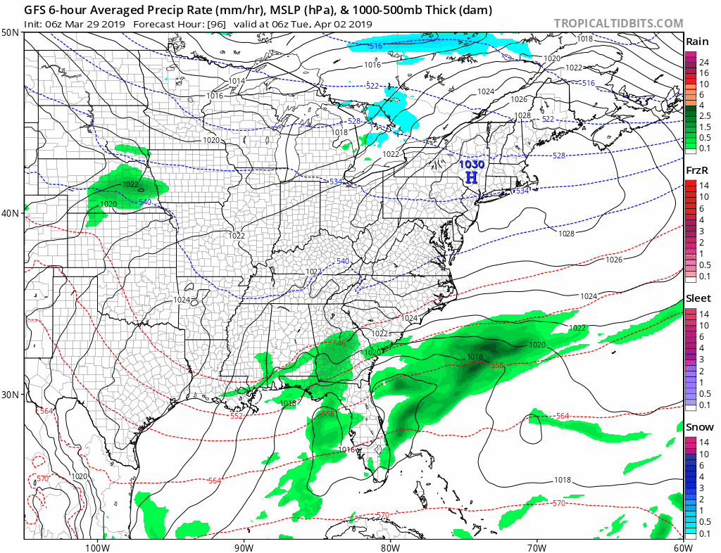
You will notice from the GFS loop of the surface map that the low begins to slide to the east and that the rain from this is confined to coastal areas and doesn’t extend that far inland. The European model is not too different from this idea. We are still in the the time frame where models are adjusting and won’t get to a better idea on this over the weekend. So in the meantime enjoy Saturday which is the better of the two weekend days.
MANY THANKS TO TROPICAL TIDBITS FOR THE USE OF MAPS
Please note that with regards to any tropical storms or hurricanes, should a storm be threatening, please consult your local National Weather Service office or your local government officials about what action you should be taking to protect life and property.


