
Weekend Is a Mix of Sun & Clouds Warm Air Comes In For Monday & Tuesday
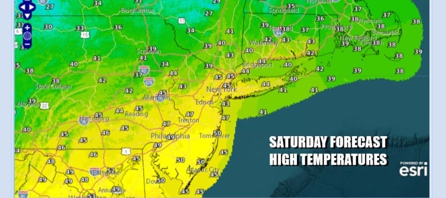
The weekend is here and we have overall a decent couple of days. What was left of a Western US snowstorm is an area of clouds. Snow and rain showers that were mostly scattered in nature have moved out to the east and we should see some improvement as the day wears on. We are going for a mix of sun and clouds. Temperatures this afternoon will reach the upper 40s and lower 50s. Tonight under clear skies we will bottom out in the 20s to around 30 degrees Sunday morning. Don’t forget to move the clocks ahead one hour in honor of daylight saving time.
SATELLITE WITH LIGHTNING STRIKES

WEATHER RADAR

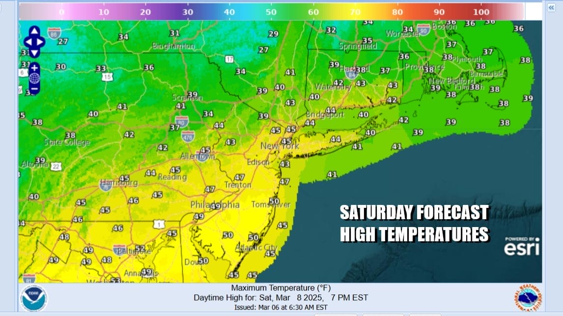
The second half of the weekend looks like a decent day as well. Low pressure moving across the lower Gulf States makes an exit to the east off the Southeast coast and will have no impact here. We have weak high pressure to the south which should allow for a mix of sun and clouds. It will be breezy with high temperatures in the upper 40s to lower 50s.

The new week looks to mostly dry at least through Friday. The one exception may be Thursday for a short time. We have a westerly flow of warmer air setting up for Monday and Tuesday with high pressure to the south. A weak backdoor cold front will approach overhead and then stall out Wednesday night and Thursday. There could be a little bit of rain along the front boundary later Thursday but before that we have a big warm up.
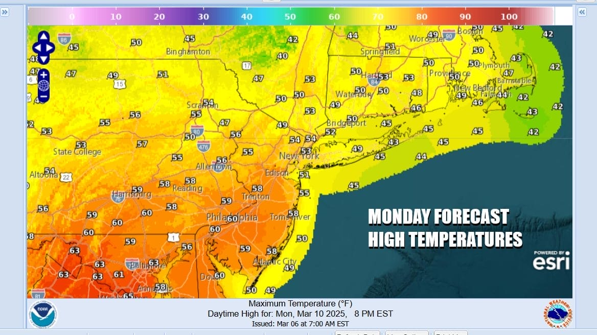
Monday sees sunshine and a west wind and high temperatures will climb into the 60s in many locations except for mid to upper 50s across the Hudson Valley and Southern New England. South and east facing shoreline areas will probably be in the 40s. Tuesday we will take temperatures a little higher with sunshine. Highs will be in the 60s and some warm spots could reach 70.

Wednesday will also be warm until the backdoor front passes and then stalls Highs will be in the 60s with sunshine and some arriving clouds. Thursday likely sees clouds with temperatures in a wide range from north to south depending on where the front winds up. Then we should finish off the week with some sunshine for Friday and warmer than normal temperatures for inland areas and cooler readings near the coast.
BE SURE TO DOWNLOAD THE FREE METEOROLOGIST JOE CIOFFI WEATHER APP &
ANGRY BEN’S FREE WEATHER APP “THE ANGRY WEATHERMAN!
MANY THANKS TO TROPICAL TIDBITS FOR THE USE OF MAPS
Please note that with regards to any severe weather, tropical storms, or hurricanes, should a storm be threatening, please consult your local National Weather Service office or your local government officials about what action you should be taking to protect life and property.


