Weekend Forecast Nice Saturday Cloudy Sunday Watching Nestor
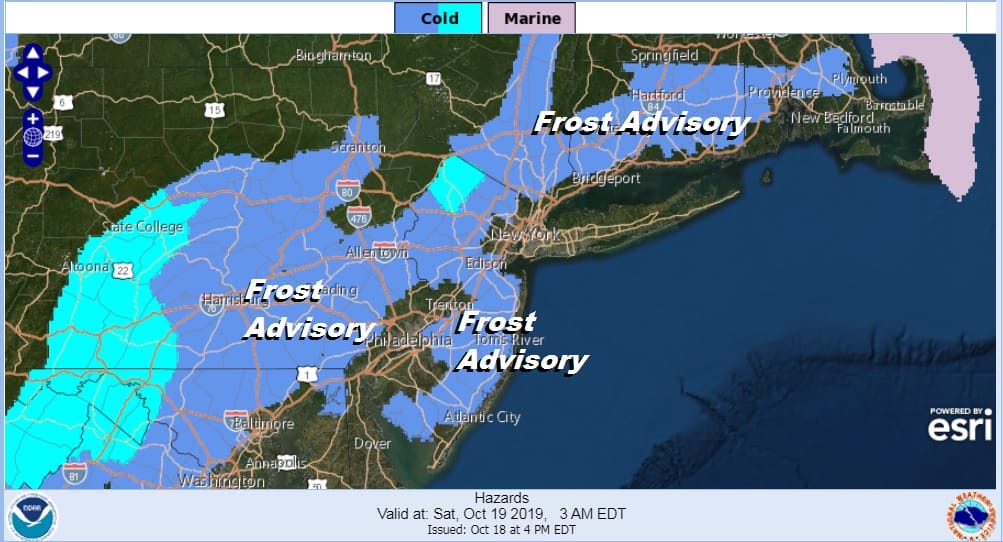
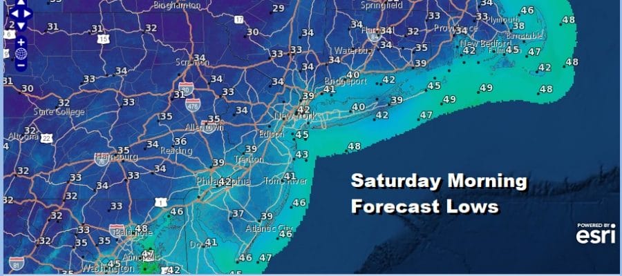
Let us get the weekend underway starting with a cold night coming up that will produce a widespread inland frost from Northwest Virginia to Southern New England. The exception to this will be the immediate coast and the warmer urban areas which should stay closer to 40 degrees or so for the overnight lows.
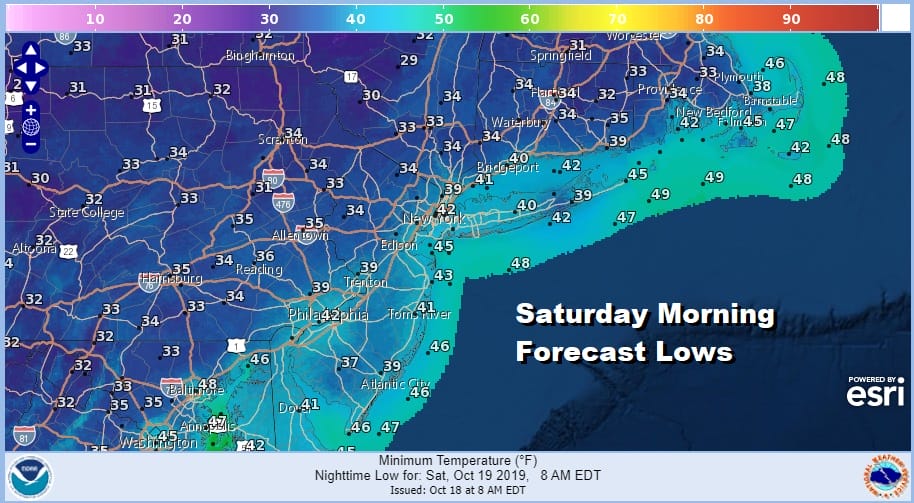
We are still seeing some residual cloud cover north and and west of coastal aresa in Upstate NY and New England as Wednesday’s storm continues to move through Eastern Canada and the upper trough is moving offshore. Skies should clear out overnight in most areas and with light winds, cold spots will approach the freezing mark as the map shows above. There are no issues to worry about regarding the radar through Saturday.
SATELLITE

REGIONAL RADAR

Saturday is the better of the two weekend days with lots of sunshine from start to finish. Temperatures will bounce back into the 60s for afternoon highs and winds will be light and variable. To the south we will be seeing rain spreading northward through the Southeast US as Tropical Storm Nestor makes landfall Saturday morning along the NW coast of Florida. The storm will transition to a non tropical cyclone as it moves up the coast through the Carolinas Saturday and Saturday night with rain.

Sunday’s dilemma is the track of the post tropical low as it passes off the North Carolina coast and then turns east northeast. This could bring the northern fringe of light rain to perhaps as far north as Southern New Jersey with heavier rain from Delmarva southward. Should this play out much of the area will be in clouds but not much else with highs reaching the 60s. Monday will put us in between the coastal low and a cold front to the west so we should see some sunshine with highs reaching the mid to upper 60s.
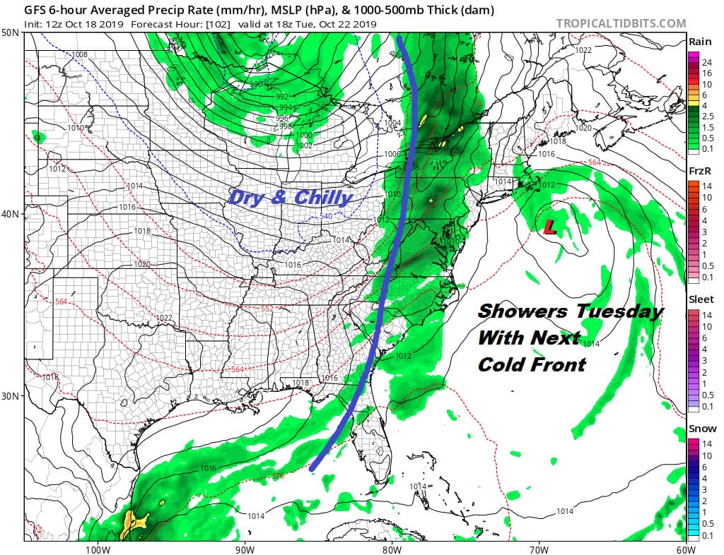
Our active weather pattern continues with the next cold front and the likelihood of showers on Tuesday into Tuesday night. This will be followed by dry and seasonally chilly air for Wednesday and Thursday with sunshine. Then the next round of changes with another cold front and the chance for rain returns next Friday.
MANY THANKS TO TROPICAL TIDBITS FOR THE USE OF MAPS
Please note that with regards to any severe weather, tropical storms, or hurricanes, should a storm be threatening, please consult your local National Weather Service office or your local government officials about what action you should be taking to protect life and property.


