
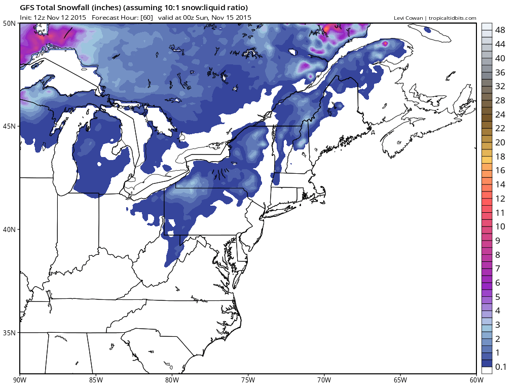
We will get the easy part of this out of the way first. There will be some lake effect snow in Upstate NY later Friday night into Saturday. It shouldn’t amount to much and weather models vary amounts and placement. Lake effect is always a difficult thing to figure out because of the local climate in Western New York but this amounts to a cheap thrill and it will all melt away fairly quickly since the cold shot of air moves out fast Sunday and Monday. Again this is a cheap thrill at best.

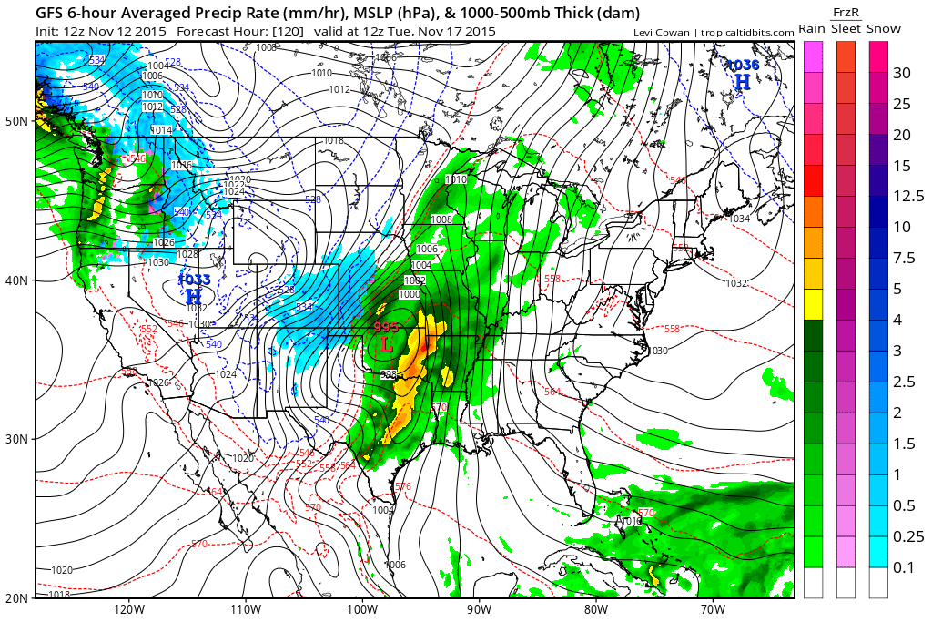
All of the action next week will be out in the Central Plains and Central Rockies as weather models are zeroing in on a very deep weather system and developing storm which looks like it could bring some big snows to Colorodo and parts of Kansas and Nebraska. From the GFS snowfall map we can probably scale back those amounts a bit but there still should be some sizable snows for somebody in that region.
You can see that while that storm is going on, here in the east we are going to be under that super strong upper ridge that is going to build up and down the Eastern seaboard. Both go hand in hand. When a deep upper air disturbance is moving into an area, strong ridges build on either side. The upper air map close up and wide shot show the extent of the trough and also show per the European weather model the position of the polar vortex remaining well north and west through the middle of next week.

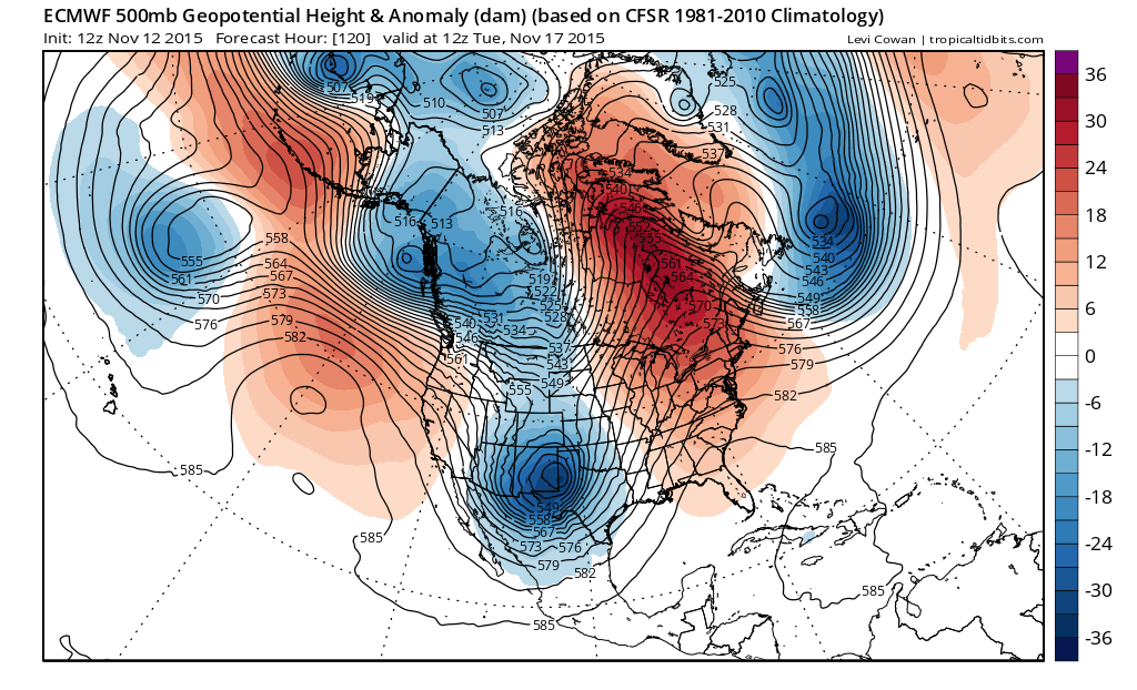
We have been discussing this feature and until it breaks down, splits, or reforms, there is not going to be a significant change in the weather pattern across the Eastern States. I have to say it has been a long time since I have seen a strong persistent ridge in the east like this for such a long period of time.

The European does break off part of this vortex and forms a new trough in the middle of the country but the main polar vortex complex remains locked across the north pole and into Asia. There is still a strong ridge along and off the east coast. Even with this “split” it is not likely to be permanent as weather forecast models will attempt to just move this along. It might mean a cold shot that lasts for a day or 2, but again there is nothing permanent here when viewed in the longer term.
JETSTREAM VIEW FOR SHORT RANGE (NEXT 6 DAYS)
SHORT TERM FORECAST FOR THURSDAY THROUGH SUNDAY
JOESTRADAMUS LONG TERM FORECAST
JOESTRADAMUS WINTER FORECAST 2015-2016


