Weather Models Diverge Long Range

Weather Models Diverge Long Range
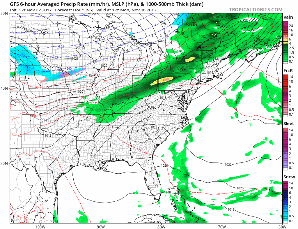
With the pattern becoming a bit more active we will being seeing more ups and downs going into next week. After tomorrow’s run back into the 70s, a cold front will put an end to that and the weekend brings with it another trip down and another trip up. Saturday looks good from the standpoint of some sunshine but highs will just be in the 50s as high pressure goes by to our north. Then the next warm front cold front combination moves through Sunday and Monday. That is pretty much the easy part of the forecast. Once the front passes through Monday it will stall to our south and weak wave will develop on the front and bring a chilly rain on Tuesday and Tuesday night. The GFS shows this playing out in a fairly straight forward way. The other models have a weaker look to all this. Either way it will be warm Monday with highs in the 70s and chilly Tuesday with highs again just in the 50s and it may be in the upper 40s and lower 50s if it does rain all day.
WEATHER MODELS GFS MONDAY THROUGH WEDNESDAY CLICK TO ANIMATE
Models a few days ago had a much stronger system and a much colder look for Tuesday and Wednesday even implying some snow in upstate NY and New England but the upper air system swinging east is now much weaker and it looks like cold dry air just basically overwhelms and the rest of the week would be cold and dry
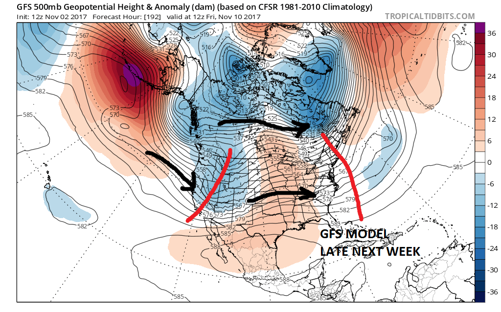
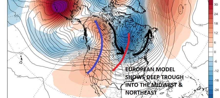
The flow across the country on the GFS flattens out and just basically goes west to east. This would suggest chilly weather Wednesday and Thursday followed by some moderation on Friday into the weekend. The European has a much different look to it with a strong vortex in Canada bleeding cold air into the Eastern US and keeping it chilly through the rest of the week and into the weekend.

Either model solution would mean mostly dry weather so it will be a matter of temperatures being near or slightly above average in the long range on the GFS or near to below average on the European. No big storms are indicated for the East in either case.
MANY THANKS TO TROPICAL TIDBITS FOR THE WONDERFUL USE OF THE MAPS

GET JOE A CIGAR IF YOU LIKE!
FiOS1 News Weather Forecast For Long Island
FiOS1 News Weather Forecast For New Jersey
FiOS1 News Weather Forecast For Hudson Valley
NATIONAL WEATHER SERVICE SNOW FORECASTS
LATEST JOESTRADAMUS ON THE LONG RANGE
Weather App

Don’t be without Meteorologist Joe Cioffi’s weather app. It is really a meteorologist app because you get my forecasts and my analysis and not some automated computer generated forecast based on the GFS model. This is why your app forecast changes every 6 hours. It is model driven with no human input at all. It gives you an icon, a temperature and no insight whatsoever.
It is a complete weather app to suit your forecast needs. All the weather information you need is right on your phone. Android or I-phone, use it to keep track of all the latest weather information and forecasts. This weather app is also free of advertising so you don’t have to worry about security issues with your device. An accurate forecast and no worries that your device is being compromised.
Use it in conjunction with my website and my facebook and twitter and you have complete weather coverage of all the latest weather and the long range outlook. The website has been redone and upgraded. Its easy to use and everything is archived so you can see how well Joe does or doesn’t do when it comes to forecasts and outlooks.
Just click on the google play button or the apple store button on the sidebar for my app which is on My Weather Concierge. Download the app for free. Subscribe to my forecasts on an ad free environment for just 99 cents a month.
Get my forecasts in the palm of your hand for less than the cost of a cup of Joe!