Weather Improves Watch for a Passing Shower
Week Ahead Brings Rain Later Wednesday

Weather Improves Watch for a Passing Shower
Week Ahead Brings Rain Later Wednesday

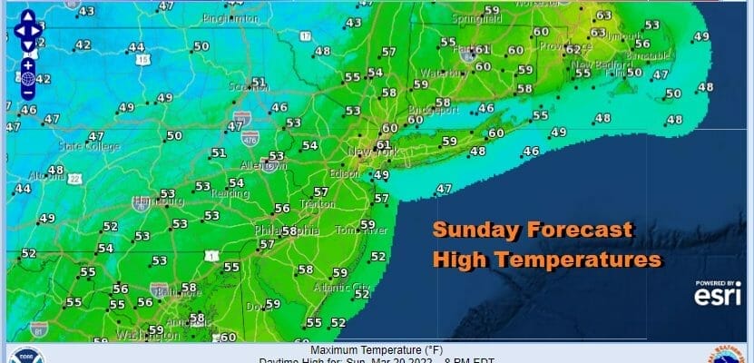
A cold front has passed through the area and in general this Sunday should be a decent day. We still have an upper trough that needs to move through so that will mean that any sunshine will mix with developing clouds a the day wears on. Temperatures today will be ni the 50s for highs. Inland that means temperatures will be 20 degrees cooler than yesterday. Along the coast temperatures will be the same as yesterday. Late this afternoon and evening the upper trough moves through so we will throw in the chance for passing scattered shower. Most of you won’t see one. Skies should partially clear afterwards with Monday morning lows in the 30s to near 40 in warmer urban settings.
SATELLITE

WEATHER RADAR

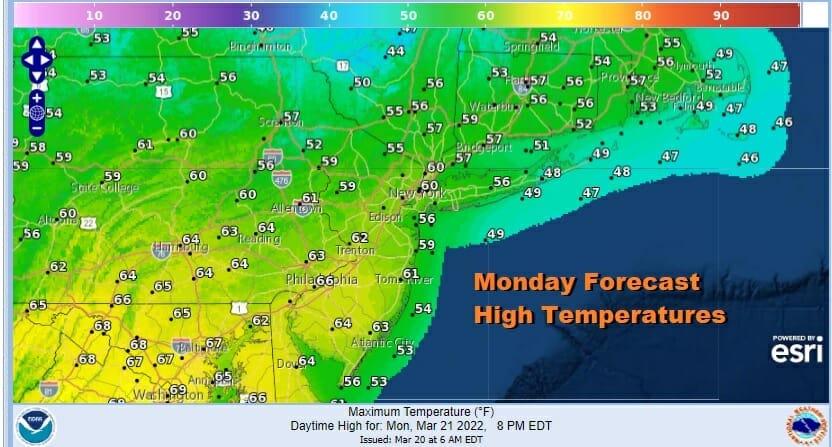
Monday will be a nice day of sunshine but again there will be some clouds around as another upper air disturbance and weak front approach. Temperatures Monday will top out in the upper 50s to lower 60s.
There will be little with the frontal passage Monday night though it turns a little colder into Tuesday morning. Tuesday should be a nice day with sunshine. Highs will be mostly in the 50s.

This week is going to be a busy week for severe weather across the South and that includes elevated risk for severe weather Monday and Tuesday in the Gulf States. Low pressure heads out of the Southern Plains and moves to the Great Lakes and Northeast Wednesday and Thursday. We are looking at increasing clouds Wednesday with rain ahead of a warm front coming in as the day wears on. Highs will be in the raw upper 40s to mid 50s with a wind off the ocean. Thursday is debatable as to whether conditions improve or a cold front slows and a second wave brings more rain later Thursday into Thursday night and then we have to wait until Friday for genuine improvement. We are leaning to the idea that weather conditions improve Thursday and Friday looks like a nice finish to the week.
BE SURE TO DOWNLOAD THE FREE METEOROLOGIST JOE CIOFFI WEATHER APP &
ANGRY BEN’S FREE WEATHER APP “THE ANGRY WEATHERMAN!
MANY THANKS TO TROPICAL TIDBITS & F5 WEATHER FOR THE USE OF MAPS
Please note that with regards to any severe weather, tropical storms, or hurricanes, should a storm be threatening, please consult your local National Weather Service office or your local government officials about what action you should be taking to protect life and property.