Weather Improves Today Deteriorates Wednesday Rain Thursday Into Friday

Weather in 5/Joe & Joe Weather Show Latest Podcast
Weather Improves Today Deteriorates Wednesday Rain Thursday Into Friday
Some areas are seeing some leftover clouds around but on the whole most places are no worse than partly sunny. The improving weather conditions advertised yesterday have come to pass. We should see no worse than partly sunny skies for the remainder of the day.
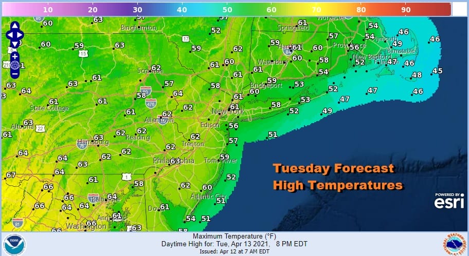
Highs this afternoon should reach the upper 50s to lower 60s except for south and east facing shorelines that could be at least a few degrees lower. The upper low from the Ohio Valley has now exited to the east. To the northwest we have the next upper low over the Great Lakes and this one is stronger and will take at least a couple of days to play through.
SATELLITE

We should see clear skies for tonight with most lows in the 40s. Wednesday look for increasing clouds as that next upper air system starts to dive southeastward to the New Jersey Coast. Some showers could pop up late in the day Wednesday from Western New Jersey westward. Highs will be in the upper 50s coast to low and mid 60s inland.
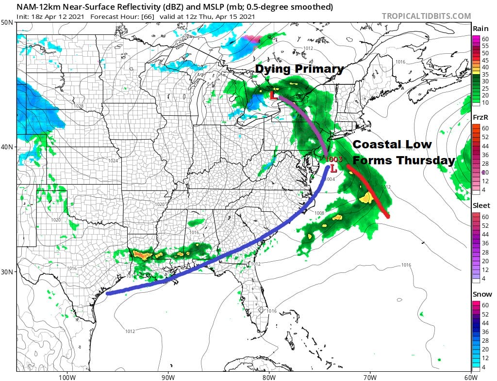
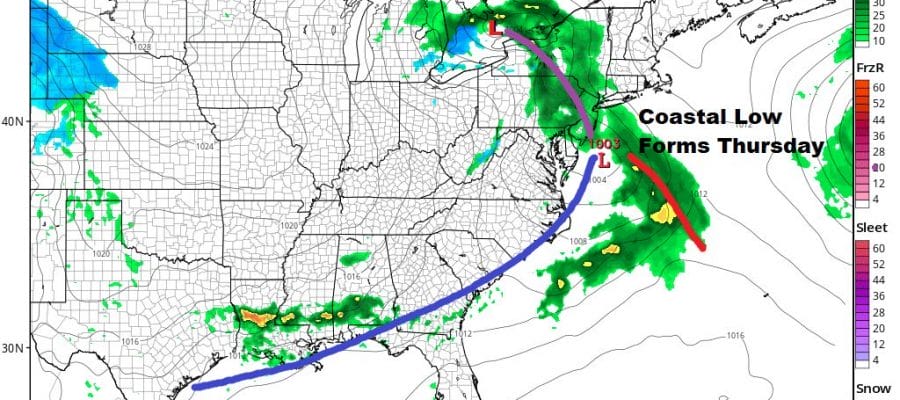
Gradually a dying primary shifts energy to a developing secondary low off the Delaware coast and that covers the area in rain Thursday morning. Thursday looks like a rather miserable rainy day. Temperatures in many areas will be just in the 40s to at best near 50.
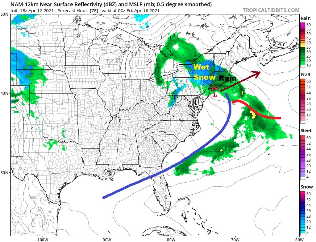
By Thursday evening colder air aloft thanks to a strong upper low will mix down to the lower atmosphere and rain will change to wet snow from Northeast Pennsylvania to Western New England, mainly in elevations above 1500 feet. At these higher elevations several inches of wet snow are possible. A cold raw rainy night will taper off Friday morning as the low starts to to move to the east. Latest models are a little faster with getting this system out of the way so we could see leftover clouds Friday afternoon and maybe even some brightening of skies inland. Temperatures will be in the mid 40s to lower 50s for highs. Saturday continues to shape up as the better of the two weekend days with clouds back on Sunday and the chance perhaps for some late day scattered showers. Temperatures over the weekend will be in the cool side of average, 50s to near 60 Saturday and low to mid 60s on Sunday.
BE SURE TO DOWNLOAD THE FREE METEOROLOGIST JOE CIOFFI WEATHER APP &
ANGRY BEN’S FREE WEATHER APP “THE ANGRY WEATHERMAN!
MANY THANKS TO TROPICAL TIDBITS FOR THE USE OF MAPS
Please note that with regards to any severe weather, tropical storms, or hurricanes, should a storm be threatening, please consult your local National Weather Service office or your local government officials about what action you should be taking to protect life and property.


