
Weather Forecasting Models Show Vortex Split But Joe Is Dubious
Last night’s model runs continue the recent trend (of the last few weeks) of models sending out signals of changes in the overall weather pattern beyond the first week only to have them completely back off over time to pretty much the same thing. Actually I would argue that the pattern has shifted into something a little different that what was the case in October. It is just that it isn’t the sort of pattern that snow lovers and winter worshipers like.
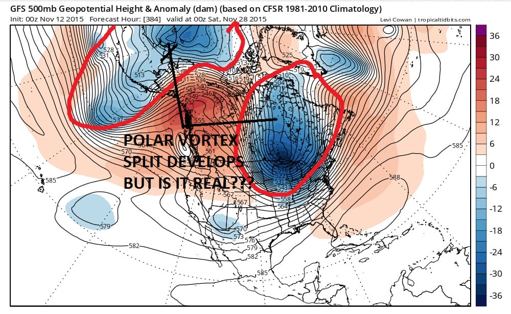
The biggest issue regarding this weather pattern has to do the upper air pattern from Alaska westward into Siberia and back over the north pole. Here lies the polar vortex and with the vortex in that position it becomes impossible for cold air to come out of the polar regions and head into Canada let alone the lower 48 of the United States. The video below illustrates the problem. It is a bit long today as I covered both the short term and the longer term weather pattern on it. Keep your eyes on the action over Northwest Canada. The model last night does split the vortex which then establishes a polar flow to some degree with air coming down from Northern Canada into the United States later in the period.
One of the reasons I use the upper air maps is that it is a broader look. If I used surface maps we would be seeing needless storms in the long range period that appear on one run and then disappear on the next so it really isn’t worth spending time on that. Rather it is important to focus on the general flavor of the upper air pattern going forward.
Note to winter lovers and snow lovers: If you honestly believe that being in a better pattern now is an indicator of a winter you will enjoy with lots of cold and snow…think again!!! If my memory serves me correctly (I’m almost 60 so it seldom does), December 1989 I believe (doing this off the top of my head) was one of the coldest Decembers in a long time which was then followed by one of the warmest January’s and warmest February’s on record for New York City. That is just one of many examples.
Note to winter haters: If you think that warm now means a warm winter..well you get the idea at this point.
JETSTREAM VIEW FOR SHORT RANGE (NEXT 6 DAYS)
SHORT TERM FORECAST FOR THURSDAY THROUGH SUNDAY
JOESTRADAMUS LONG TERM FORECAST
JOESTRADAMUS WINTER FORECAST 2015-2016


