
USE THE COUPON CODE “SPRING2025” AND GET 10 PERCENT OFF ON ANY PURCHASE

Weather Conditions Slowly Improve Today
Week Ahead Sees Below Average Temps & Rain Chances

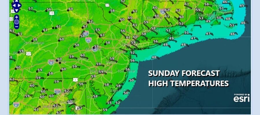
Rain from yesterday and overnight has exited offshore. Low pressure is off the New Jersey/Delaware coast and sliding slowly eastward. We do have quite a bit of leftover clouds around this morning however satellite loops show dry air across Upstate New York and Northern New England draining southward so expect to see decreasing clouds today and perhaps some developing sunshine from north to south this afternoon. The winds off the ocean continue so that will keep temperatures somewhat in check. Highs will be in the mid 50s to around 60 degrees or so this afternoon. Radars show rain offshore and dry conditions
SATELLITE WITH LIGHTNING STRIKES

WEATHER RADAR

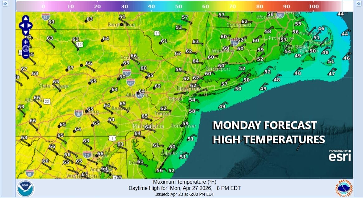
We will see skies clear out tonight across Eastern Pennsylvania to Southern New England and most Monday morning lows will be in the upper 30s inland low to mid 40s coast and warmer urban locations. Monday we will see partly to mostly sunny skies as high pressure builds into New England and winds remain from the northeast and east though the air is dry. Highs should be back into the 60s inland but along the coast it will be about 10 or so degrees lower with the ocean wind.
Two weather fronts will be approaching this week. The first Tuesday will see an area of showers gradually weaken as it nears the coast so we don’t expect much from this. A slightly stronger front is right behind it and stands to bring the risk for showers and perhaps a thunderstorm or two late Wednesday into Wednesday night. The front is forecast to move offshore Thursday morning as showers come to an end.

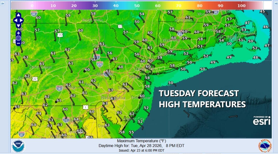
Ahead of the first front Tuesday the onshore flow continues so that puts a cap on temperatures again. We will have some sun and arriving clouds with the risk for a shower or two late in the day or Tuesday evening though the showers will be scattered in nature and many of you won’t see anything of substance. Highs Tuesday will be in the 60s inland with 50s along the coast.
Winds will be from the southeast on Wednesday so that holds temperatures back again with highs in the 60s; 50s along the coast. Expect to see more in the way of clouds around and more widespread showers developing later in the day and evening. There might be a thunderstorm or two in the mix Wednesday night. Weather conditions will dry out for Thursday and Friday and while you can expect some sunshine to return, temperatures will be below seasonal averages.
BE SURE TO DOWNLOAD THE FREE METEOROLOGIST JOE CIOFFI WEATHER APP &
ANGRY BEN’S FREE WEATHER APP “THE ANGRY WEATHERMAN!
MANY THANKS TO TROPICAL TIDBITS FOR THE USE OF MAPS
Please note that with regards to any severe weather, tropical storms, or hurricanes, should a storm be threatening, please consult your local National Weather Service office or your local government officials about what action you should be taking to protect life and property.


