
Warming Up Ahead of Rain Thunderstorms Wednesday
As Major Storm Heads for Great Lakes

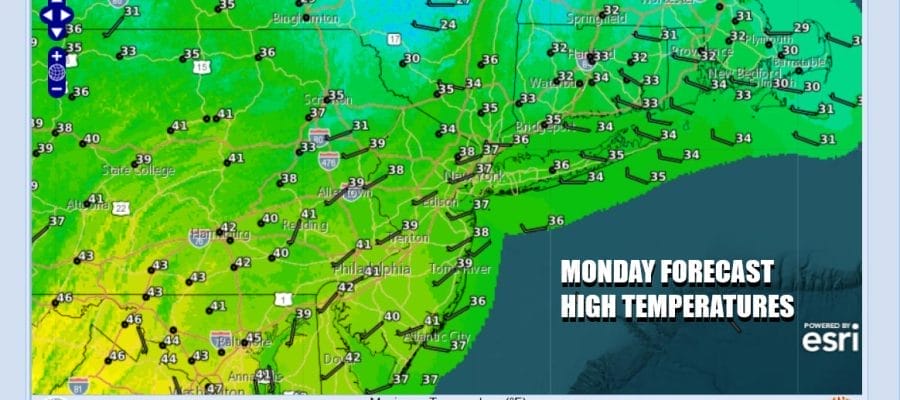
The latest cold air mass is overhead today but it will begin to move to the east as the day wears on. This will allow temperatures to start to move higher this afternoon. Winds will be more west southwest today which starts the warming process. We will have a good deal of sunshine today with nothing more than some passing patchy clouds. Highs will be in the mid 30s to around 40 degrees in most places. Radars are nice and quiet and will remain so probably through Tuesday night.
SATELLITE WITH LIGHTNING STRIKES

WEATHER RADAR

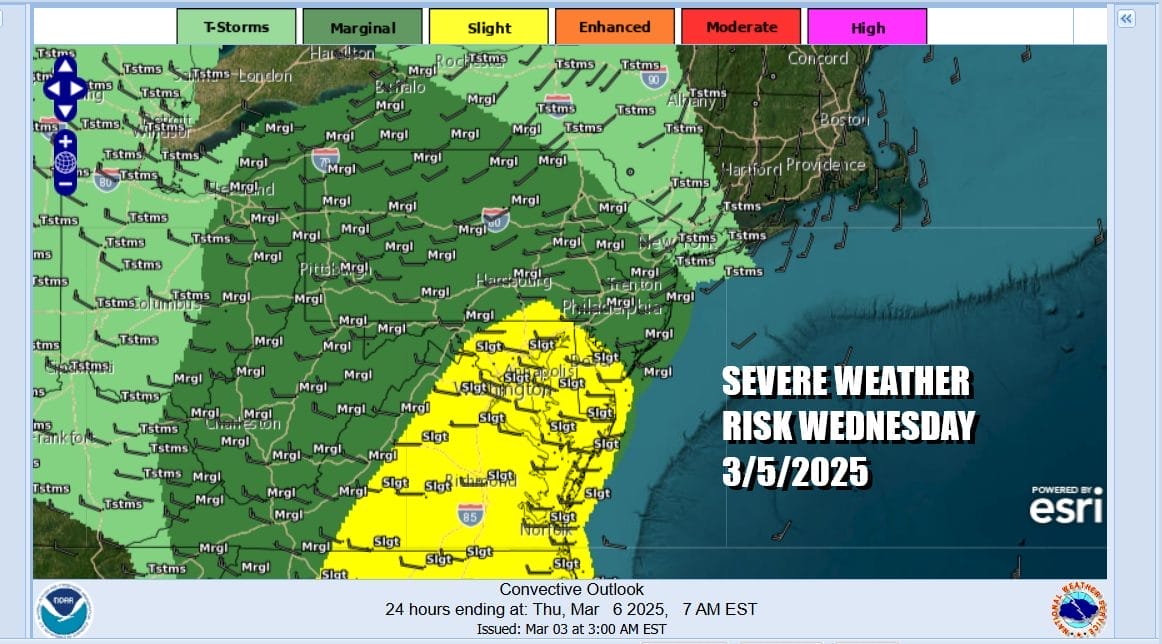
A major storm will begin to develop Tuesday in the Central Plains. This developing low will intensify rapidly as it makes its way northeastward to the Great Lake. Upper air dynamics are impressive and we could see a widespread severe weather outbreak across the Gulf States Tuesday. There is also elevated tornado risk and risk for EF-2 tornadoes in this region.

The associated cold front with this developing storm will eventually make its way to the East Coast Wednesday and from this we will see windy conditions develop with downpours and thunderstorms possible during Wednesday into Wednesday evening. The severe weather risk will shift to Eastern Pennsylvania to Southern New England and the Storm Prediction Center is showing severe weather risk pushing northward through New Jersey, though the higher risk zone is from Southern New jersey southward at least for now.
Ahead of all this we will not be as cold night as past nights with most lows in the 20s to lower 30s. Tuesday will still be a nice day with sunshine for much of the day. High temperatures will start to climb and will reach the upper 40s to lower 50s in most places. It will be cooler during the afternoon and evening along south and east facing shorelines as the south winds off the cold ocean keep temperatures on the low end of the range.

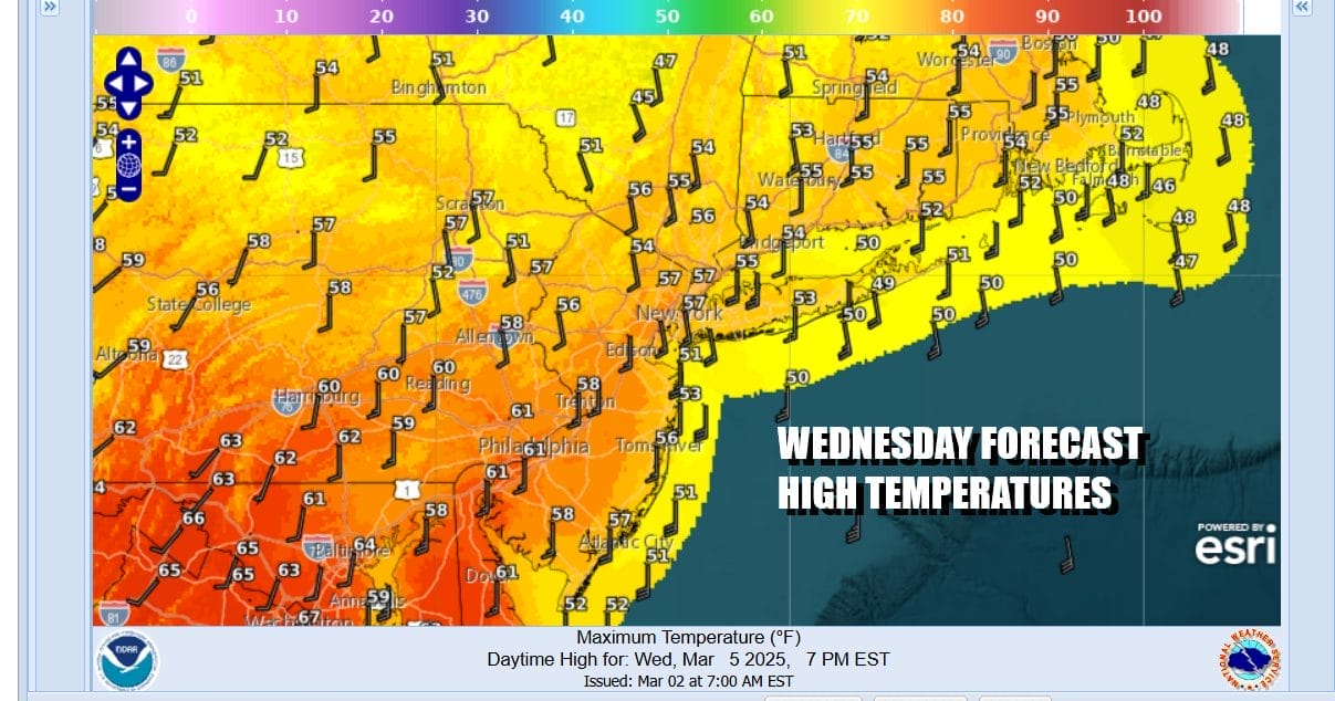
Wednesday will be a rather stormy day as a warm front surges northward into Upstate NY and New England. South winds will pick up and become strong and gusty as the day wears on. Showery rains with some heavier downpours are likely and we will look for the chance for some thunderstorms in the mix late Wednesday into Wednesday evening. Most highs will be in the mid 50s to lower 60s from south to north. Again the south wind means south and east facing shorelines will be lower.
Behind the cold front is cooler air but not cold air so while sky conditions will improve Thursday with returning sunshine, temperatures will likely still top out in the 50s. Dry air will continue to hang around for Friday with temperatures in the upper 40s to some lower 50s and we will have some sunshine.
BE SURE TO DOWNLOAD THE FREE METEOROLOGIST JOE CIOFFI WEATHER APP &
ANGRY BEN’S FREE WEATHER APP “THE ANGRY WEATHERMAN!
MANY THANKS TO TROPICAL TIDBITS FOR THE USE OF MAPS
Please note that with regards to any severe weather, tropical storms, or hurricanes, should a storm be threatening, please consult your local National Weather Service office or your local government officials about what action you should be taking to protect life and property.


