

Warmer Weather Days Ahead With No Rain or Snow Forecast Through Wednesday
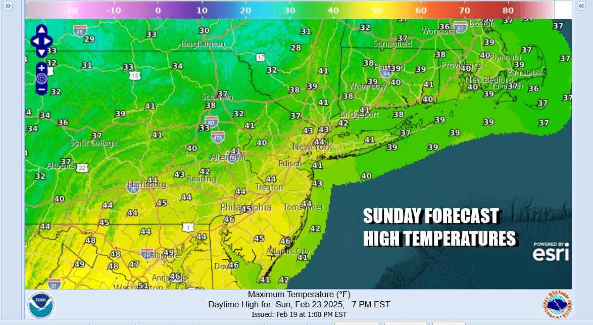
We are enjoying a nice Saturday afternoon of weather across Eastern Pennsylvania to Southern New England. The cold arctic is air is gone and now we can spend the next few days with warmer temperatures and no precipitation to worry about probably through next Wednesday. Highs this after noon are reaching the upper 30s and lower 40s. Radars are nice and quiet. Some high clouds will move in tonight as an upper trough passes by to our north. This should mean a chilly night but warmer than past nights. Sunday morning lows will be in the mid 20s to lower 30s. Sunday is looking to be a nice day of no worse than partly sunny skies. Highs will reach the 40s everywhere.
SATELLITE WITH LIGHTNING STRIKES

WEATHER RADAR

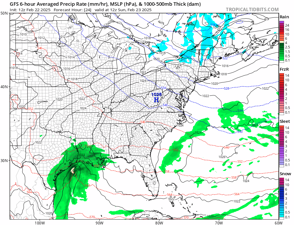
Looking to the week ahead and the last 5 days of meteorological winter, we see not much happening. A weak weather system passes Tuesday and falls apart before it gets here. The next cold front arrives Thursday and with that front we will likely see some showers ahead of it. Otherwise much of next week will be dominated by dry weather conditions and warmer temperatures.
Monday brings a west to southwest flow across the Northeast and Middle Atlantic states and that should allow temperatures to warm up nicely. Skies Monday should be no worse than partly sunny. We are looking for temperatures to rise into the 50s in most locations. Local sea breezes off the ocean will keep coastal areas a bit cooler during the afternoon and evening hours.

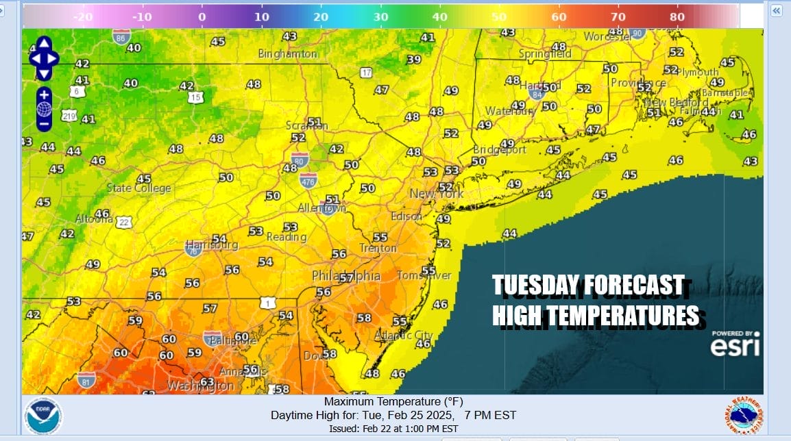
Tuesday sees a weak weather front passing through and since moisture is sparse, we are not going to mention any showers in the forecast at least for the time being. Other than that very small chance of a shower, Tuesday should see sunshine mixed with clouds and highs mostly in the 50s. Again we will see a wind off the ocean Tuesday afternoon so coastal locations particularly Long Island and coastal Southern New England holding in the 40s.
Wednesday could see temperatures a little lower due to the weak frontal passage but highs should still reach the upper 40s to lower 50s with sunshine. Thursday we will bring in the chance for showers and highs again into the 50s before slightly colder air comes in Friday. No major or even minor storms are in sight for the work week ahead.
BE SURE TO DOWNLOAD THE FREE METEOROLOGIST JOE CIOFFI WEATHER APP &
ANGRY BEN’S FREE WEATHER APP “THE ANGRY WEATHERMAN!
MANY THANKS TO TROPICAL TIDBITS FOR THE USE OF MAPS
Please note that with regards to any severe weather, tropical storms, or hurricanes, should a storm be threatening, please consult your local National Weather Service office or your local government officials about what action you should be taking to protect life and property.


