

Warmer Temperatures Delayed But Nice Weather Through Wednesday,
Showers Late Thursday
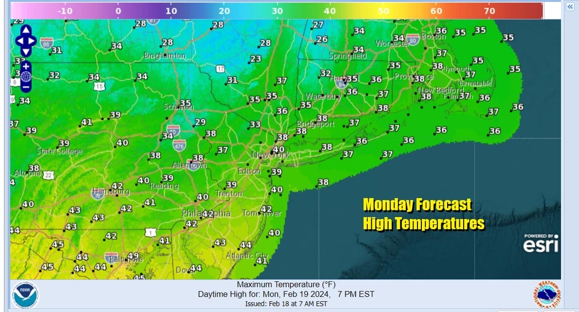
We finish off the holiday weekend with sunshine throughout much of the Northeast and Northern Mid Atlantic states. Average high temperatures are starting to rise now, about one degree every 4 or 5 days, and we should be in the upper 30s and lower 40s for highs and that is pretty much where we should be for this time of year. Low pressure is off the Florida coast and moving east so the high clouds to the south on the satellite loops won’t make it here. To the north we have some patchy clouds coming southeast from the Great Lakes and that pretty much covers the risks today. Radars should be nice and quiet.
SATELLITE WITH LIGHTNING STRIKES

WEATHER RADAR

We have a cold front that will be passing through today as it heads southeast from Canada and across the Northeast and Middle Atlantic states. Colder high pressure will be building into New England Tuesday and Wednesday, so the warm up advertised by most folks and most apps, is now delayed. It never was going to warm up much to begin with and this front and highs slows things down even more.

The next 2 weather issues will be a cold front approaching Thursday with some showers possible Thursday night into Friday morning. The next front after that comes next Sunday night into Monday morning. In between we have nice dry air and no major storms to worry about as both these systems look to be minor in nature.
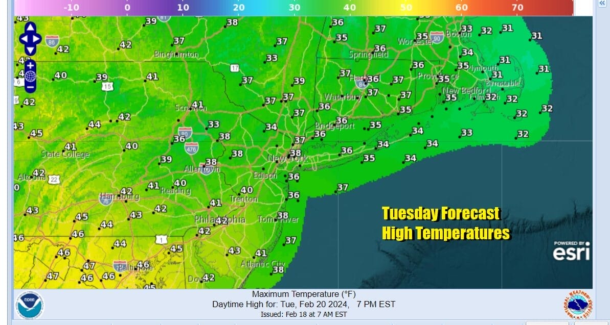
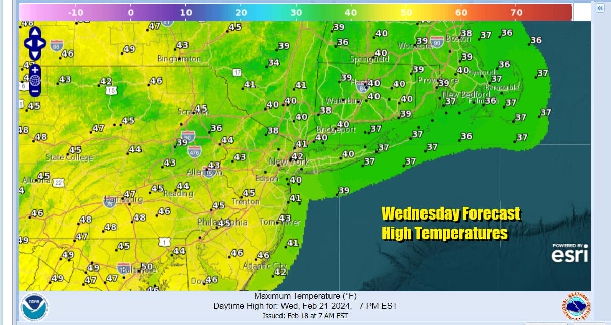
Noting all that, Tuesday and Wednesday will be on the cold side thanks to the high to the north and a north northeast wind. Sunshine will be plentiful Tuesday but highs will only be in the mid 30s in most locations around NYC and upper 30s to lower 40s for Southern New Jersey and Southern Pennsylvania. Wednesday are looking at sunshine and highs will be the upper 30s to near 40 north and low to mid 40s south.
Thursday we will see sunshine and arriving clouds with highs in the 40s. Watch for a few showers Thursday night into Friday morning and then we will see improving weather conditions and with chilly air for later Friday and the weekend looks to be dry and on the chilly side.
BE SURE TO DOWNLOAD THE FREE METEOROLOGIST JOE CIOFFI WEATHER APP &
ANGRY BEN’S FREE WEATHER APP “THE ANGRY WEATHERMAN!
MANY THANKS TO TROPICAL TIDBITS FOR THE USE OF MAPS
Please note that with regards to any severe weather, tropical storms, or hurricanes, should a storm be threatening, please consult your local National Weather Service office or your local government officials about what action you should be taking to protect life and property.
(Amazon is an affilate of Meteorologist Joe Cioffi & earns commissions on sales.)


