
Warm Week Ahead With Little To No Rain Until Perhaps Late Next Sunday

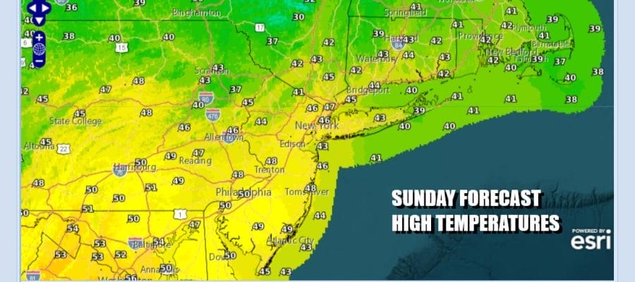
We are going to enjoy a Sunday of sunshine with nothing more than a few patchy clouds. The wind machine remains active today with gusts reaching 25 to 30 mph or so. It is at least oof the peaks of the last few days but it will still be problematic. Coupled with low relative humidity wild fire risk continues so bear that in mind if outdoors today in rural areas. Otherwise we are looking at thigh reaching the upper 40s to around 50 degrees or so with no worries as far as precipitation is concerned.
SATELLITE WITH LIGHTNING STRIKES

WEATHER RADAR

The week ahead for the Northeast and Mid Atlantic states is about as storm free as you can get. We have a system moving across the Gulf States today but that low is going straight east out into the open waters of the Atlantic. The week ahead is about higher pressure giving way to higher pressure and split in two thanks to a backdoor cold front. That front will pass through late Tuesday and stall somewhere across Southern Pennsylvania & Southern New Jersey.
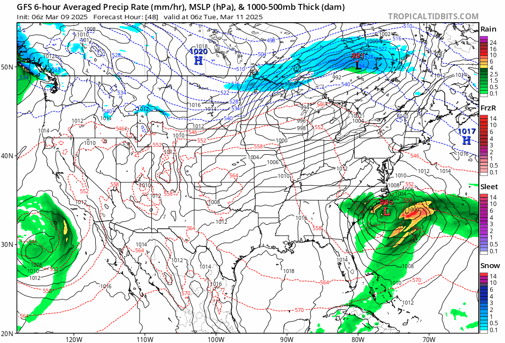
As far as any meaningful rain is concerned, we may have to wait until next Sunday at the earliest as a cold front moves eastward out of a major storm that develops in the Rockies and heads to the Northern Plains late this week and becomes a widespread severe weather producer across the Deep South and Southeast US.
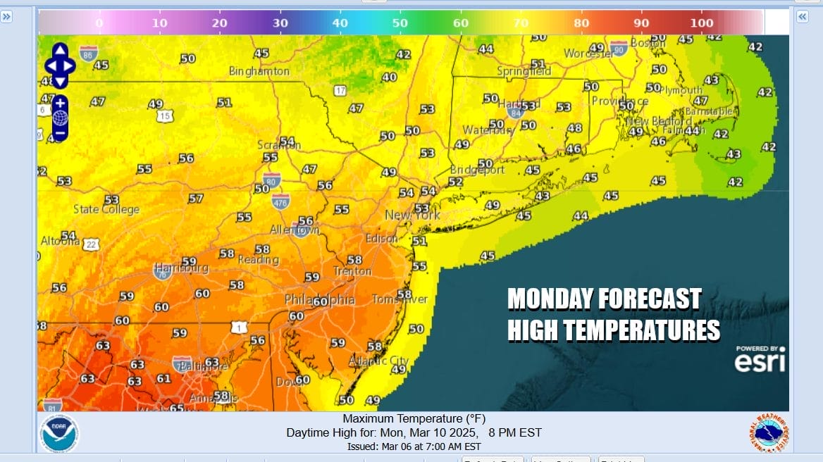
Back to short term weather tonight will be a relatively mild night under mainly clear skies. Lows will be in the 30s to around 40. Monday we will warm up nicely on mostly west winds and sunshine. Highs will reach the upper 50s to mid 60s with the coolest readings along south and east facing shorelines. We are now in sea breeze season where the land warms faster than the ocean creating onshore breezes off the ocean during afternoon and evening hours.

Tuesday ahead of the back door cold front it will be very warm with highs in the 60s just about everywhere. It would not shock me if some inland areas touch 70 degrees and that would be the first time we have been that warm since back in November. We should see a fair amount of sunshine and sea breezes will be confined to the immediate coast. The back door front will turn the wind east Wednesday and this is going to create a rather large temperature differential from northeast to southwest over time.

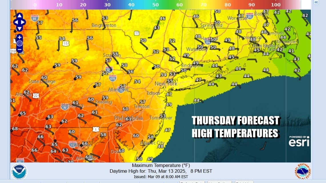
Wednesday with those east winds means that most highs will be in the 50s and coastal locations may only top in the 40s. It will be a dry day with clouds and some sunshine as high pressure builds to the north. Thursday likely see a greater spread of temperatures from north to south with a stalled front across Southern New Jersey and Southern Pennsylvania. We will likely see clouds and 40s & low 50s to the north of the stalled front and clouds with some sun to the south of the front with highs in the 60s.
The high moves out to the east late week and winds go more south southwest so we should see area wide 60s return if not Friday certainly for Saturday. Next Sunday may be the day when we get a solid shot for showers and possible thunderstorms as a cold front nears the coast. Winter is fading quickly away and spring is nosing its way in!
BE SURE TO DOWNLOAD THE FREE METEOROLOGIST JOE CIOFFI WEATHER APP &
ANGRY BEN’S FREE WEATHER APP “THE ANGRY WEATHERMAN!
MANY THANKS TO TROPICAL TIDBITS FOR THE USE OF MAPS
Please note that with regards to any severe weather, tropical storms, or hurricanes, should a storm be threatening, please consult your local National Weather Service office or your local government officials about what action you should be taking to protect life and property.


