Warm Start to New Year Week Ahead Outlook Perhaps a Little Snow Late Week?
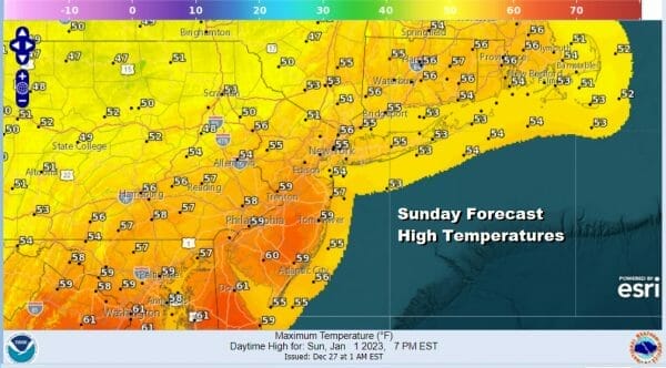
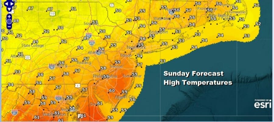
Happy New Year to everyone and as 2023 gets underway it starts with how most people feel this morning after drinking all night long, hungover and foggy. Low pressure to the northeast has moved away to the northeast and has taken the rain with it. There isn’t much of a dry push behind this system at least initially but drier air should kick in on a northwest wind later today. We will also see fog burn off and give way to sunshine. Most highs today will be in the mid 50s to around 60 degrees. Since there is no cold air around we will have a relatively mild overnight with lows Monday morning in the mid 30s to lower 40s. We should have partially clear skies.
SATELLITE

WEATHER RADAR

On to the new week and being Monday is a holiday for most we will have a rather decent day of sunshine and highs in the 50s in most places. Then as we head into Tuesday we begin to turn our attention to the next cold front that will be moving east as low pressure heads from the Rockies to the Plains to the Western Great Lakes.
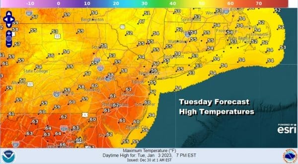
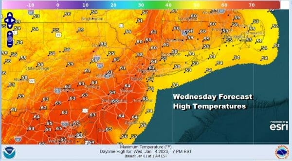
This is going to be one of those situations where the warm front sets up just to the north of NYC which means areas to the north from the Catskills to the Hudson Valley to Connecticut (mainly north of Route 84) will see some rain and temperatures in the lower 60s. While areas to the south across South Jersey and Southern Pennsylvania will be into the 60s with some breaks of sunshine.
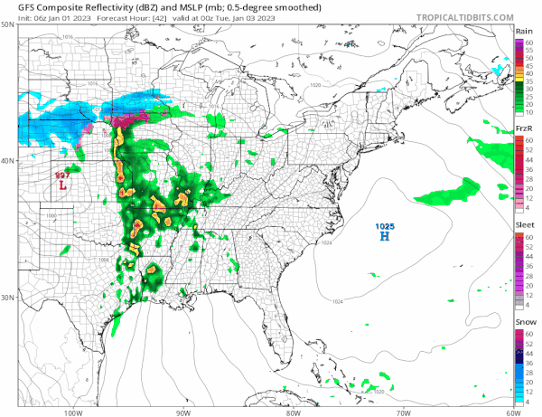
A cold front approaches Tuesday night and Wednesday and there could be a few showers Tuesday night and some more showers later Wednesday. It will be cloudy and warm in between with highs in the 60s just about everywhere. This should be the last very warm day for while as after this cold front passes Wednesday evening, cooler air starts to move in behind it.
We will cool off on Thursday with a cold front to our south and colder air in Eastern Canada that will begin to bleed southward but it doesn’t come in a rush. The front is going to stall to the south along and off the Carolinas and out into the Atlantic Ocean. Energy coming around the Great Lakes will set off a wave on that frontal boundary and it will head to the northeast from there.
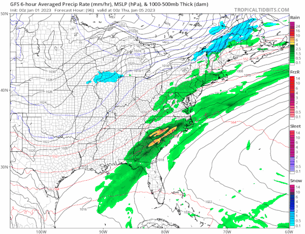
We will watch to see what transpires here. There isn’t a solid push of cold air that comes in at the end of the week, nor is this developing low anything to right home about. Still there is the chance that we could see a cold rain or even snow out of this for Friday with highs mostly in the 30s. There is nothing here that I can see (at least at the moment) that this will be anything beyond something minor if it happens. Beyond this system it looks like we will have seasonal weather conditions next weekend and beyond and no major storms are on the horizon nor do I see one anytime soon.
BE SURE TO DOWNLOAD THE FREE METEOROLOGIST JOE CIOFFI WEATHER APP &
ANGRY BEN’S FREE WEATHER APP “THE ANGRY WEATHERMAN!
MANY THANKS TO TROPICAL TIDBITS & F5 WEATHER FOR THE USE OF MAPS
Please note that with regards to any severe weather, tropical storms, or hurricanes, should a storm be threatening, please consult your local National Weather Service office or your local government officials about what action you should be taking to protect life and property.


