Very Warm Through The Weekend Little Or No Rain
Heatwave Looms Next Week

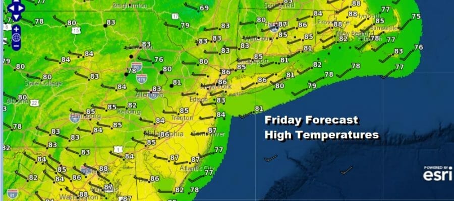
We are at the doorstep of the weekend and today is Friday getaway day. A weather front passed through last night. Humidity levels will be borderline today. Areas north of New York City will be more comfortable today than areas south of Philadelphia were dew points are a little higher. We will have partly sunny skies today and another weather front later today will bring the risk for a scattered shower or thunderstorm. Severe weather risk lies from southernmost New Jersey and Pennsylvania southward. Most areas will not see much of anything thunderstorm wise.
SATELLITE

WEATHER RADAR

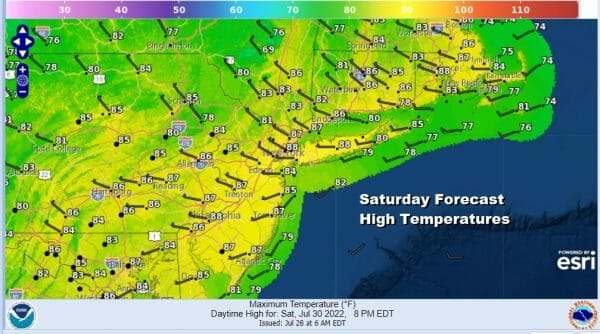
Slightly drier air comes in overnight and for the weekend. We will see dew points drop to the upper 50s to around 60. With highs both Saturday and Sunday in the mid to upper 80s, it will be very warm but reasonably comfortable and no showers or thunderstorms are forecast through the weekend.

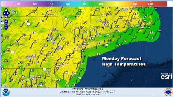
Humidity comes roaring back Monday as dew points rise back to the upper 60s to near 70. Temperatures will be in the mid to upper 80s for highs as we transition into a steamy air mass. We will have sunshine and a few clouds and not much if any chance for a shower or thunderstorm.
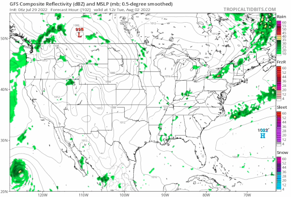
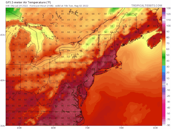
Tuesday begins what could be a long stretch of 90 degree plus highs and that stretch will likely include a few days with temperatures well into the 90s to near 100 degrees. There will be weak weather fronts along the way that will come through and raise and lower the humidity as they go by. What is uncertain is the timing of these “dew point fronts” since the air behind each one is almost as hot if not hotter than the air ahead of it.
It appears that we will see a streak of 90 degree plus day begin on Tuesday of next week and last through next Saturday August 6th at least. As far as the hottest days, it would appear to be next Thursday when we see highs in the middle to upper 90s followed by upper 90s to near or just over 100 degrees for Friday and possibly next Saturday.
There are model differences regarding whether the heatwave continues beyond Saturday which is what the European model suggests. It carries the heat into the week of August 8th while other models suggests a breakdown of the heat ridge in the Eastern US. This is outside the timeframe where the models do well so we will focus on the coming week and heat that will be returning.
BE SURE TO DOWNLOAD THE FREE METEOROLOGIST JOE CIOFFI WEATHER APP &
ANGRY BEN’S FREE WEATHER APP “THE ANGRY WEATHERMAN!
MANY THANKS TO TROPICAL TIDBITS & F5 WEATHER FOR THE USE OF MAPS
Please note that with regards to any severe weather, tropical storms, or hurricanes, should a storm be threatening, please consult your local National Weather Service office or your local government officials about what action you should be taking to protect life and property.


