Very Cold Remainder of the Week Storm Questions Rise Weekend

Very Cold Remainder of the Week Storm Questions Rise Weekend
Yesterday’s storm system is long gone and in its wake we have cold dry air that will be with us for the rest of the week. We will see some sunshine today but we still have the strong blocking storm in Atlantic Canada and that means that winds will continue to be strong and gusty during the day. Some gusts could reach 30 to 35 mph at times especially along the coast. Temperatures today will top out in the upper 20s and lower 30s. Radars are mostly quiet today across the Northeast and Mid Atlantic.
SATELLITE WITH LIGHTNING STRIKES

WEATHER RADAR

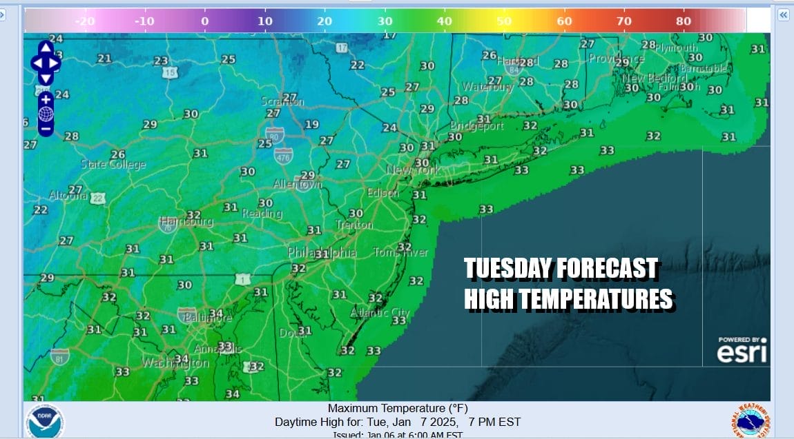
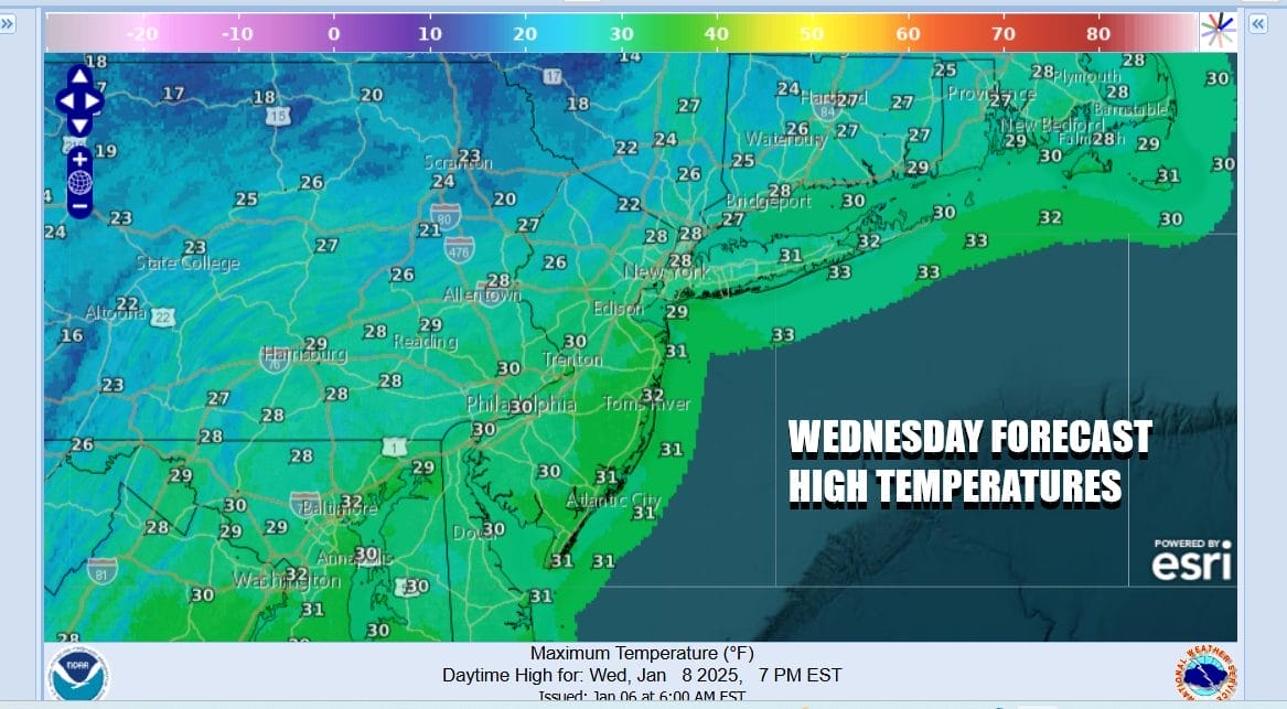
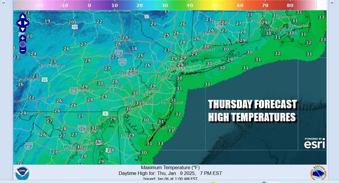
Tonight will be clear and very cold and breezy conditions. Most lows will be in the mid teens to lower 20s. Wednesday will be a repeat performance of today with sunshine breezy to windy conditions at times especially along the coast. It will be another day with temperatures topping in the upper 20s and lower 30s and down to the teens and low 20s at night. Thursday we will do it again with no worse than partly sunny skies and most highs in the upper 20s and lower 30s.
Attention is going to turn to the Gulf States. Cold air is going to be wedged down to the Deep South. This is going set up for an accumulating snow and ice event beginning Thursday across Central and East Texas and spreading into Arkansas and Northern Louisiana as the day wears on. Low pressure forms in the Western Gulf of Mexico. Thanks to the North Atlantic block, this low will track east right along the Gulf Coast through Friday.

The North Atlantic block continues to have a strong influence on storm tracks into the Eastern US. This will yet be another storm system that will track to the south so the best chances for accumulating snow across the Deep South and Southeast US. Accumulating snow will fall east across Northern Mississippi, Northern Alabama, North Georgia and Tennessee Friday into Friday night. Eventually that snow and possibly freezing rain spreads into Western South & North Carolina and then into the Mid Atlantic Saturday.
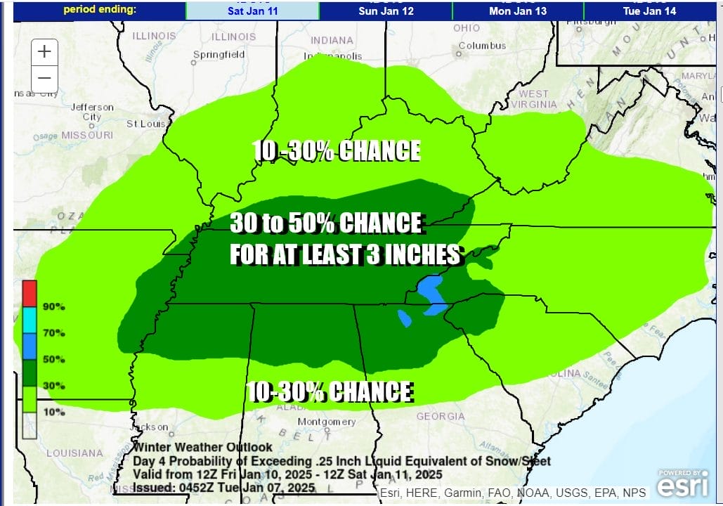
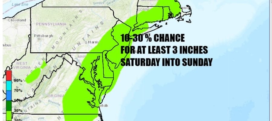
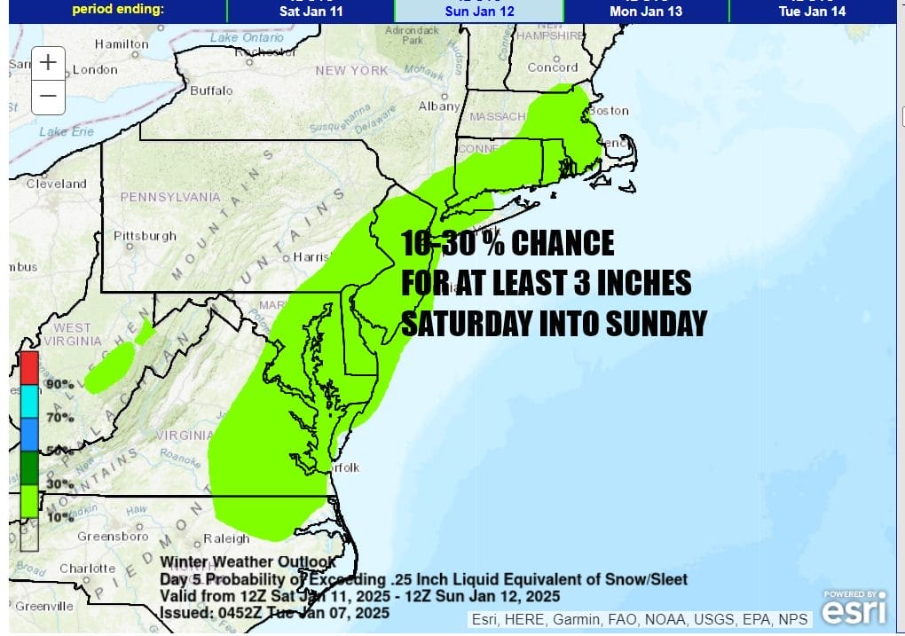
You don’t often see this but the Weather Prediction Center is forecasting a 30 to 50% chance for at least 3 inches of snow and ice accumulation over a large area of the Tennessee Valley and the Deep South for Friday into Saturday morning. The risk then shifts northward to the Carolinas northeast to Southern New England for Saturday into Sunday. The risk at this point for our area is a range of 10 to 30 percent. This is what I would expect 6 days out.
Models have been showing occasional runs with ridiculous looking major storms and snow being measured in feet. These sorts of model runs from any model tend show up in the long range beyond 8 or 9 days and should never be taken seriously. The upper pattern is not supportive of a major snowstorm from what we are seeing at this point. Instead we favor a minor to moderate snow event possible later Saturday into Sunday.
BE SURE TO DOWNLOAD THE FREE METEOROLOGIST JOE CIOFFI WEATHER APP &
ANGRY BEN’S FREE WEATHER APP “THE ANGRY WEATHERMAN!
MANY THANKS TO TROPICAL TIDBITS FOR THE USE OF MAPS
Please note that with regards to any severe weather, tropical storms, or hurricanes, should a storm be threatening, please consult your local National Weather Service office or your local government officials about what action you should be taking to protect life and property.


