DOWNLOAD MY NEW FREE JOESTRADAMUS WEATHER APP FOR ANDROID
THE APP IS ABSOLUTELY FREE TO ALL BUT CONSIDERING SUBSCRIBING TO PATREON FOR A WEATHER EXPERIENCE FREE OF ADS, EXCLUSIVE VIDEOS FOR MEMBERS ONLY AND MUCH MORE…STARTS AT $2 A MONTH..MESSAGE ME AT ANY TIME
Very Cold Gusty Winds Snow Forecast Saturday Night Sunday
We are still waiting for the pressure gradient to relax across the Northeast and it will do so later today and tonight but in the meantime we still have some very gusty winds to contend with. Temperatures are in the 20s. At least we will have more sunshine today which is good but highs will only make it back to the upper 20s to lower 30s. Winds should finally drop down to under 15 mph late this afternoon and drop even further tonight. The satellite loop shows the storm in Eastern Canada beginning to pull away and skies have cleared out for the most part over us. There are still some clouds to the north and northwest but the radars have finally shut down.
EASTERN SATELLITE

REGIONAL RADAR

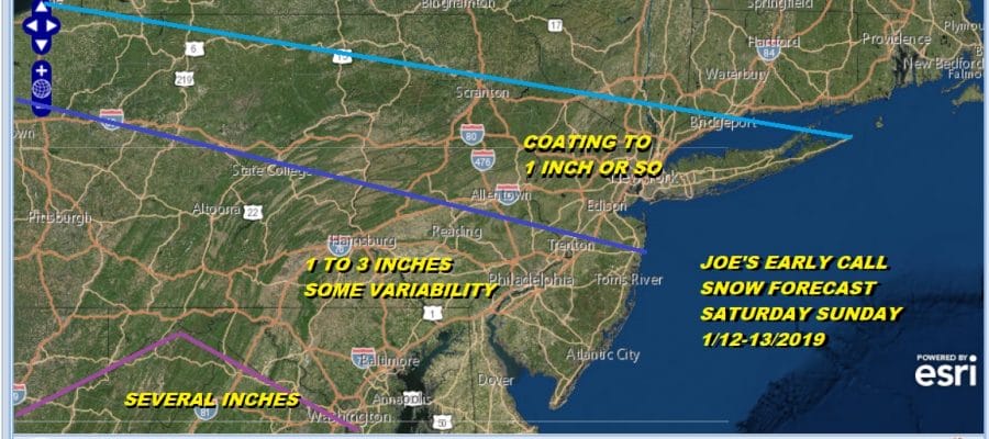
Tonight looks clear and very cold with lows in the teens to near 20. Then look for sunshine giving way to arriving clouds on Saturday with highs in the 20s to around 30. Then we wait and watch snow arrive from low pressure moving across the Tennessee Valley and then heads to the North Carolina coast. With the very flat west to east flow we remain with the same issues we had yesterday. Very dry air will be around so it will have to fight that. The system doesn’t lift up northward so it will be a matter of we get what we get and I don’t really see room here for much upside.
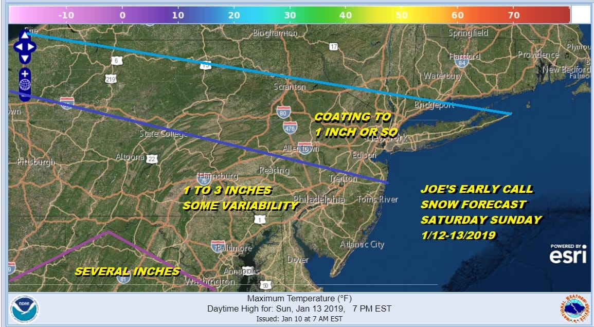
That was my map from yesterday and I’m sticking with it. Where i might juice numbers a bit would be in Southern New Jersey which might finish closer to the high end of the 1 to 3 inch range and the same for Southern Pennsylvania to Maryland. I may fine tune this a bit later today. The areas north of 195 remain the same..a coating to an inch or so seems reasonable. Snow arrives in Southeast Pennsylvania between 8pm- to 11pm but it might not get to NYC until 4am or so and to Long Island around 6am. This is where the sharp northern cut off takes hold. As quick as it gets to NYC is almost as quick as it ends and there will be a sharp cut off just north and west of the coast which sees little or nothing from this.
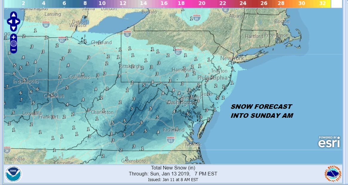
The higher amounts will be down in Maryland and Virginia where a 2-4/3-6 inch snow fall i think is a pretty good bet with some locally higher amounts. The low pulls out Sunday and weather conditions improve from north to south with leftover decreasing clouds Sunday afternoon and highs just into the 30s. Next week starts cold, moderates for a day or so and then the next front passes through midweek. Long range is looking more bullish for snow chances.
MANY THANKS TO TROPICAL TIDBITS FOR THE USE OF MAPS
Please note that with regards to any tropical storms or hurricanes, should a storm be threatening, please consult your local National Weather Service office or your local government officials about what action you should be taking to protect life and property.