
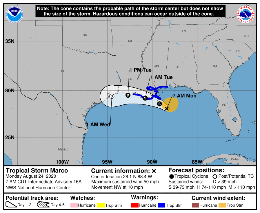
Tropical Storm Marco Weakening As It Nears Land
8AM LOCATION…28.1N 88.4W
ABOUT 85 MI…135 KM SSE OF THE MOUTH OF THE MISSISSIPPI RIVER
MAXIMUM SUSTAINED WINDS…50 MPH…80 KM/H
PRESENT MOVEMENT…NW OR 325 DEGREES AT 10 MPH…17 KM/H
MINIMUM CENTRAL PRESSURE…1005 MB…29.68 INCHES
All hurricane warnings have been discontinued this morning as Marco ran into the buzzsaw of 40 knot southwesterly winds in the upper atmosphere. We mentioned yesterday that if Marco moved to the west that it would get caught in that shear (increasing winds with height) and that is exactly what happened last night. The visible satellite picture this morning shows the exposed surface low southeast of the mouth of the Mississippi River while all the convection is being blow away to the northeast into the Florida Panhandle.
GULF OF MEXICO SATELLITE

REGIONAL RADAR

The unimpressive nature of the radar is clear and Marco could continue to weaken today as the upper trough to the west continues rip the system apart. Laura is sitting along the south coast of Cuba and will enter the Gulf of Mexico later today. That upper trough will be retrograding westward into Texas and for Laura that creates a conducive environment for development into a hurricane. More on Laura later.
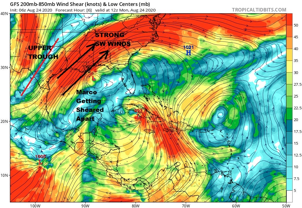
In the meantime with regards to Marco the low level center will continue to turn to the west and more than likely it will gradually weaken to a tropical depression and eventually a remnant low possibly without ever making landfall.
BE SURE TO DOWNLOAD THE FREE METEOROLOGIST JOE CIOFFI WEATHER APP &
ANGRY BEN’S FREE WEATHER APP “THE ANGRY WEATHERMAN!
MANY THANKS TO TROPICAL TIDBITS FOR THE USE OF MAPS
Please note that with regards to any severe weather, tropical storms, or hurricanes, should a storm be threatening, please consult your local National Weather Service office or your local government officials about what action you should be taking to protect life and property.


