TROPICAL STORM WARNINGS SOUTH FLORIDA
TROPICAL STORM WARNINGS CENTRAL GULF COAST
HURRICANE WATCH MISSISSIPPI ALABAMA COAST
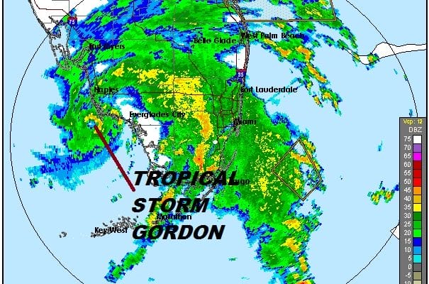
South Florida continues to deal with bands of heavy rain sweeping around the center of Tropical Storm Gordon which is actually well defined on the radars this afternoon. You can see the center rather well just offshore to the west of Everglades City & South of Naples. Gordon is straddling the coast at the moment but should begin to slide out a little further to the east. Much of the convection is on the eastern side of the circulation so the rains in South Florida on both coasts will continue into this evening. We have two radar loops with views from Miami & Key West.
RADAR MIAMI

LOCAL RADAR KEY WEST


Once leaving Florida, Gordon will move northwestward and head toward the Central Gulf Coast. Weather models remain tightly clustered along the Alabama Mississippi Gulf Coast. Since Gordon seems to be outperforming weather models and their view of this, it seems there is opportunity here for strengthening. Landfall could come late Tuesday or Tuesday evening. Gordon will be moving over water temperatures 86 degrees or higher and winds aloft appear rather light. Diminishing shear could give Gordon a shot at becoming a hurricane before landfall.
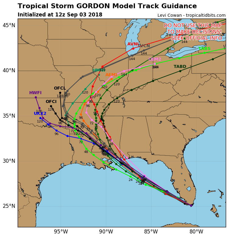
Air Force aircraft is there now investigating and that added data should offer clues on whether Gordon will strengthen while it is over the Eastern Gulf of Mexico. Heavy rains over Florida could exceed 5 inches in spots. So far an inch and a half to two inches of rain has fallen along the Florida east coast south of Miami.
THANKS TO TROPICAL TIDBITS FOR THE USE OF MAPS
Please consult your local National Weather Service office at weather.gov for the latest information on any tropical or storms or hurricanes that could be a threat to your area. Consult your local government officials regarding action you may need to take to secure life and property
FiOS1 News Weather Forecast For Long Island
FiOS1 News Weather Forecast For New Jersey
FiOS1 News Weather Forecast For Hudson Valley