
Tropical Activity To Increase This Weekend & Next Week
Tropical Activity To Increase This Weekend & Next Week
As far as tropical activity is concerned, during the month of June it tends to confine itself to the Northwest Caribbean and Gulf of Mexco during the first half of the month and then expands eastward a bit to include a portion of the South Atlantic by the end of the month. Weather models have for over a week now been pointing to the prospect of tropical activity increasing in the NW Caribbean and SW Gulf of Mexico. Right now on the latest loop of the Gulf of Mexico you can see that activity is fairly quiet.

The wider satellite loop below shows a better view of what is going on. Across the Pacific tropics you can see there is quite a bit of disturbed weather extending from the west coast of South America and Panama westward to Southern Mexico. This complex of disturbed weather will be creating lower than normal surface pressures over the next several days in the NW Caribbean. Warm water temperatures and the emergence of a low wind shear environment and you have the groundwork for something to develop. Now whether it does or not is a different matter which we basically won’t really know until we get there early next week.

All weather models develop something with this ranging from the GFS which takes it to the Southwest Gulf of Mexico and basically leaves it there..to the European which develops it into a tropical storm and takes it into Texas, and the Canadian whicn develops it and takes it to the Florida Panhandle! Right now the takeaway should be that all three models develop something.
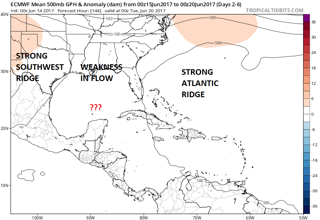
The upper flow would suggest a weakness somewhere in the Gulf of Mexico but the strength of the ridges on either side will probably determine what winds up happening here. For now it remains in the land of speculation.
JOESTRADAMUS HURRICANE SEASON GUEST FORECAST
FiOS1 News Weather Forecast For Long Island
FiOS1 News Weather Forecast For New Jersey
FiOS1 News Weather Forecast For Hudson Valley
NATIONAL WEATHER SERVICE SNOW FORECASTS
LATEST JOESTRADAMUS ON THE LONG RANGE