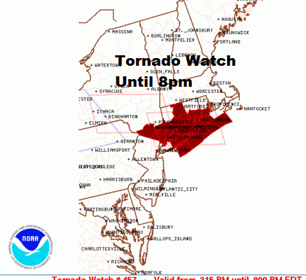
Tornado Watch Lower Hudson Valley Long Island Connecticut
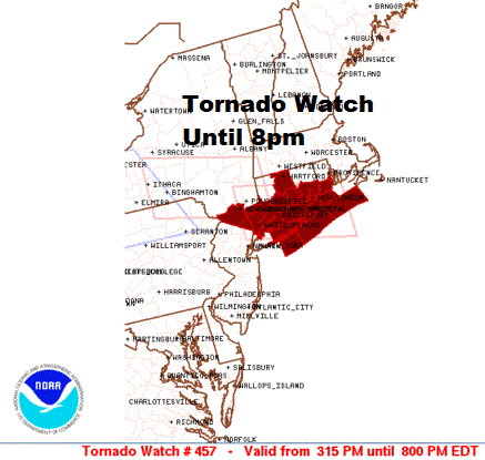
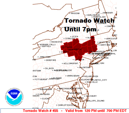
The Storm Prediction Center has posted a second Tornado Watch for Southeastern NY Long Island and Connecticut until 8pm. The earlier watch for Northeast Pennsylvania to the Hudson Valley and Western Connecticut north of Route 84 continues until 7pm Eastern Time.
SATELLITE

This morning’s warm front that brought in the steamy air is tonight’s cold front that is dropping southward. There is a large temperature contrast across NY State and New England this afternoon where many areas are in the 60s while temperatures from NYC south have reached 90 or higher. Add to that tropical dew points and we are seeing thunderstorms breaking out and moving southward on the radar.
REGIONAL RADAR

The regional radar shows an east west line of thunderstorms moving southeastward and we are seeing tornado warnings and severe thunderstorm warnings in the red and yellow warning boxes. Some very powerful cells are sitting inside that line.
LOCAL RADAR NEW YORK CITY

LOCAL RADAR PHILADELPHIA


Other cells are likely to develop in Northeast Pennsylvania and into Northern New Jersey this evening and those cells will also move southeastward and could become severe.
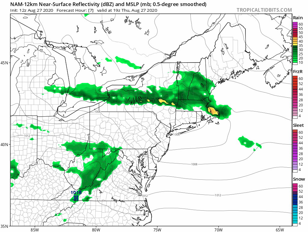
We have the NAM model view here of what to expect this evening as the thunderstorms move southeastward. Be advised that models have not handled storms that well this month and the radars are showing a far more robust look going into this evening.
BE SURE TO DOWNLOAD THE FREE METEOROLOGIST JOE CIOFFI WEATHER APP &
ANGRY BEN’S FREE WEATHER APP “THE ANGRY WEATHERMAN!
MANY THANKS TO TROPICAL TIDBITS FOR THE USE OF MAPS
Please note that with regards to any severe weather, tropical storms, or hurricanes, should a storm be threatening, please consult your local National Weather Service office or your local government officials about what action you should be taking to protect life and property.


