DOWNLOAD MY NEW FREE JOESTRADAMUS WEATHER APP FOR ANDROID

THANKSGIVING BITTER COLD AIR ABOUT TO ARRIVE LATER TODAY
SOME SNOW SHOWERS POSSIBLE LATE THIS AFTERNOON & EVENING
TEMPERATURES THURSDAY LOW 20S WIND CHILLS SINGLE DIGITS
WARMER AIR SOME RAIN OVER THE WEEKEND
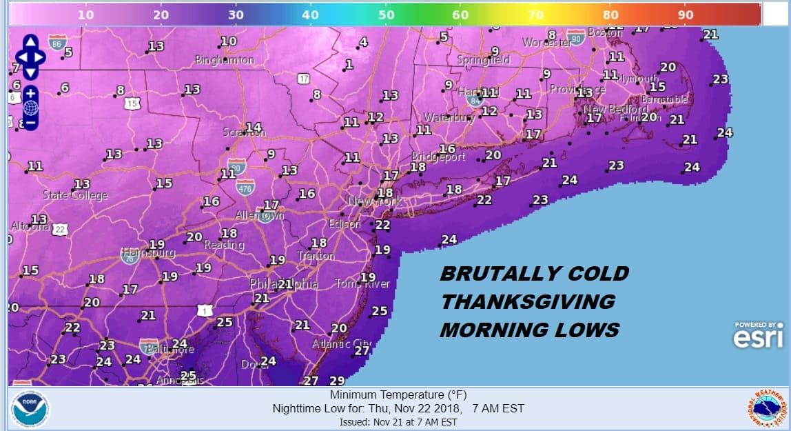
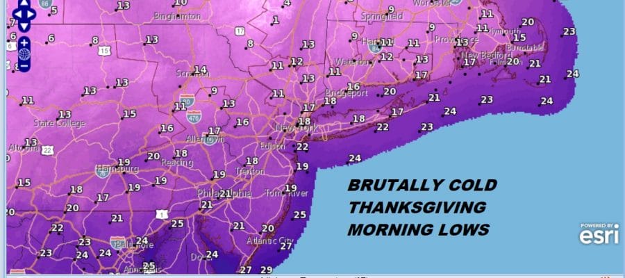
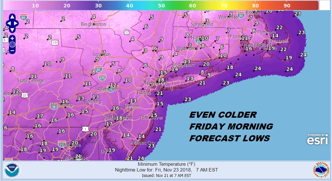
We sit this morning, turkeys either almost defrosted and getting their initial preps for thanks giving. While this is going on we are seeing the arctic getting every closer as it heads southeastward across NY State. It will get here late this afternoon. Thursday morning will be one of the coldest Thanksgiving mornings ever with temperatures hitting bottom in the teens and single digits as the map above shows. When the cold air arrives late today the question of snow showers or a heavier snow squall occurring pops up.
EASTERN SATELLITE

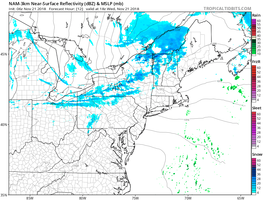
REGIONAL RADAR

On the regional radar the lake effect snow machine is revving up and look for this to increase as the day wears on. The front will pass through western NY with a little bit of energy and then head south with an east west band of snow showers. Just like a summertime line of showers and thunderstorms this line will approach late this afternoon and evening however most models seem to weaken the line of snow showers as it moves through.
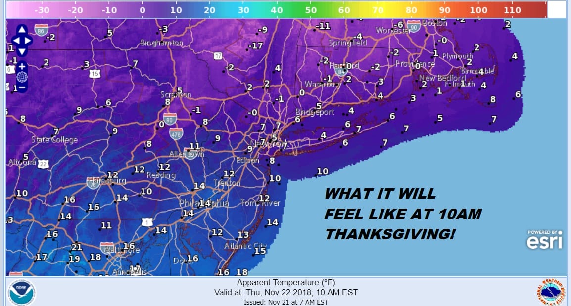
Worst case scenario is that the ground gets whitened for a few minutes before it goes by. Then it down we go with temperatures and Thanksgiving day itself will be brutal with temperatures in the low to mid 20s all day long. Macy’s Thanksgiving Day Parade goers should expect temperatures in the upper teens and lower 20s with plenty of sun, a gusty wind of 20 to 30 mph, and wind chills in the single digits.
If that wern’t cold enough it will be even colder Thursday night into Friday morning under clear skies so you early shoppers who plan to stand outside in the bitter cold waiting for stores to open had better be dressed up to handle it. Record temperatures are possible both Thursday and Friday mornings.
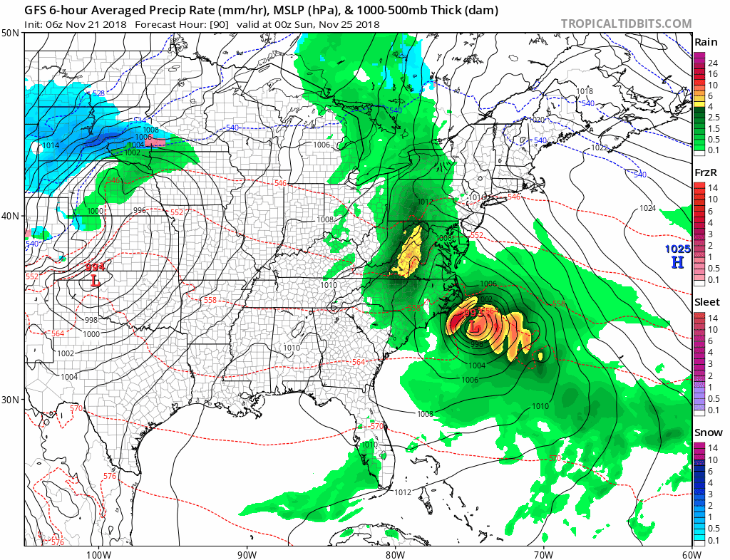
Thankfully the cold shot moves out to the east on Friday so we will see sunshine and moderating temperatures as highs get back into the 30s. The weekend promises even higher temperatures with 40s Saturday and 50s on Sunday but it comes with the cost of some rain developing Saturday night and lingering into Sunday morning.
Next week it will be all about the developing blocking pattern that takes control and that will mean watching cold air and high pressure across Canada forcing cold air southward while a series of systems moves across the US and while they attempt to move to our west, the block forces them to move east and redevelop to our south. Weather models all showing a rather active week to finish off November and kick off the month of December.
SUBSCRIBE TO PATREON FOR A WEATHER EXPERIENCE FREE OF ADS, EXCLUSIVE VIDEOS FOR MEMBERS ONLY AND MUCH MORE…STARTS AT $2 A MONTH..MESSAGE ME AT ANY TIME

MANY THANKS TO TROPICAL TIDBITS FOR THE USE OF MAPS
Please note that with regards to any tropical storms or hurricanes, should a storm be threatening, please consult your local National Weather Service office or your local government officials about what action you should be taking to protect life and property.

