Temperatures Bounce Higher Next Chance for Rain or Showers Tuesday This morning we woke up to the coldest temperatures of
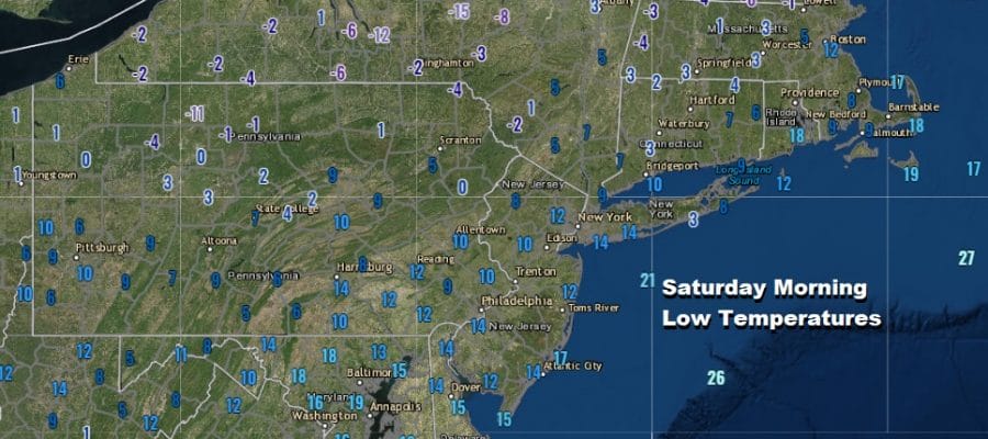
Temperatures Bounce Higher Next Chance for Rain or Showers Tuesday This morning we woke up to the coldest temperatures of