Sunshine Warmer Today, No Issues Through Friday
Rain Coastal Low Bring Gloom & Doom Weekend

Sunshine Warmer Today, No Issues Through Friday
Rain Coastal Low Bring Gloom & Doom Weekend
Our relatively quiet weather week continues and we are still under the influence of a strong upper air storm in Eastern Canada. Over the last few days we have seen periods of self destructive sunshine but that should be less the case to day. An upper trough swinging around the low is moving through New England. This should leave us in partly sunny skies today though clouds will be an issue from time to time. The air is not all that cool now so we will see highs back to the upper 60s to some lower 70s.
SATELLITE WITH LIGHTNING STRIKES

WEATHER RADAR

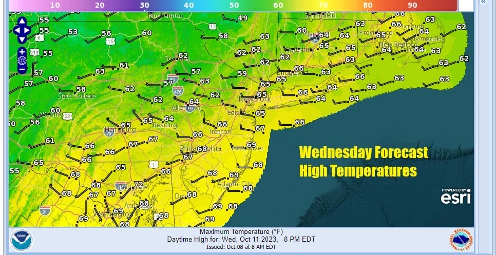
The upper low in Eastern Canada also suppresses the active subtropical jet stream that is running across the Gulf States and Florida with areas of heavy rain. Low pressure in the Eastern Gulf of Mexico will cross Florida and move straight east rather than to the north. In the meantime this leaves us with nice weather for Thursday with partly sunny skies. High pressure will begin to build in from the northwest and that means cooler air will be moving southward.
It will still be a relatively warm day however with highs in the mid 60s north to lower 70s as you head south. We will hold on to the dry air through Friday but we have the upper low in Canada moving east to Eastern Canada and at the same time, low pressure is moving out of the Plains and heading southeast into the Ohio Valley Friday into Saturday.
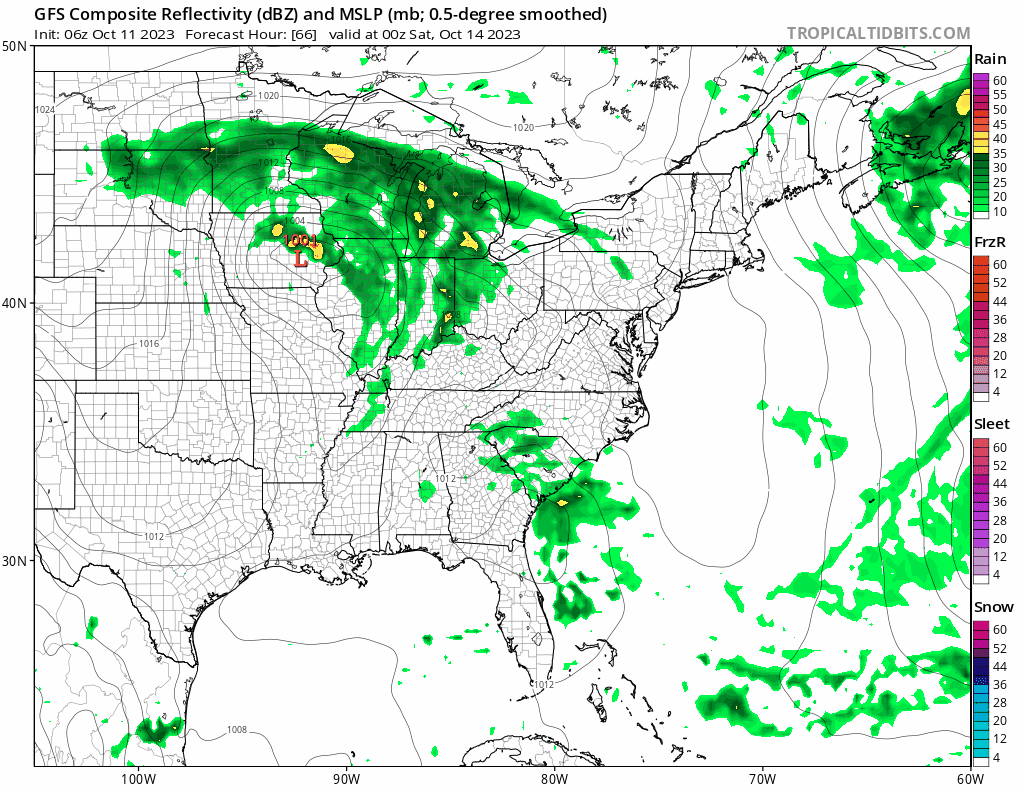
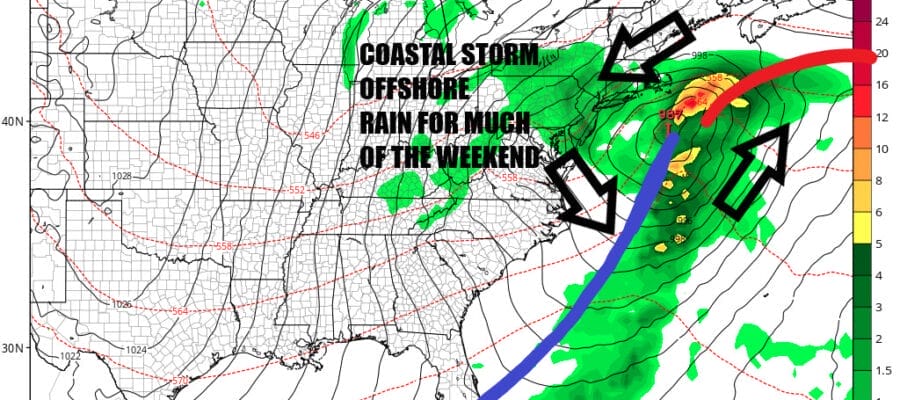
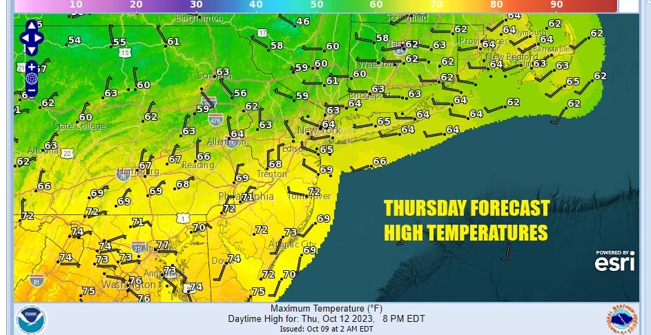
Friday should be no worse than partly sunny with highs mostly in the 60s. Then clouds will increase Friday night and we will for for rain on Saturday. There is still a timing question as to whether the rain arrives as quickly as the GFS shows which is by daybreak, or does it hold off to early afternoon as other slower models indicated. Either way Saturday will be a “gloom and doom” type of day with cloudy skies, rain, and a gusty northeast wind along the coast. Earlier in the week models were pointing to a stronger noreaster type system. Since then the Eastern Canada upper low has taken longer to exit and as a result we have a different outcome. The low redevelops offshore and heads east. I would probably describe this as a “low end” noreaster. Rain will last into Sunday morning and then taper off but we will still have lots of leftover clouds. The start of next week leaves us in a northeast flow and another upper trough in the Eastern US and that means we could be in lots of clouds for awhile along with areas of light rain scattered around Monday and Tuesday with no realy clearing until at least Wednesday.
BE SURE TO DOWNLOAD THE FREE METEOROLOGIST JOE CIOFFI WEATHER APP &
ANGRY BEN’S FREE WEATHER APP “THE ANGRY WEATHERMAN!
MANY THANKS TO TROPICAL TIDBITS FOR THE USE OF MAPS
Please note that with regards to any severe weather, tropical storms, or hurricanes, should a storm be threatening, please consult your local National Weather Service office or your local government officials about what action you should be taking to protect life and property.
(Amazon is an affilate of Meteorologist Joe Cioffi & earns commissions on sales.)


