
Sunshine Very Warm Into Friday Weekend Outlook & Long Range
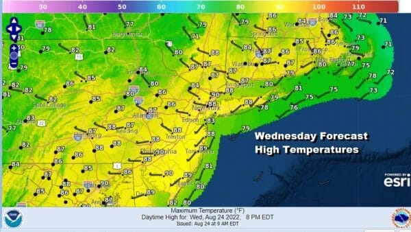
Dry air and a more stable air mass is building into the Northeast and Middle Atlantic states making for a nice late summer day. The satellite views are showing mainly sunny skies and the more stable atmosphere today means no rain in the forecast. Humidity levels are lower today except for areas to the east in Eastern Long Island to Southeastern New England. Highs today will reach the mid 80s to around 90 degrees. Temperatures along the shore and to the east in Coastal New England and Long Island will be in the upper 70s and lower 80s. Skies tonight will be clear with most lows in the 60s except near 70 in warmer urban settings.
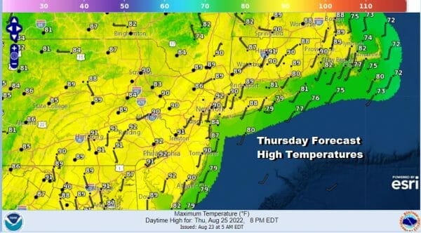
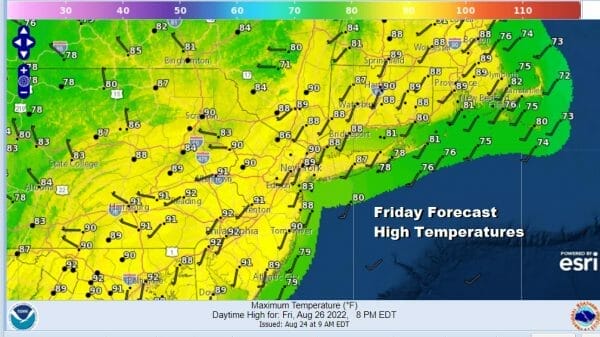
Thursday will be nice and sunny with high temperatures reaching the upper 80s to some lower 90s. Humidity levels will come up a bit making it a little more uncomfortable. Friday we see a very warm to hot and humid day with some sunshine. A cold front will be approaching and moving through late in the day and in the evening opening the door to the chance for some thunderstorms.
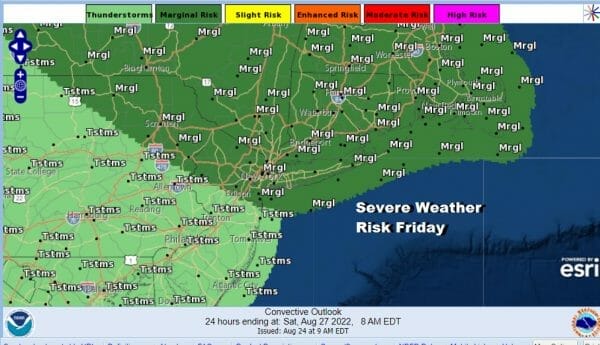
The Storm Prediction Center is indicating a marginal risk for severe weather Friday which means isolated severe thunderstorms are possible. The risk area this time extends from Northeastern Pennsylvania to Northern New Jersey northeastward into Uptate NY and New England. This includes the I-95 Corridor from NYC to Hartford, Providence and Boston.
The front will pass offshore and high pressure will build across New England. This will turn the flow more onshore for Saturday and Sunday but it should not be a problem weather wise. Saturday should be no worse than partly sunny. Temperatures will be a little lower with highs in the mid to upper 80s except a few degrees lower at the coast.

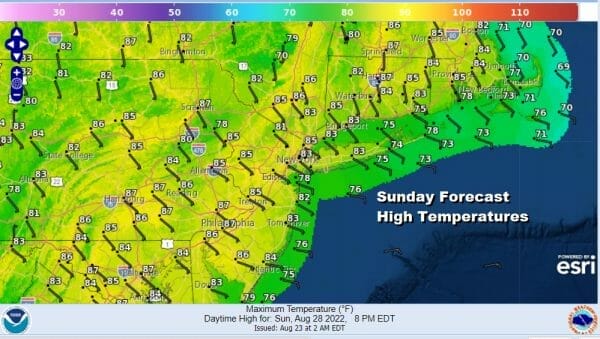
The same holds for Sunday with the high to the northeast and the flow off the ocean continuing. Again it will be no worse than partly sunny with Sunday afternoon highs in the mid to upper 80s. It will be cooler at the shore. There is a small chance for an isolated shower or thunderstorm over the weekend.
Long range into next week we will see hot and humid weather Monday and Tuesday with sunshine taking highs to the upper 80s to some lower 90s. There is the chance for some scattered thunderstorms Monday afternoon and again Tuesday. A more important cold front is likely to approach and pass on Wednesday with a better chance for thunderstorms. The second half of next week should be cooler and we will also see growing signs of the tropics picking up in activity as we near the Labor Day holiday weekend.
BE SURE TO DOWNLOAD THE FREE METEOROLOGIST JOE CIOFFI WEATHER APP &
ANGRY BEN’S FREE WEATHER APP “THE ANGRY WEATHERMAN!
MANY THANKS TO TROPICAL TIDBITS & F5 WEATHER FOR THE USE OF MAPS
Please note that with regards to any severe weather, tropical storms, or hurricanes, should a storm be threatening, please consult your local National Weather Service office or your local government officials about what action you should be taking to protect life and property.


