

Sunshine Mild Wednesday Ahead of Shower Chances Thursday,
Then On to the Weekend
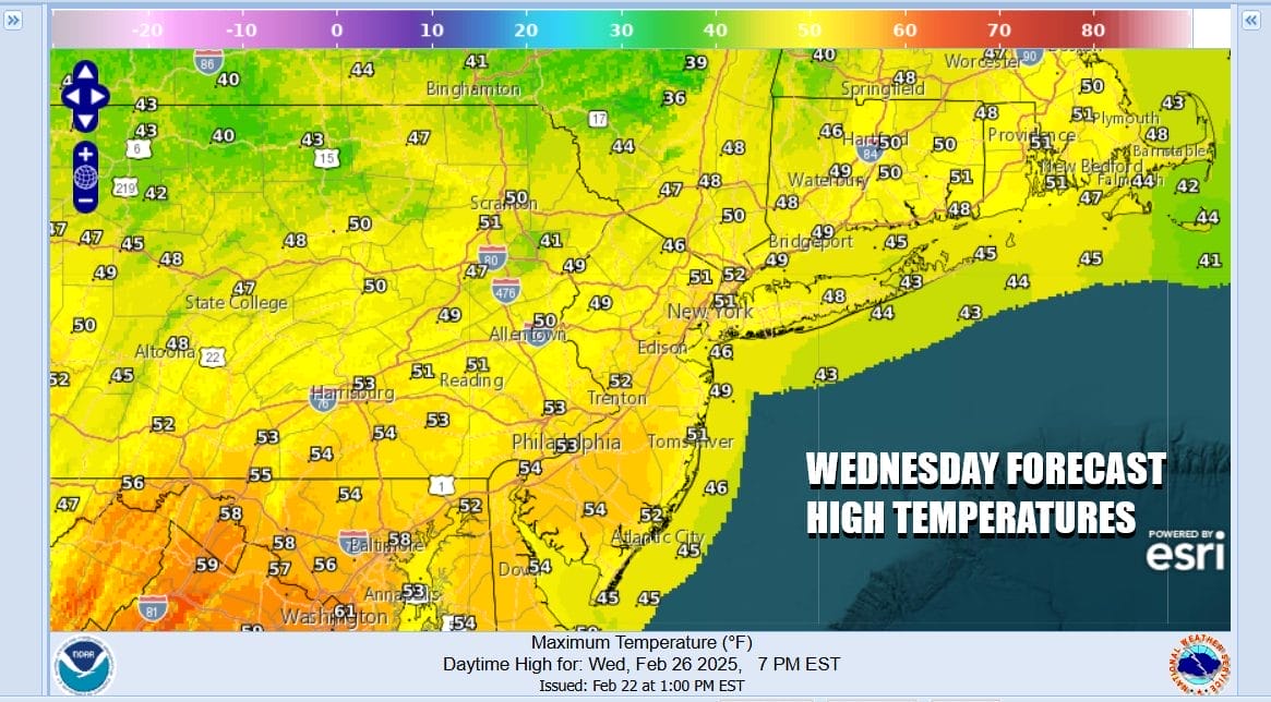
Across Eastern Pennsylvania to Southern New England today is shaping up as an early spring-like day. A chilly start and a warmer finish is typically what you might see in late March or early April. Also we will see local sea breezes develop along south and east facing shorelines. We are between a storm off shore and low pressure moving through the Great Lakes. That leaves us in sunshine for most of the day. Some clouds could approach in the afternoon ahead of a warm front but the dayside will be dry. Highs will range from the upper 40s along the immediate coast and low to 50s inland.
SATELLITE WITH LIGHTNING STRIKES

WEATHER RADAR

Tonight we have a warm front that will be moving northward followed by a cold front for later Thursday. This system is moisture starved to some extent. We look for the warm front to pass overnight and that could produce a couple of rain showers when it goes by. We are not expecting much from this and the front should be to our north by Thursday morning.

The dayside Thursday should be rather warm with clouds and perhaps some breaks of sunshine but we will see the cold front approach and pass later in the day creating the chance for a few showers. Thursday highs should reach the 50s everywhere except perhaps for immediate coastal areas. Some areas inland in the southern half of New Jersey & Southeastern Pennsylvania could see upper 50s and lower 60s.
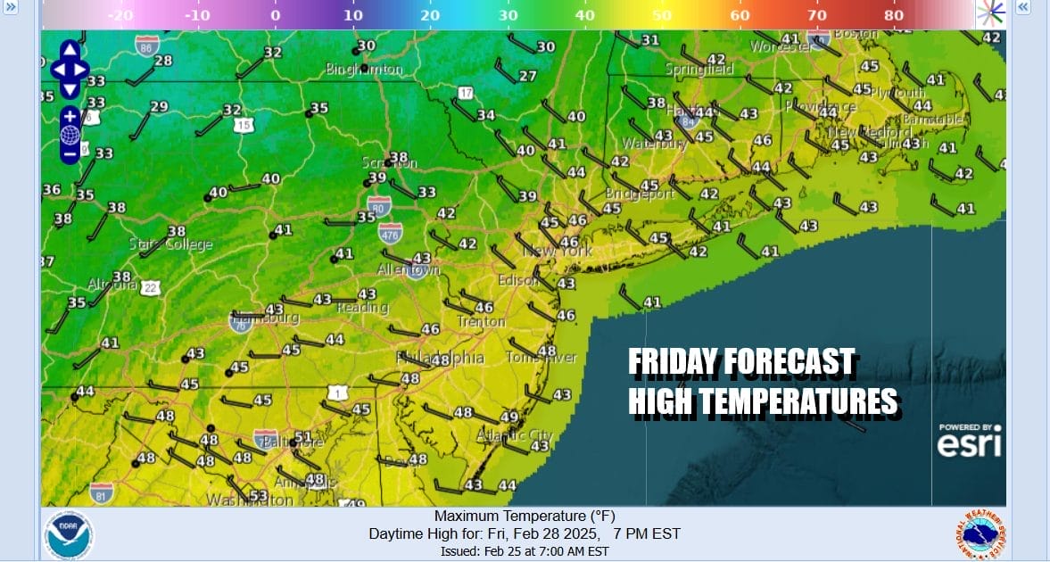
Behind the cold front, slightly cooler air moves in for Friday and it should be a nice day with some sunshine and a bit if a gusty northwest wind at times. Highs will be mostly in the mid to upper 40s area wide. Saturday we will be waiting for another cold front to pass through late in the day. This front also looks like a non event but it does have a shot of very cold air behind it.

A head of that front Saturday we will have a gusty west wind and some sunshine and that should take temperatures up well into the 50s to near 60 before the front passes. Then it turns much colder behind the front as a Canadian high slowly builds in. Sunday we will see sunshine, a gusty wind, and highs only in the 30s. We will be in the teens to lower 20s by Monday morning. Next week starts dry and cold with sunshine and highs just in the 30s for Monday. No major or even minor storms are in sight for the next week or so.
BE SURE TO DOWNLOAD THE FREE METEOROLOGIST JOE CIOFFI WEATHER APP &
ANGRY BEN’S FREE WEATHER APP “THE ANGRY WEATHERMAN!
MANY THANKS TO TROPICAL TIDBITS FOR THE USE OF MAPS
Please note that with regards to any severe weather, tropical storms, or hurricanes, should a storm be threatening, please consult your local National Weather Service office or your local government officials about what action you should be taking to protect life and property.


