

Mostly Dry Weather Slight Shower Chance Today Higher Chance Thursday
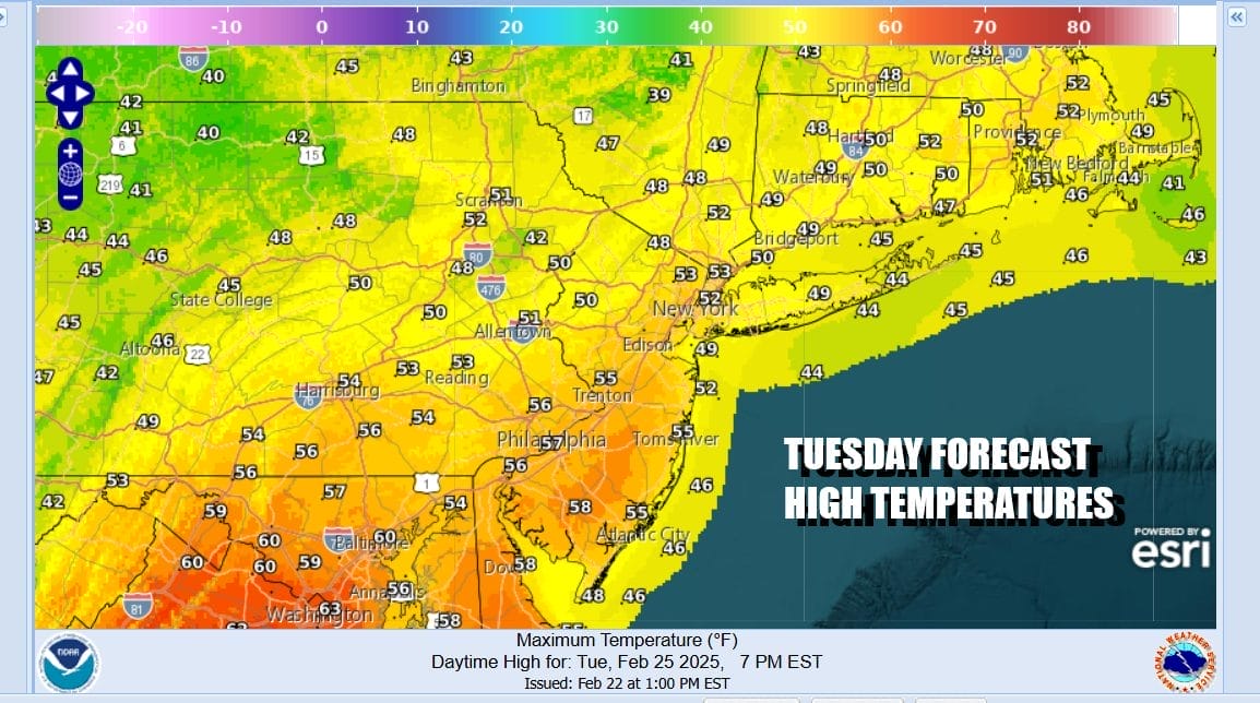
Today begins a parade of cold fronts that will be coming through over the next 5 days. This first front is producing clouds and some areas of rain and snow around the Great Lakes and Upstate NY and New England. There isn’t much punch with this front but there are some showers on the radar. They will probably weaken some as the day wears on. We are going to throw in the chance for a passing shower today. Otherwise look for clouds and some breaks of sunshine. Warmer temperatures are with us and highs will be in the 50s to perhaps near 60 in some inland areas. However south and east facing shorelines will be dealing with sea breeze action this afternoon and temperatures likely top out about 10 degrees or so lower in those areas.
SATELLITE WITH LIGHTNING STRIKES

WEATHER RADAR

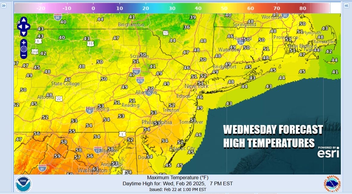
Once this front passes we get a weak high that builds in for Wednesday but the air behind the cold front is about the same as the air ahead of it. Another cold front is forecast to approach Thursday in much the same way as this one. However there might be a little more moisture with this system so we could see some showers as the front passes.

Another low pressure system will be moving southeast from Central Canada and cross the Great Lakes and Northeast Saturday. Again this is going to me a moisture starved system but behind it will be a more robust shot of colder air coming in for the second half of the weekend. Ahead of all this we come back to Wednesday’s forecast which is for sunshine and highs mostly in the low to mid 50s.
Thursday ahead of the cold front we will warm up on southwest winds. Look for some sun early followed by clouds and some afternoon showers. Rainfall is not going to amount very much. Temperatures will warm to the mid 50s to lower 60s before the front passes through during the late afternoon or early evening.

The air mass behind the this front is a little more robust but not overly so. Friday we will see sunshine return with most highs in the mid to upper 40s. Saturday will be warmer with highs reaching the mid 50s to lower 60s before a much colder air mass arrives for Sunday. Gusty northwest winds will be back Sunday along with some sunshine but highs will not get out of the 30s. No major storms are on the horizon for the next 7 days or longer.
BE SURE TO DOWNLOAD THE FREE METEOROLOGIST JOE CIOFFI WEATHER APP &
ANGRY BEN’S FREE WEATHER APP “THE ANGRY WEATHERMAN!
MANY THANKS TO TROPICAL TIDBITS FOR THE USE OF MAPS
Please note that with regards to any severe weather, tropical storms, or hurricanes, should a storm be threatening, please consult your local National Weather Service office or your local government officials about what action you should be taking to protect life and property.


