Sunday Monday Best Part of the Holiday Weekend
Hot Humid Conditions Return Tuesday

Weather in 5/Joe & Joe Weather Show Latest Podcast
Sunday Monday Best Part of the Holiday Weekend Hot Humid Conditions Return Tuesday
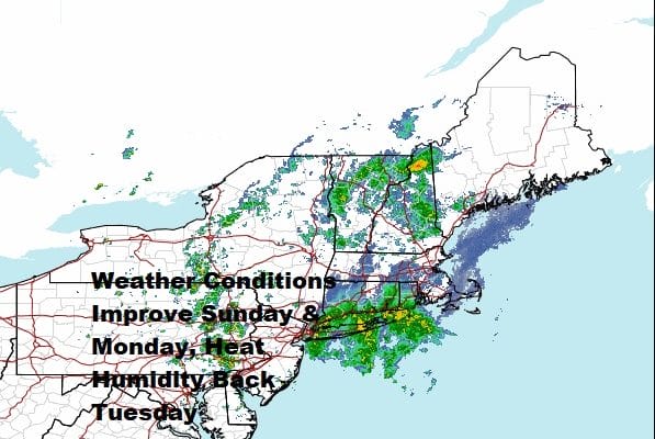
This is one of those days where your location means everything. Southern Pennsylvania, Southern New Jersey and points south are enjoying some sunshine this afternoon but the satellite shows low pressure sitting just offshore and impacts of that and an upper trough in the Northeast are keeping areas from Northern New Jersey, the Hudson Valley northeast into New England and Long Island in a gloom and doom scenario for the rest of today.
SATELLITE

As far as rain is concerned we are seeing a lot of it centered over Long Island and pushing northward. The back edge cuts off around NYC. South and west of there the regional radar is picking up on showers in the Eastern half of Pennsylvania moving southeastward. Notice the counterclockwise rotation and that is the upper low center crawling eastward across New Jersey. Once that moves offshore weather conditions will improve area wide and we should see partial clearing of skies tonight. Temperatures this afternoon where there is sun are in the 70s but where it is overcast it is in the raw low and middle 60s. Sunday morning lows will be in the mid 50s to around 60 with low humidity.
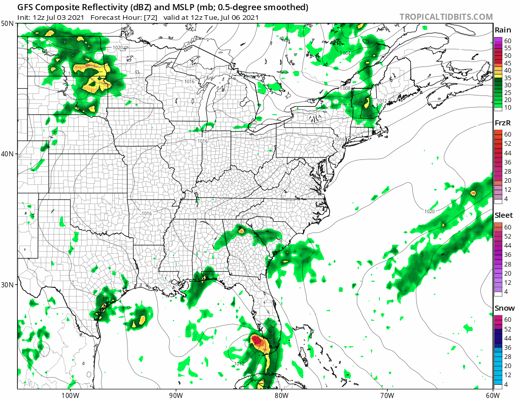
WEATHER RADAR

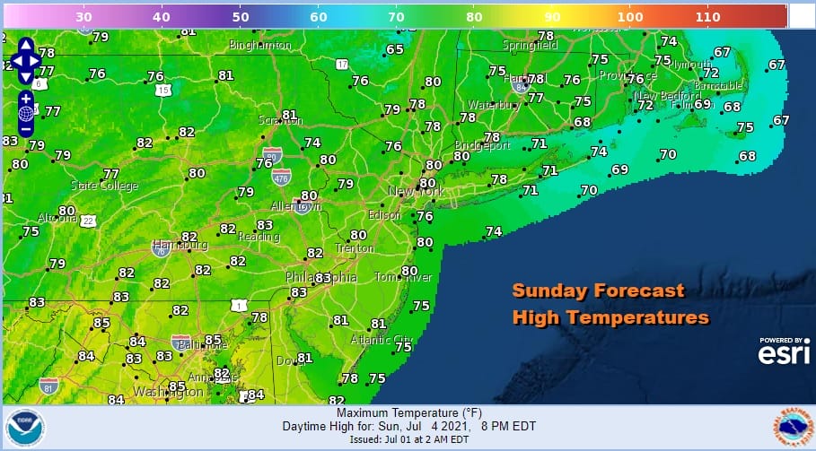
Sunday will be a better day with no worse than partly sunny skies. Temperatures will top out in the mid 70s to lower 80s and humidity levels will be low. July 4th festivities should be free of any showers though we will mention the outside chance for a passing brief shower inland. There should be no issues at all for fireworks displays Sunday night.
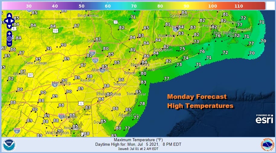
Monday will a return of humidity as a southwest flow begins. Temperatures will reach the mid 80s to around 90 degrees in many areas but it will be a little cooler in Southern New England and Long Island with the wind off the ocean. Again skies should be no worse than partly sunny.
Tuesday brings heat and high humidity back on the scene as highs will reach the low and middle 90s away from the ocean. There is the chance for a pop up shower or thunderstorm but they should be widely scattered in nature.
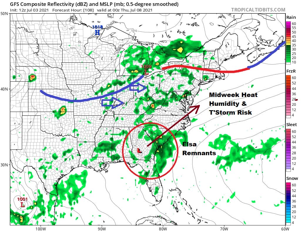
Wednesday starts the next round of changes with very warm to hot and humid conditions and probably an elevated chance for showers and thunderstorms. There could even be some severe weather risk involved so we will watch for that possibility. Highs will be in the upper 80s to mid 90s. The cold front to the west will draw closer Thursday and produce thunderstorms.
Also part of the mix could be the remnants of Elsa which will be in the Southeast US at this point. What survives is unclear regarding Elsa. An intact circulation could wind up enhancing downpours and thunderstorms while a remnant feature would add some moisture to the mix but it would be more limiting. We will be updated the latest on Elsa which is now a tropical storm once today’s model cycle is complete. This will be posted on my weather platform on Patreon.
BE SURE TO DOWNLOAD THE FREE METEOROLOGIST JOE CIOFFI WEATHER APP &
ANGRY BEN’S FREE WEATHER APP “THE ANGRY WEATHERMAN!

MANY THANKS TO TROPICAL TIDBITS & F5 WEATHER FOR THE USE OF MAPS
Please note that with regards to any severe weather, tropical storms, or hurricanes, should a storm be threatening, please consult your local National Weather Service office or your local government officials about what action you should be taking to protect life and property.


