Sunday Clouds Humid Rain Thunderstorm Risk Late Today Into Monday
The second half of this weekend will be not quite as nice as yesterday. We have finally some rain coming for tonight into Monday morning. We already see more clouds around today than we had yesterday and the radars are showing clusters of showers and thunderstorms from Western NY southwarrd to the Western Carolinas. This is due to a warm from cold front combination heading east. In the meantime we will describe today as cloudy to partly sunny with highs in the low to middle 80s.
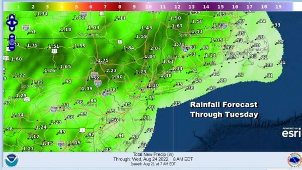
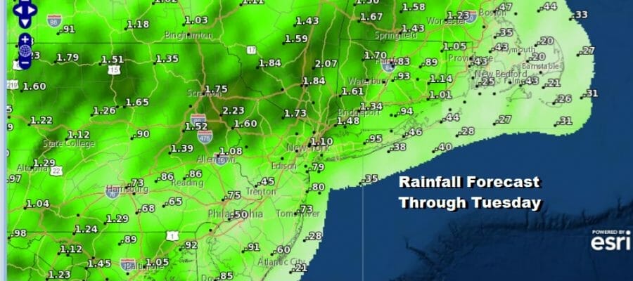
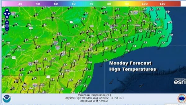
There will be two rounds of rain to deal with. First off is the rain that comes with the warm front and that will be tonight into early Monday morning. The second round comes during Monday with a cold front. From that front we will see some showery rains and one or two thunderstorms. The risk for showers will continue into Tuesday though they should be less numerous. Monday highs will be in the 70s to near 80 degrees.
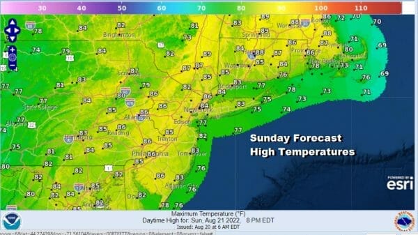
We are likely to see showery rains into Tuesday though they will be mostly from Northeast Pennsylvania & Northern New Jersey northward into Southern New England. Otherwise it will be a cloudy to partly sunny kind of day with highs 80 to 85 in most places, cooler along shore areas.

Wednesday through Friday will be warm, humid, with little or no rain in the forecast. In fact we may not see any rain of consequence for quite awhile. Some sunshine will occur each day and temperatures will be in the mid to upper 80s Wednesday and mid 80s to around 90 or so Thursday and Friday.
BE SURE TO DOWNLOAD THE FREE METEOROLOGIST JOE CIOFFI WEATHER APP &
ANGRY BEN’S FREE WEATHER APP “THE ANGRY WEATHERMAN!
MANY THANKS TO TROPICAL TIDBITS & F5 WEATHER FOR THE USE OF MAPS
Please note that with regards to any severe weather, tropical storms, or hurricanes, should a storm be threatening, please consult your local National Weather Service office or your local government officials about what action you should be taking to protect life and property.


