Summer Weather Is Here Next Several Days Hot Humid Start Next Week

Weather in 5/Joe & Joe Weather Show Latest Podcast
Summer Weather Is Here Next Several Days Hot Humid Start Next Week
All the atmospheric house cleaning is done and we are at the start of a hot humid stretch that will take us into the middle of next week. The satellite picture shows it cleared out nicely overnight and we are enjoying lots of sunshine today.

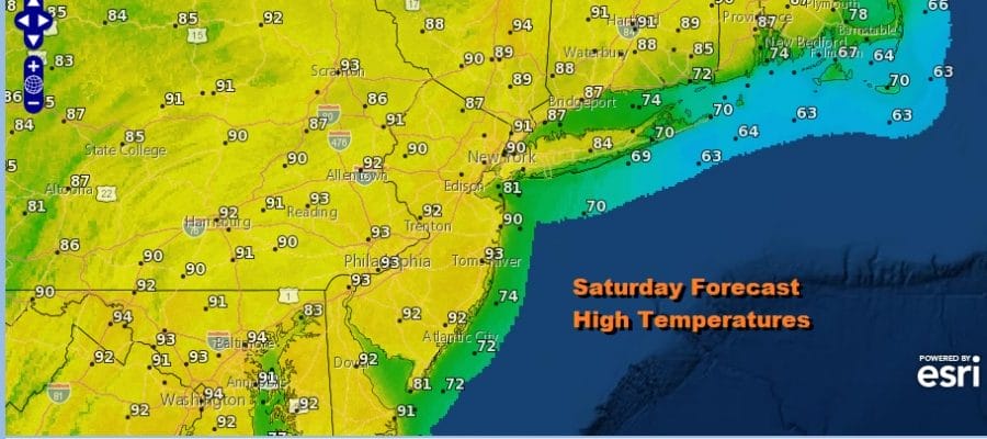
The launching pad was set this morning as we bottomed in the warm 60s in most places. Lots of sunshine, a favorable mostly west wind, and no showers or thunderstorms will take temperatures to the upper 80s and lower 90s. South and east facing shorelines should see some sea breeze action during the afternoon and evening so highs will be a bit lower but still many areas will reach the warm 80s especially just inland.
SATELLITE

It is all about the upper ridge along the East Coast that has forced the Canadian jet north of the border and it doesn’t return until the middle of next week. Humidity levels are moderate today and Sunday but it will grow increasingly more uncomfortable Monday through Wednesday.
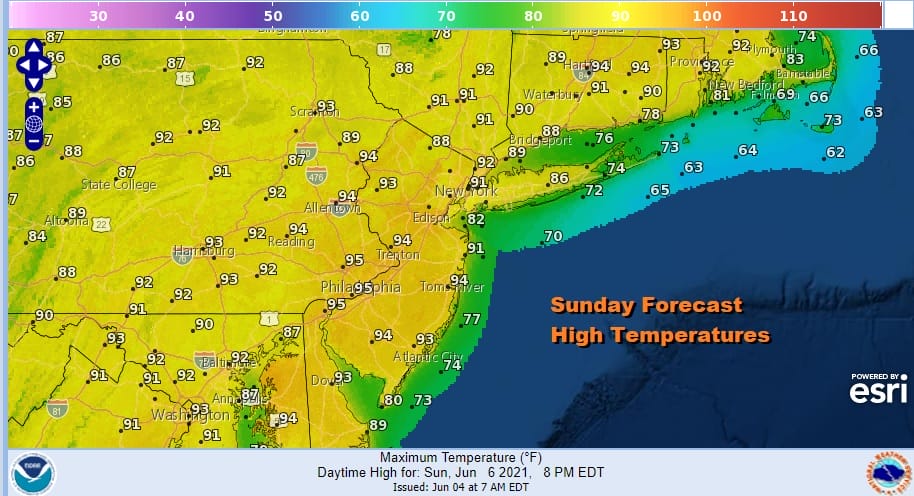
As for Sunday. It will be a sunny hot day with a west wind, limited sea breeze action and no thunderstorms. Many areas will see highs in the low to middle 90s. Monday looks about the same too with highs in the low 90s inland and 80s near coastal areas. The wind Monday will be more south-southwest which takes the temperatures a little lower than Sunday.

Tuesday could be the first day where we need to mention the chance for scattered thunderstorms as the upper ridge weakens and a trough begins to approach from the north in Eastern Canada. This will put some clouds in the mix. Temperatures will be in the mid 80s to near 90.
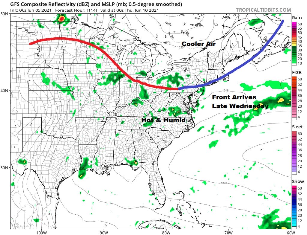
Wednesday brings a back door cold front southward so it should be very warm to hot and humid ahead of it with the chance for scattered thunderstorms. Highs will be in the 80s to near 90. The front may stall just to our south as latest model runs suggest and this could be a problem Thursday morning. We have an annular solar eclipse that will be visible at sunrise. A stalled front nearby may mean lots of clouds around unless that high from the north pushes southward. This is becoming increasingly less likely and one may have to travel north into New England to enjoy a mainly clear sunrise. The stalled front to the south will also put us at risk for showers and thunderstorms later Thursday and Friday.

BE SURE TO DOWNLOAD THE FREE METEOROLOGIST JOE CIOFFI WEATHER APP &
ANGRY BEN’S FREE WEATHER APP “THE ANGRY WEATHERMAN!
MANY THANKS TO TROPICAL TIDBITS FOR THE USE OF MAPS
Please note that with regards to any severe weather, tropical storms, or hurricanes, should a storm be threatening, please consult your local National Weather Service office or your local government officials about what action you should be taking to protect life and property.


