Squeezing in a Dry Day Before Next Weather System Brings Clouds & Rain
Dry Late Week

Squeezing in a Dry Day Before Next Weather System Brings Clouds & Rain
Dry Late Week
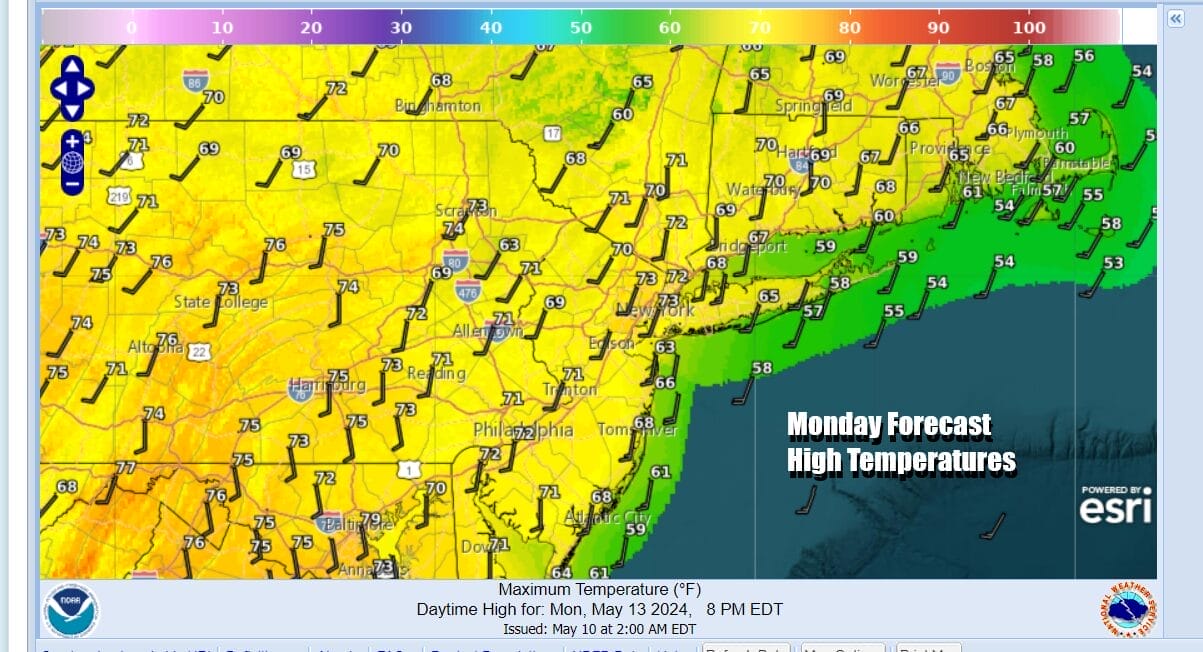
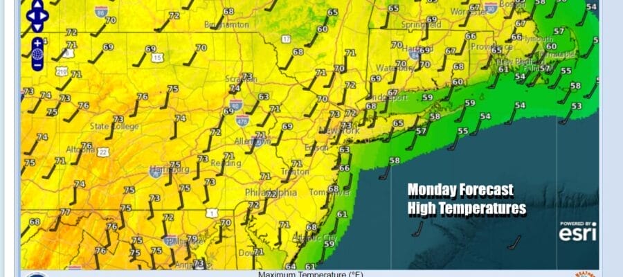
We are going to squeeze in once “nice” day before rain comes back and we start dealing with another potential stretch of what I refer to spring gloom & doom weather. We are going to start the day with sunshine. There is a weak warm front to the northwest in Northern and Western NY that likely brings some showers well inland north and west today. Some clouds will probably come in this afternoon mainly inland but we should be rain free today. Temperatures today should get back to where they should be for this time of year and that is upper 60s to lower 70s.
SATELLITE WITH LIGHTNING STRIKES

WEATHER RADAR

Clouds will continue to increase tonight with most lows in the 50s. Tuesday we have an approaching cold front and low pressure in the Southern Plains that is taking a track eastward across the Tennessee Valley and eventually off the Mid Atlantic coast Wednesday. This southern track means that severe weather today will be across the Gulf States from Texas to South Carolina and Tuesday it shifts to the Southeastern States.

Rain and showers will develop during the day Tuesday and we will see it continue through Wednesday as an offshore low forms and strengthens. The northern edge of the rain may cut off around NYC and Long Island leaving less or little rain to areas north in the Hudson Valley and heavier rain to the south in Southern New Jersey and Southern Pennsylvania. Tuesday highs will reach the 70s away from the ocean and before the rains come. and then be in the upper 50s from NYC east and northeast Wednesday, lower 60s to the south.

As long as the offshore low drifts away to the east or southeast Thursday, weather conditions should improve for Thursday and Friday. We look for some sunshine to return for both days. Highs will reach the upper 60s and lower 70s both days. We are probably settting up for another round of showers over next weekend with Saturday being the day of better risk but we still can’t rule out some lingering rain or showers for Sunday at this early stage.
BE SURE TO DOWNLOAD THE FREE METEOROLOGIST JOE CIOFFI WEATHER APP &
ANGRY BEN’S FREE WEATHER APP “THE ANGRY WEATHERMAN!
MANY THANKS TO TROPICAL TIDBITS FOR THE USE OF MAPS
Please note that with regards to any severe weather, tropical storms, or hurricanes, should a storm be threatening, please consult your local National Weather Service office or your local government officials about what action you should be taking to protect life and property.
(Amazon is an affilate of Meteorologist Joe Cioffi & earns commissions on sales.)


