
Some Sunshine Over the Weekend, Week Ahead,
Storm Deep South Stays South, New California Major Storm

Some Sunshine Over the Weekend, Week Ahead,
Storm Deep South Stays South, New California Major Storm
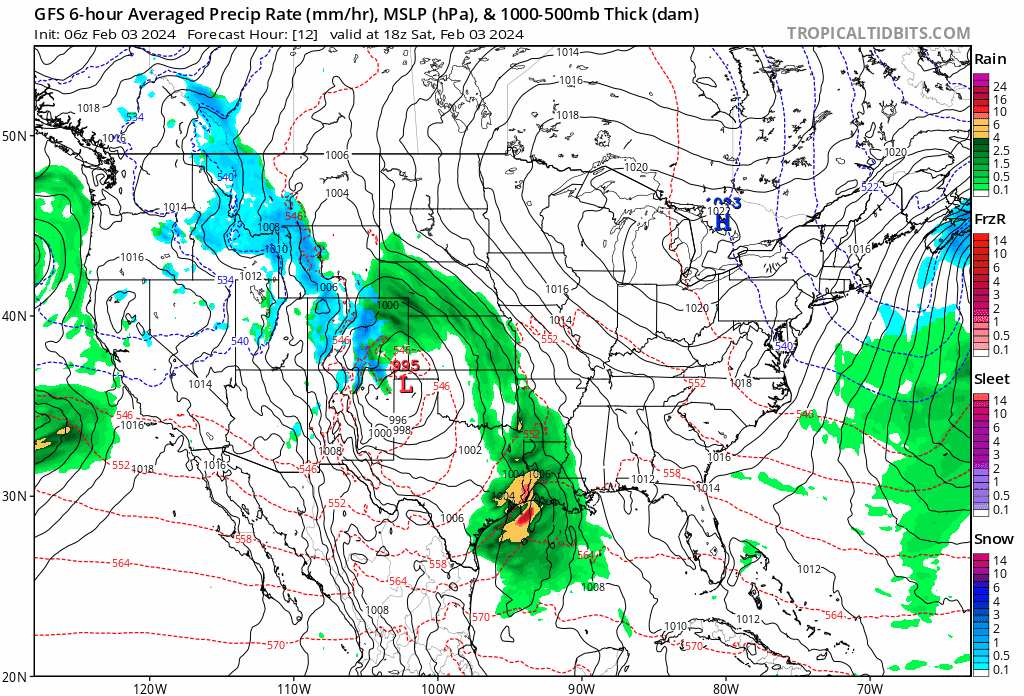
We have reached the weekend in what is a active pattern across the southern half of the US. Storms are on either side with one from California a few days ago moving across the Deep South today and Sunday. Heavy rain will occur across the Gulf States and we see severe weather risk for Floriday Sunday. A new storm is coming ashore in California this weekend with another round of very heavy rain of six inches or more and heavy mountain snows of up to two feet for that state and others in the Southwest.
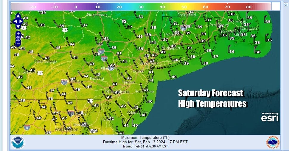
This southern storm track is one that goes straight west to east and neither of these storms will bring nasty weather to the Mid Atlantic and Northeast. Much of this area has struggled with cloudy or near cloudy conditions for the last 10 days. Finally today we are going to see some sunshine though there are going to be clouds around. The northwest flow should help to dry things out and highs will be mostly in the lower 40s. Then tonight skies should clear and most lows Sunday morning will be in the 20s to lower 30s.
SATELLITE WITH LIGHTNING STRIKES

WEATHER RADAR

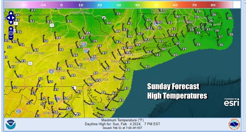
Sunday looks to be a nice day. Storminess is so far south that the low in the Gulf States actually reforms off the Florida east coast. From there it tracks east toward or even south of Bermuda! Even the high clouds won’t make it up the coast. This leaves us with high pressure overhead and sunshine for Sunday. Afternoon highs will be in the middle to a few upper 40s.
Looking ahead to the new week, we do not see anything happening rain wise (or snow wise) given the blocking pattern over Central Canada. and the strong southern jet going west to east and not south to north. Initially Monday through Wednesday will be dry days with sunshine and most highs a little above average for this time of year. Highs will be in the low 40s each day. Some places could push it up to 44 or 45. Nights will be quiet and clear for the most part with lows in the 20s to lower 30s. Later in the week we will see temperatures move up a bit and the next cold front will probably come late Friday with a chance for showers. No major storms are on the horizon for the Northeast and Mid Atlantic states.
BE SURE TO DOWNLOAD THE FREE METEOROLOGIST JOE CIOFFI WEATHER APP &
ANGRY BEN’S FREE WEATHER APP “THE ANGRY WEATHERMAN!
MANY THANKS TO TROPICAL TIDBITS FOR THE USE OF MAPS
Please note that with regards to any severe weather, tropical storms, or hurricanes, should a storm be threatening, please consult your local National Weather Service office or your local government officials about what action you should be taking to protect life and property.
(Amazon is an affilate of Meteorologist Joe Cioffi & earns commissions on sales.)


