Showers Will Exit Slow Improvement Through the Weekend, No Storms In Sight

Showers Will Exit Slow Improvement Through the Weekend, No Storms In Sight
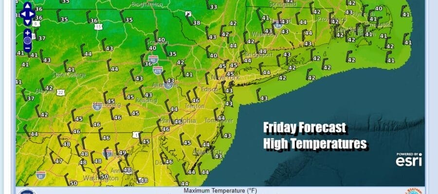
We have a cold front passing through this morning and it producing a few showers. It isn’t much of a cold front since the air behind the front isn’t something that I would describe as cold. Once these showers that are on the radar this morning we should see improving weather conditions this afternoon with leftover clouds giving way to some sunshine. Temperatures today will probably hold in the middle 40s. Then we should see skies clear out tonight. Lows Saturday morning will be in the mid 20s to lower 30s.
SATELLITE WITH LIGHTNING STRIKES

WEATHER RADAR

The upper air weather pattern remains one where we are seeing a minimal amount of cold air across much of the US and Canada. We also have a blocking high in South Central Canada which is forcing the jet stream to undercut the upper high. Storm tracks as a result are well to the south as we have seen with a couple of systems this week and another system is going to do the same thing this weekend and early next week.
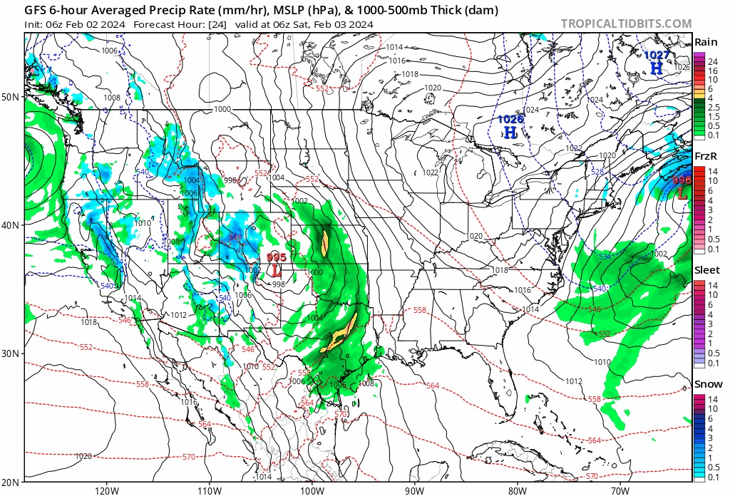
Low pressure is moving out of California and will take a track across the Deep South and Gulf States. We have contended all week long that there was no way on God’s green earth that this system was going to move up the East Coast. Instead due to the blocking high, we see it tracking not only off the Southeast US coast but the low winds up tracking south of Bermuda!
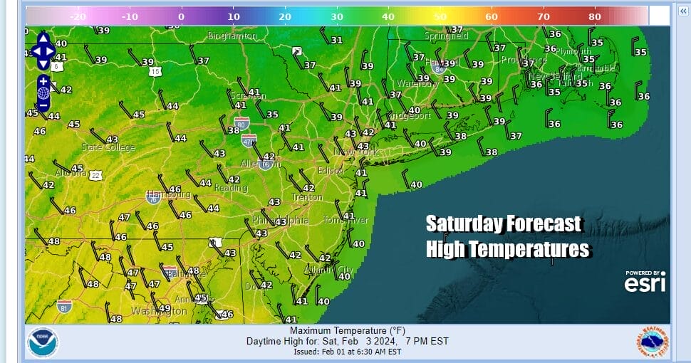
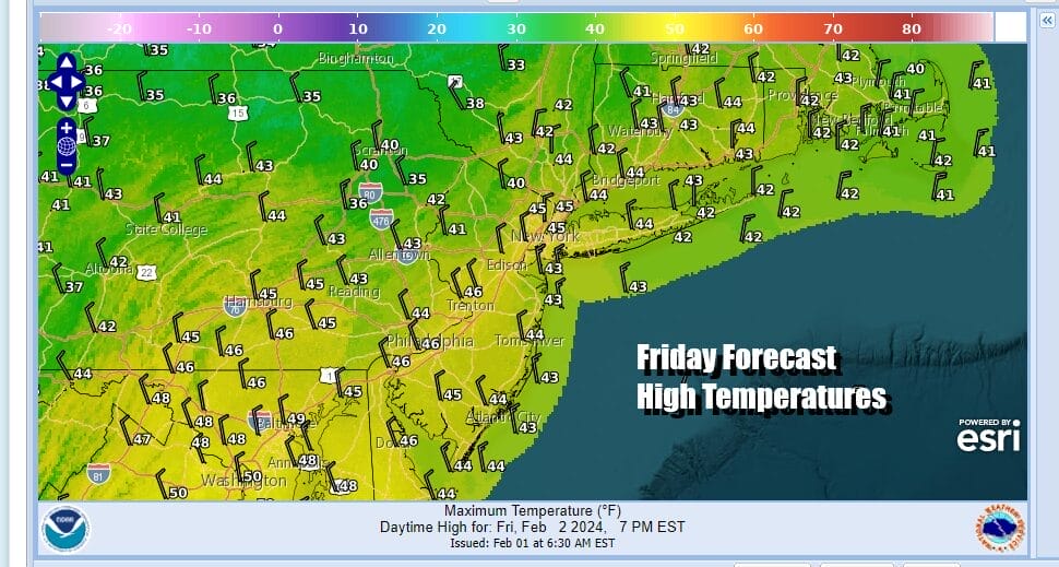
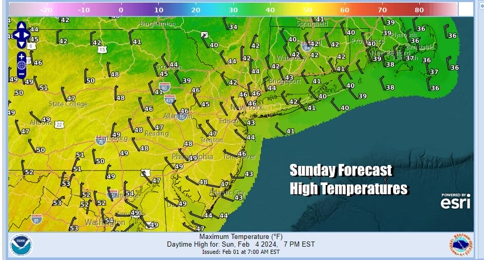
This leaves us with a rather nice weekend across Eastern Pennsylvania to Southern New England with sunshine for Saturday and highs in the low to middle 40s. Saturday night we will see clear skies with lows in the 20s to lower 30s. Sunday will be a nice day of sunshine. Highs will be mostly in the mid to upper 40s.
Next week looks to be nice overall with above average temperatures. High pressure covers the East Coast as that storm we spoke of earlier heads out to the east. Monday we will have some sunshine with highs in the low to middle 40s. Tuesday and Wednesday might be a shade lower temperature wise with highs in the upper 30s and lower 40s both days. Then we should warm up some Thursday and Friday. The next cold front and th next chance for rain or showers probably comes next weekend as low pressure heads from the Plains to the Great Lakes. No arctic air and no snowstorms, not even small snow storms are in sight for the Northeast and Mid Atlantic states any time soon.
BE SURE TO DOWNLOAD THE FREE METEOROLOGIST JOE CIOFFI WEATHER APP &
ANGRY BEN’S FREE WEATHER APP “THE ANGRY WEATHERMAN!
MANY THANKS TO TROPICAL TIDBITS FOR THE USE OF MAPS
Please note that with regards to any severe weather, tropical storms, or hurricanes, should a storm be threatening, please consult your local National Weather Service office or your local government officials about what action you should be taking to protect life and property.
(Amazon is an affilate of Meteorologist Joe Cioffi & earns commissions on sales.)


