Snow Wednesday Night Thursday Cheap Thrill

Snow Wednesday Night Thursday Cheap Thrill
The first of two systems is going to moving through our area Wednesday night into Thursday morning. It is one those systems that looks innocent enough and it shouldn’t amount to much (famous last words) but after Saturday’s system where the snow areas basically flipped themselves around, it is probably a good idea to keep your eyes open in case something unexpected happens again.
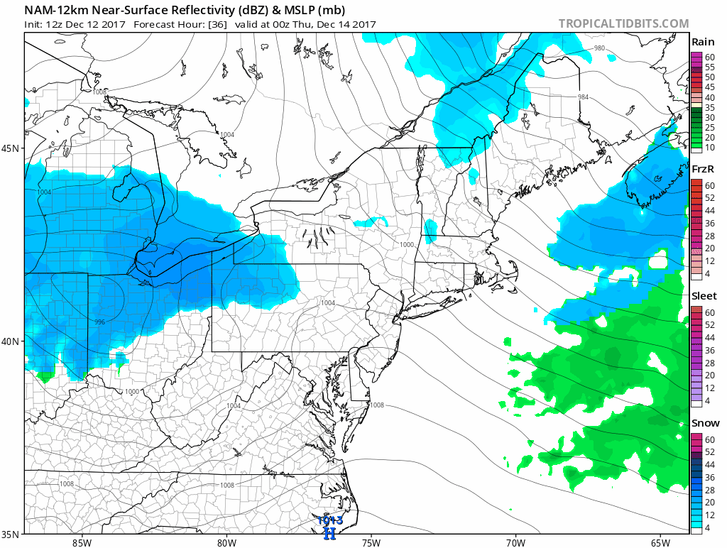
NAM MODEL SURFACE MAP WEDNESDAY NIGHT INTO THURSDAY
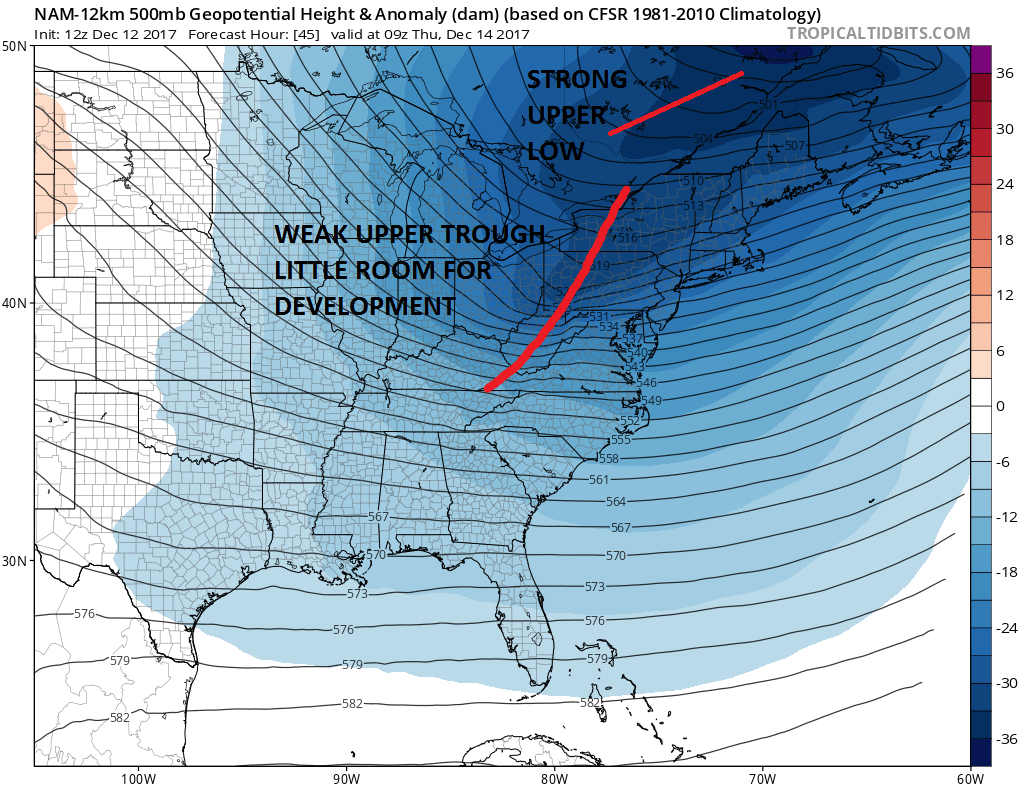
The issue with this system is the strong upper low to the northeast which is dominating the low and that leaves little room for this little low to develop much. Usually with these things the snow to the west which will probably be in the 2 to 4 inch range will get left west of the mountains which leaves us with the question of how much survives the trip east.
UPPER AIR FLOW THURSDAY MORNING
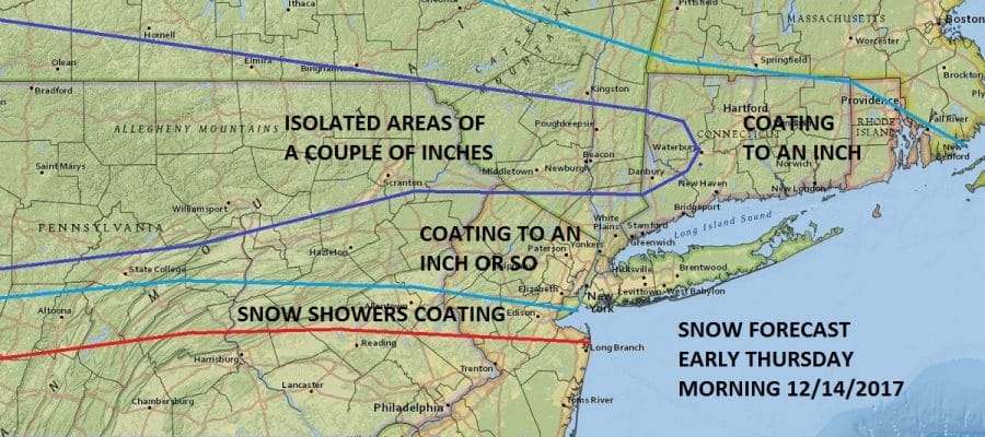
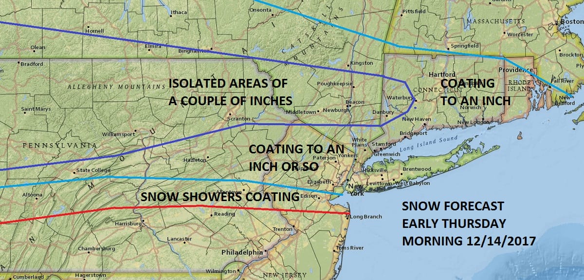
For now it would seem that there will be some snow showers around with this or perhaps a few areas might see a steady period of snow for a few hours. With cold temperatures below freezing Wednesday night, it seems a coating to a inch or so is possible.
SNOW FORECAST THURSDAY MORNING
Another system is forecast to develop Friday night along the coast. Latest weather models show this to be weaker and further east. We will wait to evaluate this system until tomorrow as we watch the first system. I always try to focus on these snow systems one at a time.
MANY THANKS TO TROPICAL TIDBITS FOR THE WONDERFUL USE OF THE MAPS

GET JOE A CIGAR IF YOU LIKE!
FiOS1 News Weather Forecast For Long Island
FiOS1 News Weather Forecast For New Jersey
FiOS1 News Weather Forecast For Hudson Valley
NATIONAL WEATHER SERVICE SNOW FORECASTS
LATEST JOESTRADAMUS ON THE LONG RANGE
Weather App

Don’t be without Meteorologist Joe Cioffi’s weather app. It is really a meteorologist app because you get my forecasts and my analysis and not some automated computer generated forecast based on the GFS model. This is why your app forecast changes every 6 hours. It is model driven with no human input at all. It gives you an icon, a temperature and no insight whatsoever.
It is a complete weather app to suit your forecast needs. All the weather information you need is right on your phone. Android or I-phone, use it to keep track of all the latest weather information and forecasts. This weather app is also free of advertising so you don’t have to worry about security issues with your device. An accurate forecast and no worries that your device is being compromised.
Use it in conjunction with my website and my facebook and twitter and you have complete weather coverage of all the latest weather and the long range outlook. The website has been redone and upgraded. Its easy to use and everything is archived so you can see how well Joe does or doesn’t do when it comes to forecasts and outlooks.
Just click on the google play button or the apple store button on the sidebar for my app which is on My Weather Concierge. Download the app for free. Subscribe to my forecasts on an ad free environment for just 99 cents a month.
Get my forecasts in the palm of your hand for less than the cost of a cup of Joe!