Snow For Skiers In New England 03312017
Snow For Skiers In New England 03312017
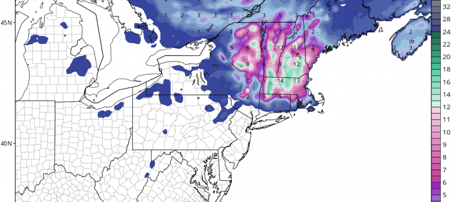
As this storm system continues to move eastward toward the Delaware New Jersey coast line the area of snow continues to expand across Northeastern NY eastward into Central and Northern New England. Up to a foot of snow will fall along and north of the MASS Pike (I-90) as well as elevated areas in Northeastern NY. The heaviest snow will fall tonight into Saturday morning. This is a nice shot of snow for you late season skiers who may want to get in one more weekend before the snow eventually melts away. Actually another storm approaching on Tuesday might bring more snow for Northern New England. This certainly makes up for the lack of snow last winter.
GFS MODEL SNOW FORECAST THROUGH SUNDAY MORNING
The GFS model snow map this afternoon has finally adjusted to reality and I think this is a fair representation of what could fall between now and Saturday morning. The high end amounts shown maybe a bit lower as this reflects 10-1 rations of snow to rain and the ratios may be more on the order of 7 to 8 to 1. There should be nothing of consequence along and south of Route 84 as there just isn’t enough cold air in play. Weather conditions will begin to improve later Saturday everywhere as the storm pulls away.
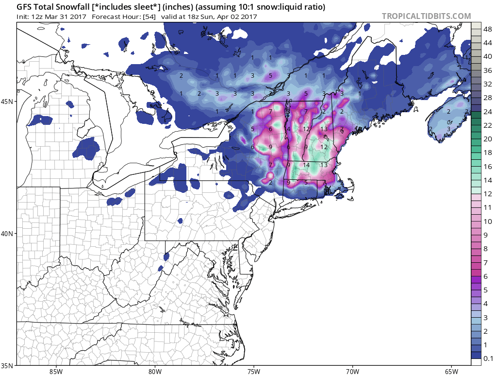
GFS MODEL RAIN FORECAST THROUGH SUNDAY MORNING
Rainfall amounts for our area will be in the 1.50-2.50 inch range area wide. The heaviest rains on the GFS model are concentrated around Coastal New Jersey, New York City, and Long Island. Other models vary but I think the bottom line is the general range forecast works for all areas.

GET JOE A CIGAR IF YOU LIKE


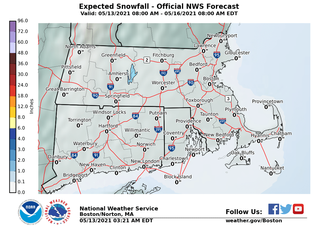
The maps below are the National Weather Service forecast snow maps with the most likely snowfall prediction.