Snow Showers Moving Southeast First Of The Season
SHOP THE JOESTRADAMUS STORE
Snow Showers Moving Southeast First Of The Season
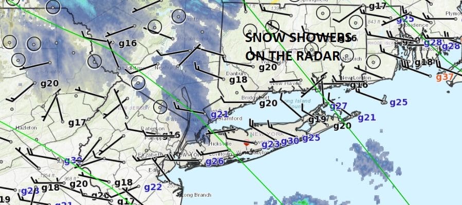
The first snow showers of the season are showing up on the radar over parts of our area this morning though not everywhere and not all will see it. Still the flakes are reaching the ground in spots and it is a gentle reminder that we are approaching the beginning of winter. Meteorological Winter begins in 11 days on December 1st.
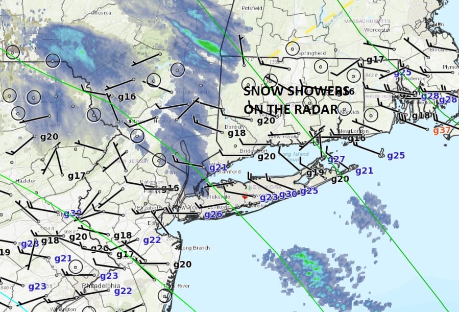
You can see the radar echos on the map above. Most are over Northeastern Pennsylvania, Northeastern New Jersey to NYC, Hudson Valley and eventually into Western Connecticut and parts of Long Island. Most of that is aloft but flakes are making it downstairs to the surface. This marks the upper trough swinging around and through the area and then lifting northeast. Once these go by we should see sunshine and temperatures this afternoon in the 40s.
SATELLITE LOOP

REGIONAL RADAR

LOCAL RADAR NEW YORK CITY

LOCAL RADAR PHILADELPHIA


Warmer temperatures follow Tuesday with sunshine and some clouds with highs in the mid to upper 50s. We do have a wave of low pressure moving offshore to our south and east providing us with clouds but not much more. Then it will be dry for Wednesday with some sunshine with highs in the low 50s. Thursday Thanksgiving and Friday the big shopping day continue to be dry with some sunshine and highs in the 40s. There are no major or even minor storms to worry about through early next week. We could see a few showers on Saturday with a cold front followed by another shot of colder air Sunday and Monday. It is a pretty simple and straightforward pattern. Enjoy the snow showers if you see them.
 GET JOE A CIGAR IF YOU LIKE

FiOS1 News Weather Forecast For Long Island
FiOS1 News Weather Forecast For New Jersey
FiOS1 News Weather Forecast For Hudson Valley


