Snow Developing Evening Commute Begins
SHOP THE JOESTRADAMUS STORE
Snow Developing Evening Commute Begins
Snow Developing Evening Commute Begins
There are no changes to the forecast. Snow is rapidly breaking out across the area from Eastern Pennsylvania to Southern New England. This will be a general 1 to 3 inch snowfall for most places amounts on the low end as you go north and west of ROUTE 95 and skew on the high side of the range south and east of Route 95.

All of this comes to an end during this evening from west to east. The satellite shows the upper trough swinging across the Great Lakes and moisture is blossoming right along the coast.
SATELLITE LOOP

REGIONAL RADAR

LOCAL RADAR NEW YORK CITY

LOCAL RADAR PHILADELPHIA


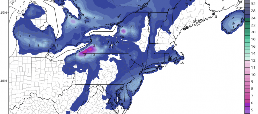
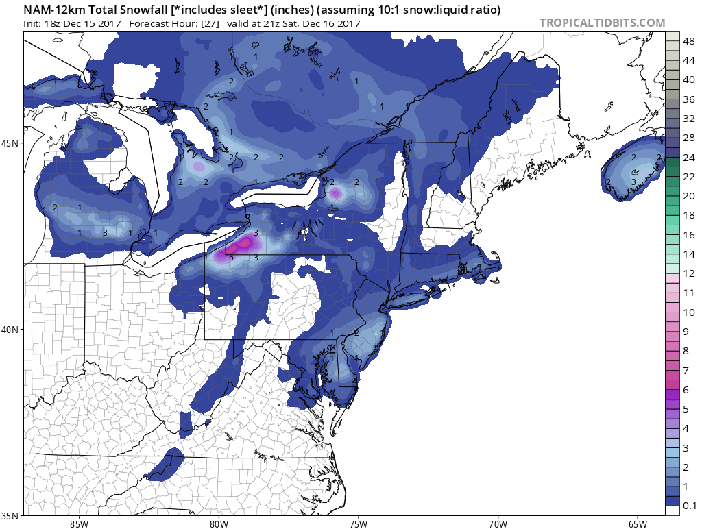
NAM model snow amounts didn’t change much on the newest model run so we will just leave things alone. This is third snowfall in the last 6 days. We have two other weak systems for the weekend but we don’t think they will produce much.
NAM MODEL SNOW FORECAST
This all moves out this evening from west to east and skies will clear out overnight with lows by morning in the teens to lower 20s. Saturday we will see clouds and sun with highs in the 30s. There is a weak disturbance dropping southeast from the Great Lakes that will produce clouds and perhaps a few passing snow showers late in the afternoon Saturday. Sunday we will cloud up and there is another weak disturbance that could produce some snow or a wintry mix Sunday night as milder air approaches. By Monday morning weather conditions should improve some. Next week on the whole looks quiet. However longer range I think we could be setting up for something to happen around Christmas Eve or Christmas Day. We will talk more about this in the coming day.
 GET JOE A CIGAR IF YOU LIKE

FiOS1 News Weather Forecast For Long Island
FiOS1 News Weather Forecast For New Jersey
FiOS1 News Weather Forecast For Hudson Valley