
Sitting Between Areas of Rain Today
Sitting Between Areas of Rain Today
While the satellite picture this morning shows lots of clouds over the Middle Atlantic States & the Northeast, the rain on the radar seems to be split into two areas with one to the southeast offshore and a couple of narrow bands of heavier rains to the northwest. This is the kind of day it will be with lots of clouds and an onshore flow. Temperatures probably will be sitting in the 50s to lower 60s all day. Yes it could rain but there will be some dry periods in between.
US SATELLITE

REGIONAL RADAR

The rain to the southeast is due to Atlantic ocean moisture that originated from off the Florida coast. The rain to the northwest is being enhanced by any approaching cold front. It seems that we will miss out on the heaviest rain which will remain offshore but some heavier downpours are possible nonetheless.
LOCAL RADAR NEW YORK CITY

LOCAL RADAR PHILADELPHIA


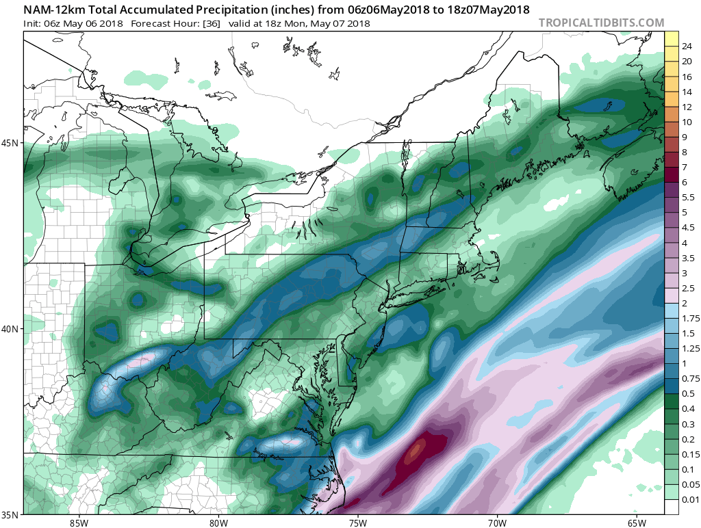
Late this afternoon and tonight a steadier more widespread will develop in some areas. When it is all said and done by Monday morning you can see on the rainfall forecast maps that there is a huge gap between two areas of 1/2 inch to an inch of rain with much less in between.
NAM RAIN FORECAST
Weather conditions will begin to improve during Monday with a mix of sun and clouds developing with highs in the 60s. Tuesday and Wednesday we will see a fair amount of sunshine with highs Tuesday in the upper 60s and lower 70s and into the 70s on Wednesday.
 GET JOE A CIGAR IF YOU LIKE

FiOS1 News Weather Forecast For Long Island
FiOS1 News Weather Forecast For New Jersey
FiOS1 News Weather Forecast For Hudson Valley


