
DOWNLOAD MY NEW FREE JOESTRADAMUS WEATHER APP FOR ALL DEVICES
THE APP IS ABSOLUTELY FREE TO ALL BUT CONSIDERING SUBSCRIBING TO PATREON FOR A WEATHER EXPERIENCE FREE OF ADS, EXCLUSIVE VIDEOS FOR MEMBERS ONLY AND MUCH MORE…STARTS AT $2 A MONTH..MESSAGE ME AT ANY TIME
Showers Thunderstorms Weaken Into Marine Layer Weather Improves Wednesday
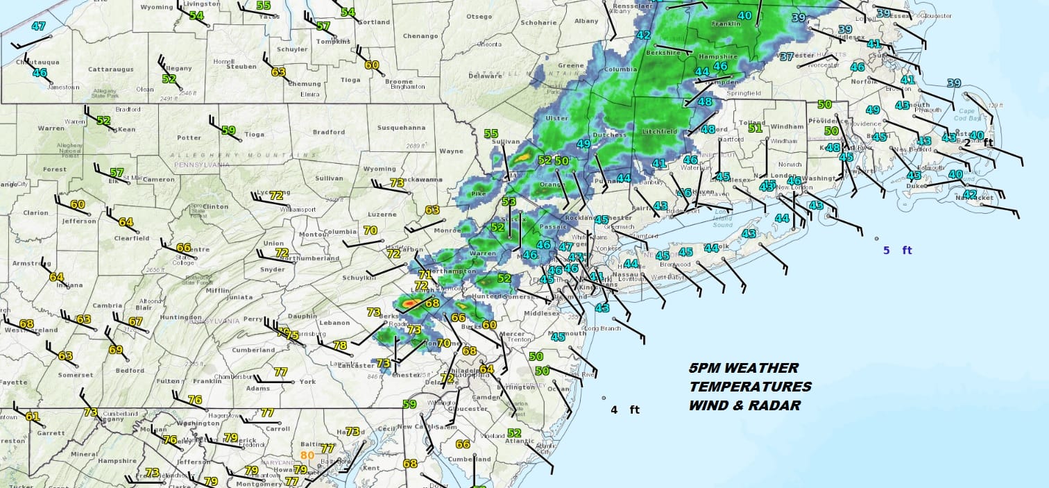
Our cold front is arriving on time with a line of showers and thunderstorms. A few of those cells have been on the strong side as they move out of Pennsylvania and into New Jersey however just to the east lies the marine layer. East winds and temperatures that are still in the 40s in those areas will effectively weaken these storms to a line of showers as they progress across NYC Long Island and Connecticut.
REGIONAL RADAR

LOCAL RADAR NEW YORK CITY

The local radars show the storms moving east but notice that the area in the Hudson Valley has weakened to just some showers as they were the first to encounter to ocean air. Marine air is cool and stabilizes the atmosphere. Thunderstorms don’t like cool marine air at all. Further southwest where the marine air cuts off the thunderstorms are still there but these too will weaken as they move to the east. They will all be offshore by 7 or 8pm and weather conditions will improve from there. Skies will clear overnight with most lows in the upper 30s to middle 40s.
LOCAL RADAR PHILADELPHIA


Now we move on to the next big weather player and that is a major spring blizzard in the Plains and Upper Midwest. All sorts of blizzard warnings are up from Northeastern Colorado to Southwest Minnesota. Denver today has a temperature near 80 and they have a blizzard warning up for tomorrow night into Thursday! That’s how it works this time of year. Up to a foot and a half of snow will fall from this storm across the Plains.

On the other hand, we here in the Eastern US will have some quiet days ahead of us with no issues into Friday. Sunshine Wednesday and Thursday will keep most highs in the 50s to near 60. For some places Wednesday will be warmer than today thanks to a northwest wind instead of an east wind. Thursday it is a south wind that holds temperatures down a bit. Friday the Plains blizzard will be heading into the Northern Great Lakes. We have a cold front from this storm headed our way. Clouds will be here Friday with a south wind and temperatures again in the 50s and lower 60s. Showers are likely Friday night into Saturday morning.
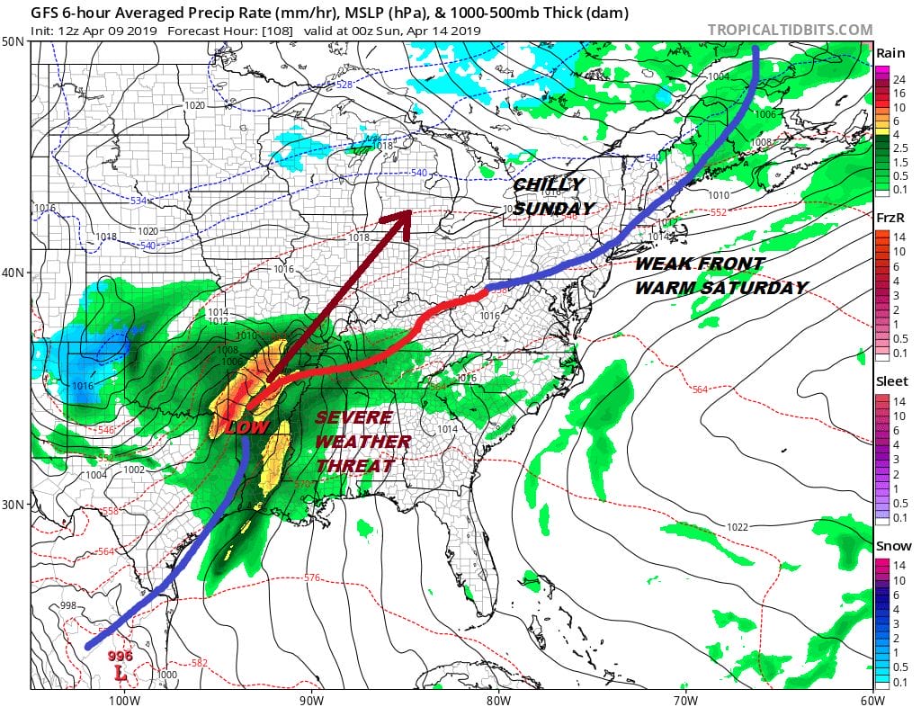
Saturday I think will be a warm day as we have to wait for a second weak front to move through late Saturday with little weather. We could see temperatures reach the upper 60s and lower 70s Saturday. Then another storm comes out of the Gulf States. Weather models were showing this tracking up the East Coast due to blocking however that blocking is considerably weaker and that means this low heads to the Ohio Valley. That said clouds will increase Sunday with an ocean wind and temperatures in the 50s. Showers are likely to move in Sunday night into early Monday before they move out and weather conditions improve again. The weather pattern remains busy with storms developing every two or three days so we continue to suggest enjoying the nice days when they come in between weather events.
MANY THANKS TO TROPICAL TIDBITS FOR THE USE OF MAPS
Please note that with regards to any tropical storms or hurricanes, should a storm be threatening, please consult your local National Weather Service office or your local government officials about what action you should be taking to protect life and property.


