Showers Thunderstorms Late Today & Again Wednesday Night Into Thursday Weekend Outlook

Showers Thunderstorms Late Today & Again Wednesday Night Into Thursday Weekend Outlook
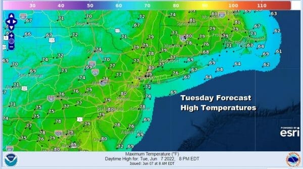
The nice stretch of weather is coming to an end today but we have some time. The satellite shows a clouds to the west ahead of a cold front that will be moving through tonight. Most of the support with this system is well to the northwest in Southeastern Canada so while we will see some showers and thunderstorms develop and move through late this afternoon and into tonight, I’m not expecting anything severe. In the meantime we have increasing clouds for today and temperatures will be a little lower than past days. Highs will be in the mid 70s to near 80 degrees.
SATELLITE

WEATHER RADAR

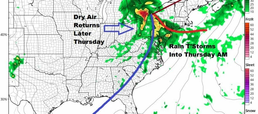
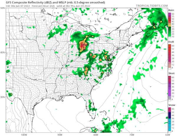
Most of the showers are well to the west at the moment on the regional radar. As they move through this evening they will do a slow fade and fall apart once the front passes and that leaves us with leftover clouds overnight with lows in the 60s. Wednesday looks to me that we could be dry for much if not all of the dayside. The front stalls and then another wave develops and that brings a round of heavier rain and thunderstorms Wednesday night into Thursday morning. Highs Wednesday will be in the upper 70s to some lower 80s.

The rain will end from west to east beginning at 5am in Eastern Pennsylvania, around 8AM in NYC in the Hudson Valley to Coastal NJ and between 8 and 11am in Southern and Southeastern New England. After that drier air will move in and we should see decreasing clouds and perhaps some sunshine Thursday afternoon. Highs will be in the upper 70s to lower 80s.
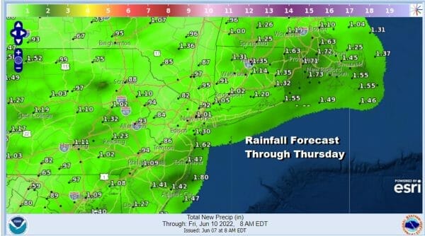
Most rainfall amounts will be between 3/4 inch and 1.25 inches through Thursday morning. Friday will be a dry day but we have the next weather system headed our way from the west and southwest with a cold front and upper trough. We will see some rain from this Friday night into Saturday morning.
There are some questions on this. The GFS has showery rains as a low tracks to the west and then a cold front moves through. Other models take a more southern route with heavy rain during the day Saturday but it should be exiting during the afternoon from southwest to northeast. For now we will go for some rain or showers Friday night into Saturday afternoon and look for some improvement though not perfect for Sunday.
BE SURE TO DOWNLOAD THE FREE METEOROLOGIST JOE CIOFFI WEATHER APP &
ANGRY BEN’S FREE WEATHER APP “THE ANGRY WEATHERMAN!
MANY THANKS TO TROPICAL TIDBITS & F5 WEATHER FOR THE USE OF MAPS
Please note that with regards to any severe weather, tropical storms, or hurricanes, should a storm be threatening, please consult your local National Weather Service office or your local government officials about what action you should be taking to protect life and property.


