Severe Weather Risks Rise This Week As Heat & Humidity Make a Comeback

Severe Weather Risks Rise This Week As Heat & Humidity Make a Comeback
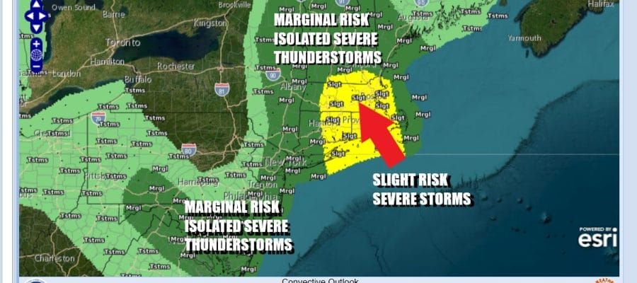
We are in the summer vacation season home stretch this week. For most of you this is the last week of the summer vacation season and we are seeing a return to higher humidity and some heat heat over the next 3 days along with severe thunderstorm risk. The Storm Prediction Center is indicating a marginal to slight risk for severe thunderstorms late today from New England south to the Mid Atlantic states and that includes Eastern NY state south to Long Island, Connecticut, Southeastern New England, New Jersey, Delaware, Maryland and Virginia.

Ahead of an upper trough and weak weather front moving southeast from Eastern Canada, we will see sunshine, higher humidity, and temperatures this afternoon reaching the middle to upper 80s. The discomfort level rises today especially when you compare it to the super dry air we had last week. Scattered thunderstorms will develop late today mainly from New Jersey north and east and there will be isolated severe storms in the mix. The highest risk will be in Southeast New England to Eastern Long Island. Not everyone will see thunderstorms late today.
SATELLITE WITH LIGHTNING STRIKES

WEATHER RADAR

Severe weather is expanding from west to east this week over the top of a large ridge of high pressure centered in the Middle Mississippi Valley. This is pushing 90 degree plus highs and higher humidity eastward into the Northeast and Middle Atlantic states. It appears that the heat will apex Wednesday before beginning a slow retreat late this week.

Temperatures will continue to move higher Tuesday and Wednesday but the very hot weather of upper 90s and low 100 degree highs should stay well to our west. Dew points will approach 70 Tuesday and into the lower 70s Wednesday so it will be uncomfortable. Tuesday we see any nighttime and morning low clouds burning off to sunshine and highs reaching the upper 80s and lower 90s.
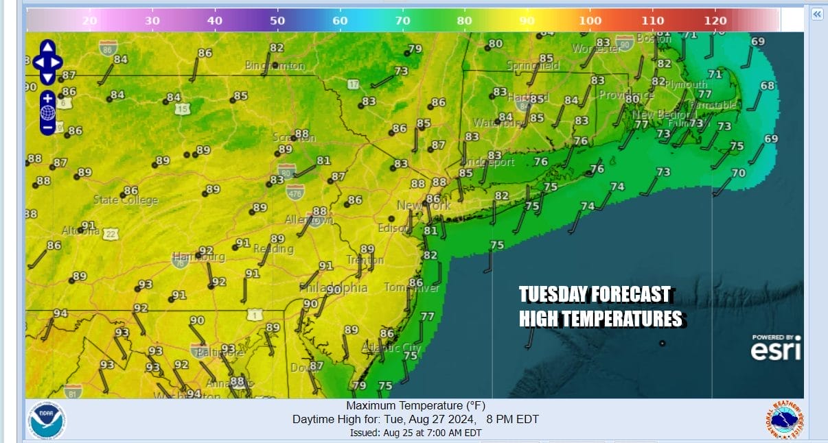
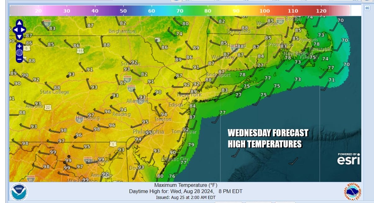
It appears thunderstorm risk for Tuesday will be minimal but Wednesday sees an upper trough and cold front moving Southeast from Eastern Canada. Temperatures will be heading into the low and middle 90s from New York City south and upper 80s to near 90 degrees to the north and east. Humidity levels will be high relative to the temperature as dew points rise above 70.
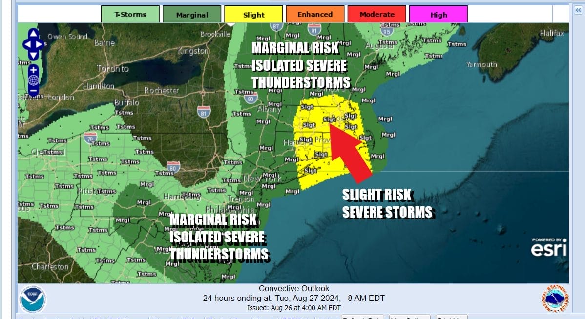
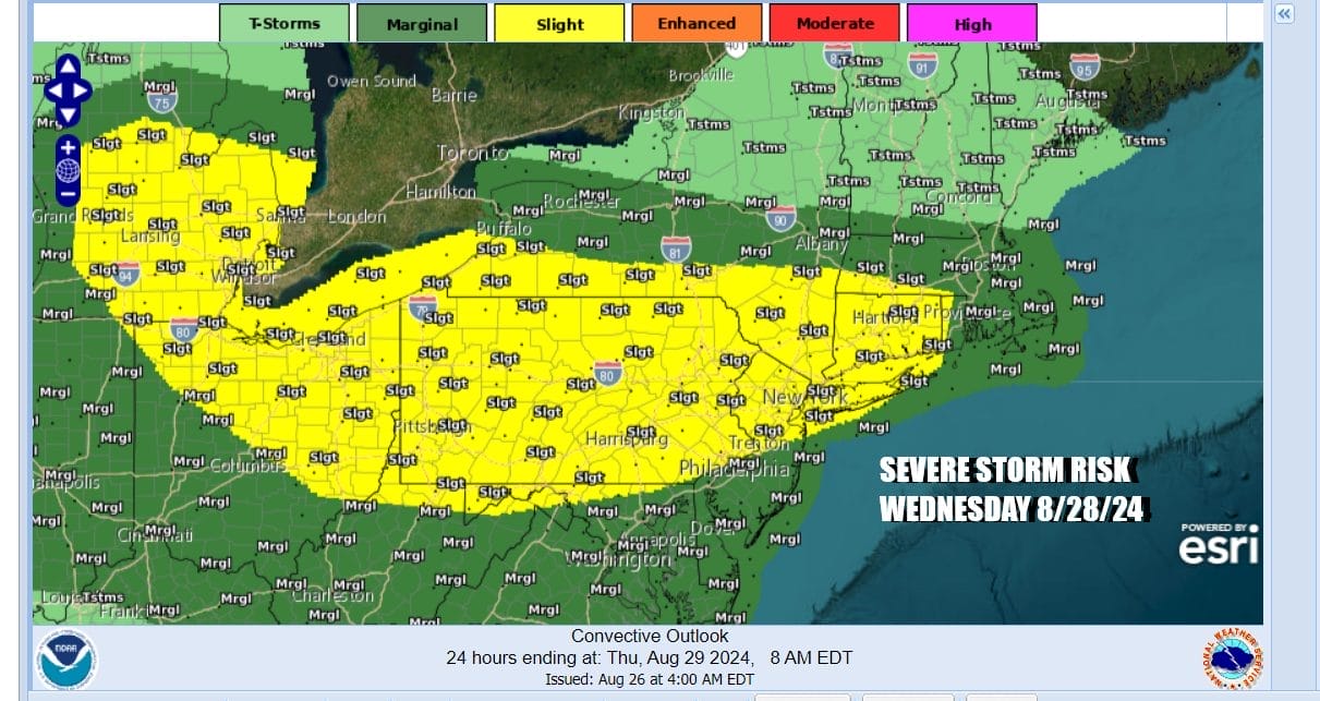
The upper trough to the northwest will be pushing into this hot humid air mass Wednesday afternoon and evening and this sets up for a more widespread round of thunderstorms. The Storm Prediction Center has in its early day 3 forecast is indicating a marginal to slight risk for a large area of the Northeast and Northern Mid Atlantic back to the Ohio Valley and Great Lakes.
The heat ends Thursday as a cold front moves southward and stalls across the Mid Atlantic and high pressure sets up across the Northeast and New England. This puts us in the land of the onshore flow Thursday and Friday and expect to see lots of clouds both days, an ocean wind, some passing showers or drizzle, and highs both days mostly in the 70s. Humidity levels will drop somewhat especially north and northeast of New York City. We do see it turning warm and humid Saturday with late thunderstorms and highs in the 80s. As long as weather systems move along we will see drier and cooler conditions for Sunday and Monday Labor Day.
BE SURE TO DOWNLOAD THE FREE METEOROLOGIST JOE CIOFFI WEATHER APP &
ANGRY BEN’S FREE WEATHER APP “THE ANGRY WEATHERMAN!
MANY THANKS TO TROPICAL TIDBITS FOR THE USE OF MAPS
Please note that with regards to any severe weather, tropical storms, or hurricanes, should a storm be threatening, please consult your local National Weather Service office or your local government officials about what action you should be taking to protect life and property.


