
RISK FOR SEVERE WEATHER BEGINS TONIGHT, MORE WIDESPREAD FRIDAY INTO SATURDAY AM
With two waves of low pressure moving up the coast to our west and a warm front followed by a stalling cold front and a second wave Friday night into Saturday morning, we are looking at the chance for downpours and thunderstorms. The risk tonight into Friday morning is over a smaller geographic area to the west of the coast in parts of Eastern Pennsylvania and an area in the middle and upper Hudson Valley. The second round of risk comes later Friday into Saturday morning and this has a much wider geographic area of risk.
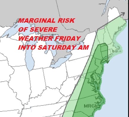
For later Friday into Saturday morning we see a severe weather risk for Eastern Pennsylvania, all of New Jersey, the Hudson Valley, much of Southwestern New England and Long Island. That risk extends southward all the way into Northern Florida.
SEVERE WEATHER RISK INTO FRIDAY MORNING

As to the radar activity late this afternoon we are seeing rain on the regional radar way upstate in Western NY & Northwestern Pennsylvania. Nothing is anywhere close to our region through the first part of tonight but some showers will likely start to come on the scene during the hours before daybreak and during the Friday morning commute.


Friday into Friday night we will see on and off showers but they will become more numerous Friday night into Saturday morning as the second wave goes by. From this we could see some strong thunderstorms overnight into early Saturday morning.
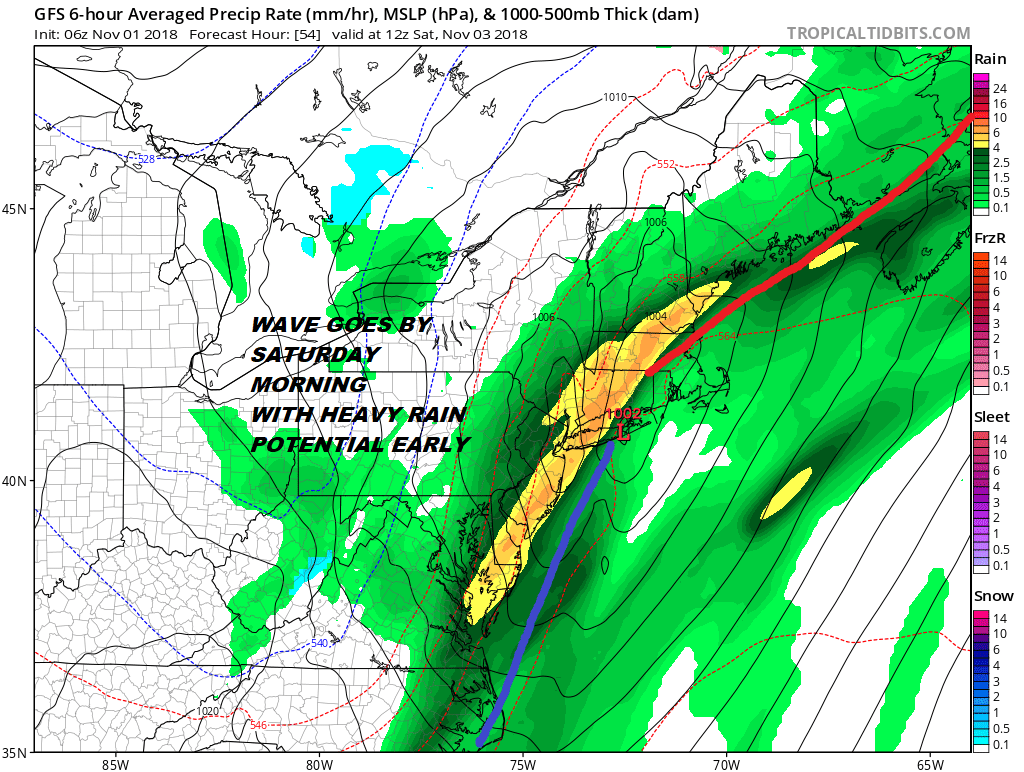
The rain should come to an end by midday in most places and then slow improvement Saturday afternoon. Temperatures will be in the warm 60s on Friday and then it will be in the 50s to near 60 Saturday. Sunday look for some sunshine and a developing onshore wind and highs just into the 50s.
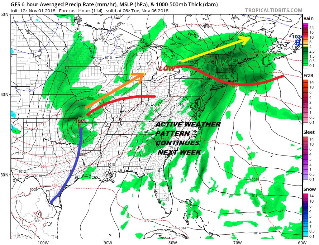
Clouds and rain will be back quickly on Monday as the first of 2 lows moves up. Onshore winds and showers are likely later Monday into Monday night. There could be a brief break but weather models show a second low heading to the Great Lakes. That could bring more rain and downpours later Tuesday and Tuesday night into early Wednesday.
FiOS1 News Weather Forecast For Long Island
FiOS1 News Weather Forecast For New Jersey
FiOS1 News Weather Forecast For Hudson Valley
NATIONAL WEATHER SERVICE SNOW FORECASTS
LATEST JOESTRADAMUS ON THE LONG RANGE