
STRONG TO SEVERE THUNDERSTORMS POSSIBLE THIS EVENING
WEEKEND VERY WARM HUMID SATURDAY OCEAN WIND COOLER SUNDAY
SOME RAIN IN THE MIX
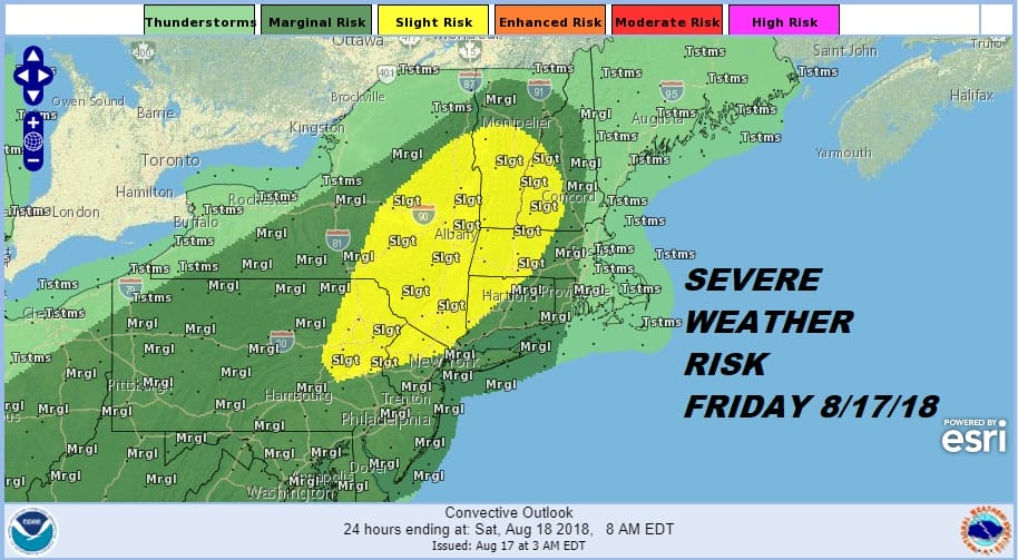
We have another very warm humid day ahead of us with a cold front approaching. There is actually a trough running ahead of the front that will arrive this evening. The atmosphere is very unstable. Add a little daytime heating and various indices are pointing to the possibility of strong thunderstorms. The Storm Prediction Center has expanded its slight risk area to include a larger portion of Northern New Jersey and Northeastern Pennsylvania northeastward into the Hudson Valley and Northwest Connecticut. Overall risk extends from Middle Atlantic States northeastward into Western New England. As usual not much happens until late afternoon and evening although a few renegade thunderstorms and downpours could start popping up this afternoon.
EASTERN SATELLITE

REGIONAL RADAR

Satellite and radar loops are showing some downpours and thunderstorms this morning moving through Northeastern Pennsylvania northward to North Central NY. Those downpours will pass to our north as a warm front pushes across upstate NY and into New England; setting the table for evening thunderstorms for our area. Highs today will reach the upper 80s to a few spots hitting 90 or so.
LOCAL RADAR NEW YORK CITY

LOCAL RADAR PHILADELPHIA


One of the interesting things about the high temperatures of the last few days is that they have been falling short of model forecasts by several degrees and that could be due to the heavy rains of the last few weeks and the very high soil moisture content helping to slow the temperature rise. Heading into the weekend we will still be dealing with the cold front coming through on Saturday with the chance for showers and thunderstorms. Highs will be in the 80s. The front will pass through and winds will turn northeast Saturday night. A wave develops on the front and this makes Sunday’s forecast a tough one.
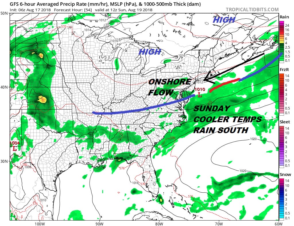
Rain will be close by to our south but for now it looks to be offshore. The wind from the northeast is likely to keep us in clouds. Areas north and west of the coast might be close enough to dry air trying to drain southward. It is quite possible that the Hudson Valley for example sees some breaks of sunshine while Central and Southern New Jersey sit in clouds and deal with patchy light rain on the radar. Temperatures will be impacted with highs in the 70s to near 80. The same holds for Monday with the high to the east remaining rather strong or at least strong enough to keep the onshore flow going. Then on Tuesday a warm front comes up from the south ahead of the next cold front. It will be a transition back to warm humid conditions with the chance for thunderstorms late Tuesday and Tuesday night.
Behind this front we could see a couple of days with a real break from the unrelenting humidity of the last 5 weeks. We will discuss this further later today.
MANY THANKS TO TROPICAL TIDBITS FOR THE USE OF MAPS
Please note that with regards to any tropical storms or hurricanes, should a storm be threatening, please consult your local National Weather Service office or your local government officials about what action you should be taking to protect life and property.
LATEST JOESTRADAMUS ON THE LONG RANGE


