Severe Weather Risk This Evening As Cold Front Passes Sunshine Returns Tuesday
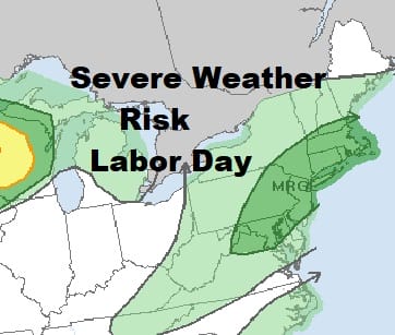
We have seen some showers and downpours move through today. Next is the cold front to the west which is producing a line of showers and thunderstorms. You can see a narrow strip of bright white clouds in Northwest Pennsylvania. That area is swinging eastward into a humid air mass. Some areas are seeing some late day sun heating the atmosphere up and that should help to fire these storms as they move through this evening. The Storm Prediction Center still has us in a marginal risk of severe weather.
SATELLITE

REGIONAL RADAR

Regional radar shows showers across much of New England extending south to about NYC & Long Island. To the west two lines of showers and thunderstorms with one in Southern Pennsylvania and the other to the northwest of that. We will keep an eye on things in case we get the odd severe weather cell that develops.
LOCAL RADAR NEW YORK CITY

LOCAL RADAR PHILADELPHIA


Weather conditions will improve tonight with some late night clearing and lows mostly in the mid 50s to lower 60s with mid 60s in the warmer urban areas. Tuesday looks nice and Sunny and it will be warm with highs reaching into the 80s.
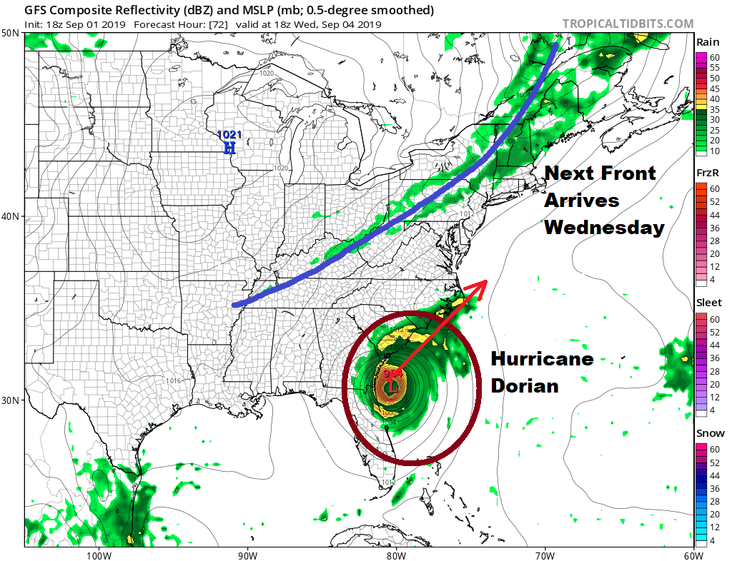
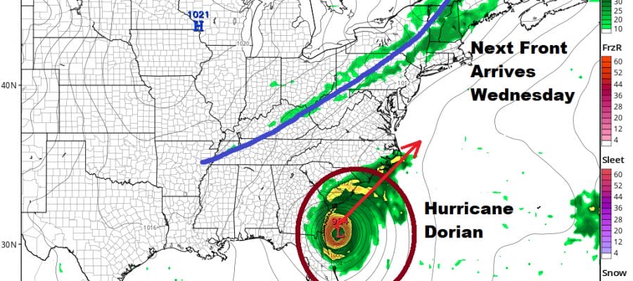
There are no changes in the outlook going forward with another front Wednesday which will be a very warm and humid day with sunshine and highs in the mid to upper 80s. There could be a few scattered showers or a thunderstorm when this front passes. Then we turn attention to Dorian which by late Wednesday should be off the Georgia coast and heading for a possible landfall in the Carolinas. The Outer Banks of North Carolina seen at the greatest risk for Dorian to either make landfall or perhaps pass to the west of Cape Hatteras.
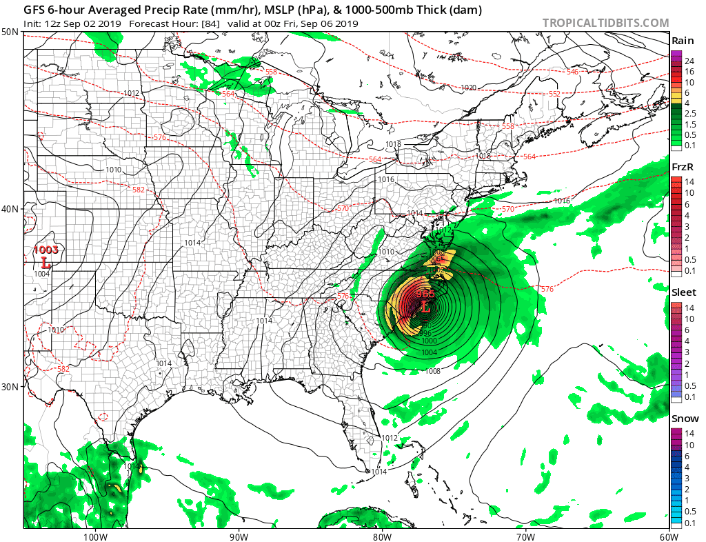
Thursday look for arriving clouds with highs in the 70s with a northeast breeze developing. Then we watch Dorian which both the GFS and the European model track northeast from North Carolina and passing well south of 40N/70W. This track would bring a glancing pass of wind and rain for Coastal New Jersey to Long Island to Southeastern New England. It wouldn’t amount to much with fringe gales perhaps touching the coastlines of New Jersey and Long Island. Southeastern New England could see a more serious period of gales and rain. The bottom line is that no direct hit from Dorian can occur with the upper pattern set up for a west southwest flow off the Middle Atlantic coast. Areas north and west of the coast will see just some clouds perhaps and not much more. Temperatures Friday will likely be in the 60s. The payoff is a beautiful weekend of sunshine and cool dry air as a big high comes down behind it. Highs Saturday and Sunday will be just in the 70s and lows at night mostly in the 50s. It will be a nice payoff for what could be ( as currently advertised) as a minor inconvenience.
HURRICANE DORIAN WEAKENS TO A CATEGORY 4
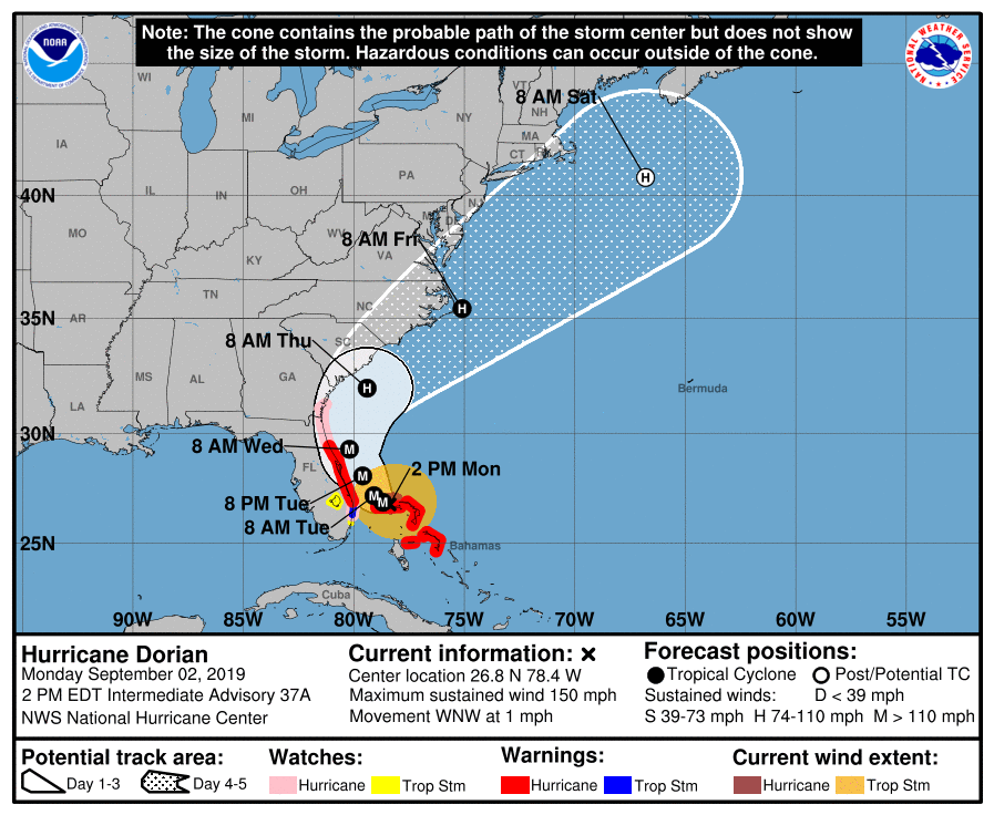
The slow movement of Dorian and the long visit to the Northern Bahamas as weakened Dorian from well off its peak strength. Winds are now 150 mph (just!) and the pressure has risen from 910 to 939 millibars. Dorian is crawling west northwest at all of 1 mile an hour so it remains basically stationary. We will update Dorian this evening after the new advisory and forecast arrives from the National Hurricane Center.
MANY THANKS TO TROPICAL TIDBITS FOR THE USE OF MAPS
Please note that with regards to any tropical storms or hurricanes, should a storm be threatening, please consult your local National Weather Service office or your local government officials about what action you should be taking to protect life and property.